Landmark: Reserva Natural de Tacuarembó
City: Tacuarembo
Country: Uruguay
Continent: South America
Reserva Natural de Tacuarembó, Tacuarembo, Uruguay, South America
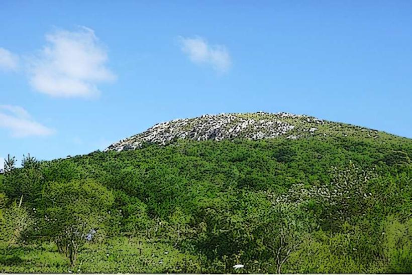
Reserva Natural de Tacuarembó is a protected natural area situated in the Tacuarembó Department of Uruguay. It encompasses a significant portion of the regional landscape, preserving native flora and fauna.
Visual Characteristics
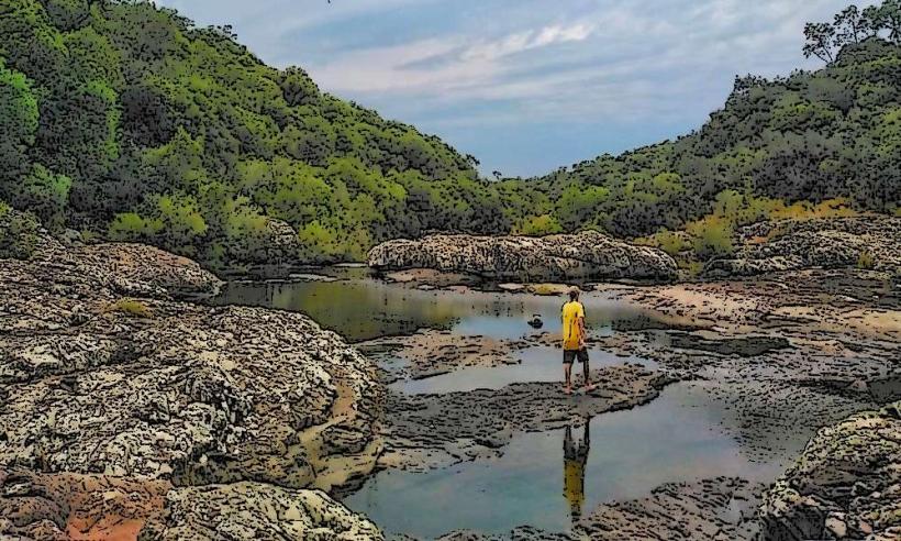
The reserve features rolling hills covered in mixed grasslands and native forests, primarily composed of species like the ombú (Phytolacca dioica) and various acacia trees. Water bodies include streams and small lagoons with clear to slightly turbid water. Rock formations are predominantly sedimentary, with some areas exhibiting lateritic soils.
Location & Access Logistics
The reserve is located approximately 15 kilometers west of the city of Tacuarembó. Access is via National Route 5, turning onto Departmental Route 27. The entrance is marked. Parking is available at designated points near the visitor center. Public transport options to the reserve are limited; bus services operate between Tacuarembó and nearby towns, requiring onward travel by taxi or private vehicle.
Historical & Ecological Origin
The area was established as a natural reserve in 1972 to protect the remaining native ecosystems of the Uruguayan savanna and Atlantic Forest transition zone. Ecologically, it represents a transition between the Mesopotamian grasslands and the Atlantic Forest, supporting a diverse range of species adapted to these environments.
Key Highlights & Activities
Activities include hiking on marked trails, birdwatching, and nature observation. Specific trails include the "Sendero del Arroyo" (Stream Trail) and the "Mirador del Cerro" (Hilltop Viewpoint). Wildlife observation is possible, with opportunities to see native mammals and a variety of bird species.
Infrastructure & Amenities
Basic infrastructure includes a visitor center with information displays, marked trails, and designated picnic areas. Restrooms are available at the visitor center. Shade is provided by natural tree cover along trails and in picnic zones. Cell phone signal (4G) is intermittent within the reserve, with better reception near the entrance and visitor center. No food vendors are present within the reserve; visitors should bring their own provisions.
Best Time to Visit
The best time for visiting is during the spring (September to November) and autumn (March to May) months, when temperatures are moderate and vegetation is at its most vibrant. For photography, early morning and late afternoon offer optimal lighting conditions. No specific tide requirements apply.
Facts & Legends
A notable historical oddity is the presence of ancient ombú trees, some estimated to be several centuries old, which are iconic to the Uruguayan landscape. Local folklore sometimes associates these large trees with ancient indigenous gatherings.
Nearby Landmarks
- Museo del Indio y del Gaucho (20km East)
- Parque de la Hispanidad (18km East)
- Laguna de las Lavanderas (25km Southeast)
- Cerro Batoví (30km Southwest)