Landmark: Cerro de los Burros
City: Tacuarembo
Country: Uruguay
Continent: South America
Cerro de los Burros, Tacuarembo, Uruguay, South America
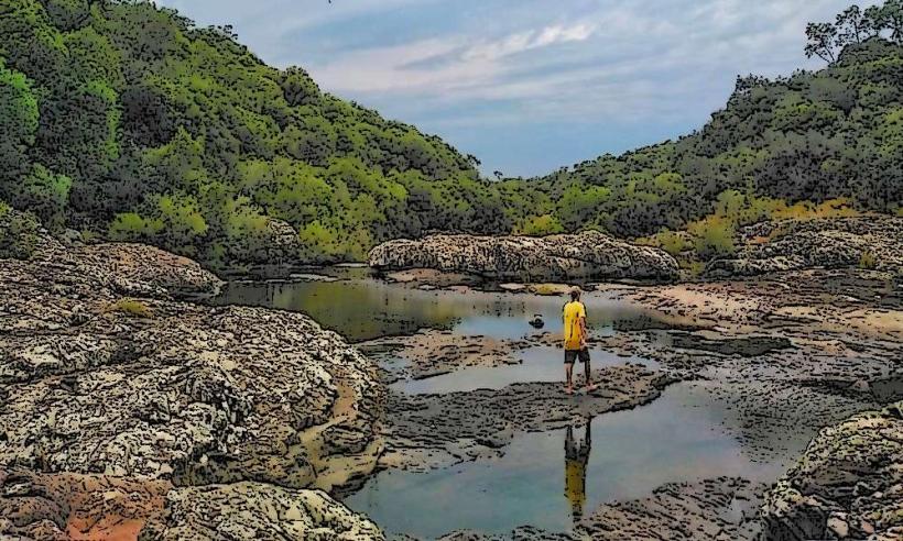
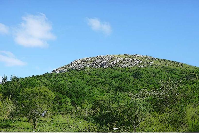
Cerro de los Burros is a geological formation located in the department of Tacuarembó, Uruguay.
This site is a prominent hill characterized by its rocky outcrops and sparse vegetation.
Visual Characteristics
The hill's surface is composed primarily of sedimentary rock, exhibiting shades of brown and grey. Vegetation is limited to grasses and low-lying shrubs. The summit offers a panoramic view of the surrounding plains.
Location & Access Logistics
Cerro de los Burros is situated approximately 15 kilometers west of the city of Tacuarembó. Access is via National Route 5, turning onto Provincial Route 203 (Ruta Departamental 203) for 8 kilometers. The final approach involves a gravel road, approximately 2 kilometers in length, suitable for most passenger vehicles. Parking is available at the base of the hill. Public transport to the immediate vicinity is not available; visitors typically use private vehicles.
Historical & Ecological Origin
Geologically, Cerro de los Burros is part of the Tacuarembó Formation, dating back to the Late Cretaceous period. It represents an erosional remnant of ancient sedimentary layers. Historically, the area was utilized by indigenous populations and later by early settlers for grazing livestock.
Key Highlights & Activities
Hiking to the summit is the primary activity. The ascent is moderately challenging and takes approximately 45 minutes to 1 hour. Observation of local flora and fauna, including various bird species, is possible. Photography of the landscape is recommended.
Infrastructure & Amenities
No formal infrastructure is present at Cerro de los Burros. There are no restrooms, designated shade structures, or food vendors. Cell phone signal (4G/5G) is intermittent and generally weak at the base of the hill, becoming non-existent on the ascent and summit.
Best Time to Visit
The optimal time for visiting is during the morning hours, between 8:00 AM and 11:00 AM, for cooler temperatures and favorable lighting conditions for photography. The months of March through May and September through November offer the most pleasant weather, with average temperatures ranging from 15°C to 25°C. Avoid visiting during the midday heat of summer (December-February).
Facts & Legends
The name "Cerro de los Burros" (Hill of the Donkeys) originates from local accounts of wild donkeys that historically inhabited the area. A specific geological feature at the summit, a cluster of unusually shaped rocks, is locally referred to as "El Trono del Indio" (The Indian's Throne), though its origin is purely natural erosion.
Nearby Landmarks
- Tacuarembó City Center (15km East)
- Parque de Vacaciones UTE y Antel (12km Southeast)
- Museo del Indígena (14km East)
- Laguna de las Lavanderas (10km Northeast)