Landmark: Dataw Island
City: Beaufort
Country: USA South Carolina
Continent: North America
Dataw Island, Beaufort, USA South Carolina, North America
Dataw Island is a residential island located in Beaufort, South Carolina, USA.
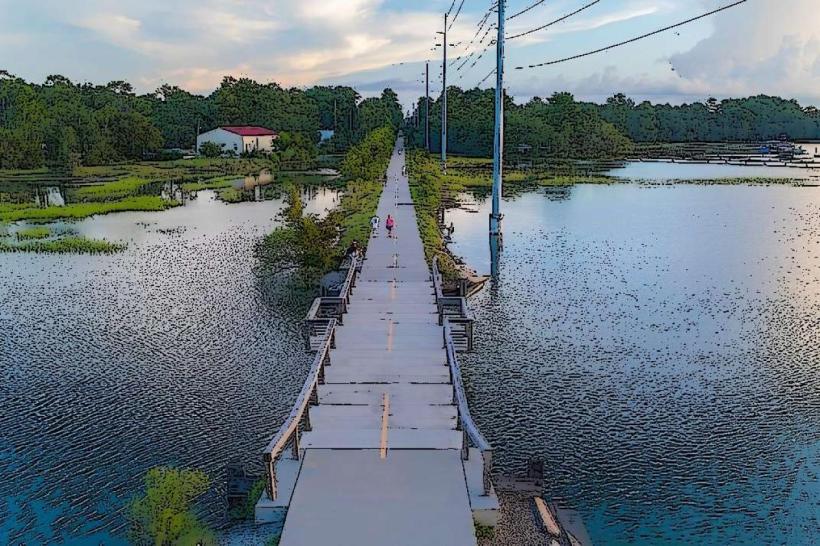
It is situated within the coastal marshlands of the Lowcountry region.
Visual Characteristics
The island features a mix of mature live oaks draped with Spanish moss and extensive salt marsh estuaries. Residential areas consist of homes built in architectural styles common to the region, including Lowcountry vernacular and coastal craftsman. The landscape is characterized by flat terrain with elevations generally not exceeding 10 feet above sea level.
Location & Access Logistics
Dataw Island is accessed via a causeway from the mainland. The primary access road is Dataw Island Road, which connects to SC Highway 21. The island is approximately 10 miles south of downtown Beaufort. Access is controlled by a gatehouse, requiring residents or their guests to pass through. Public transport is not available to the island; private vehicle access is required.
Historical & Ecological Origin
Historically, Dataw Island was part of the Sea Islands, utilized for agriculture, particularly cotton and rice cultivation, prior to the Civil War. The island's current development began in the late 20th century as a planned residential community. Ecologically, it is a barrier island characterized by tidal creeks, salt marshes, and maritime forests, forming a critical habitat for various coastal species.
Key Highlights & Activities
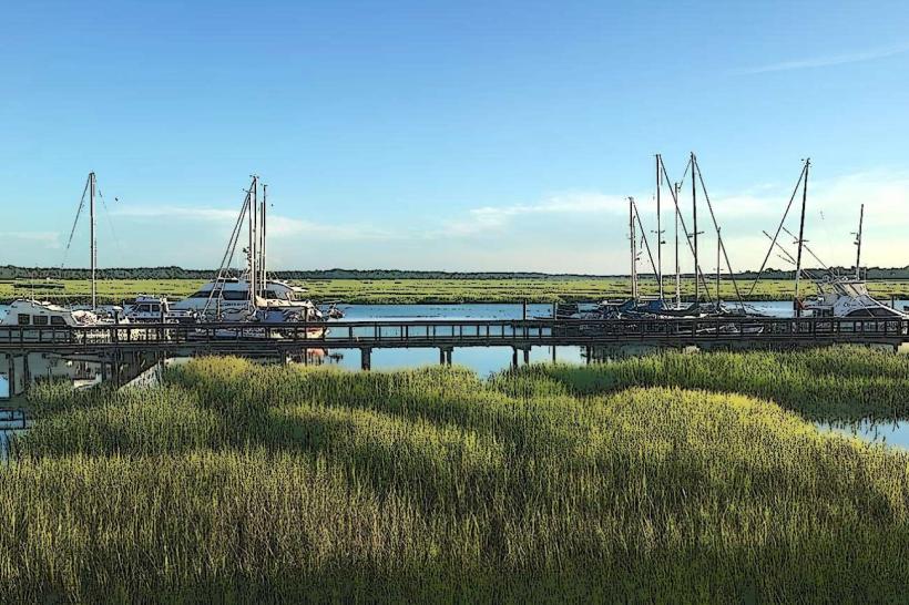
Activities include golf on the Morgan River and Cotton Dike courses, tennis, swimming in community pools, and kayaking or paddleboarding on the tidal creeks. Access to the Morgan River and St. Helena Sound is available via community docks. Walking and biking trails traverse the island's interior and marsh edges.
Infrastructure & Amenities
The island has a community center, fitness facilities, dining options at the clubhouse, and a marina. Restrooms are available at recreational facilities. Cell phone signal (4G/5G) is generally consistent across the developed areas. Shade is provided by the tree canopy in wooded areas and by structures at recreational sites.
Best Time to Visit
The best time for outdoor activities is during the spring (March-May) and fall (September-November) when temperatures are moderate, ranging from 60°F to 80°F. Summer months (June-August) are hot and humid. Photography is optimal in the early morning or late afternoon for softer light on the marsh landscapes.
Facts & Legends
A notable historical artifact found on the island is a cannonball dating back to the Revolutionary War, suggesting past military activity in the area. The island's name is believed to derive from the Native American Catawba word "Datta," meaning "land."
Nearby Landmarks
- Hunting Island State Park (12km Southeast)
- Beaufort National Cemetery (8km Northwest)
- Fort Fremont Historical Park (7km Northwest)
- Parris Island Museum (10km West)
- Historic Downtown Beaufort (16km Northwest)