Landmark: St. Helena Island
City: Beaufort
Country: USA South Carolina
Continent: North America
St. Helena Island, Beaufort, USA South Carolina, North America
St. Helena Island is a large sea island located in Beaufort County, South Carolina, USA.
It is the second-largest of the Sea Islands in South Carolina.
Visual Characteristics
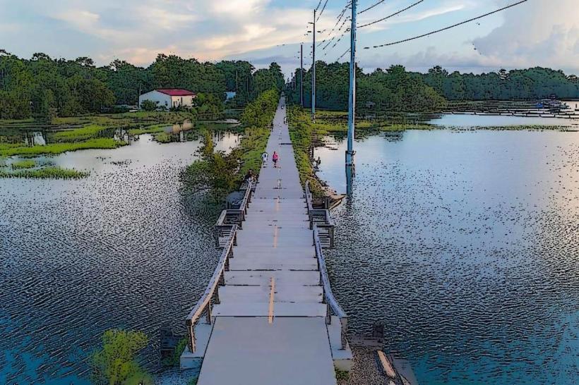
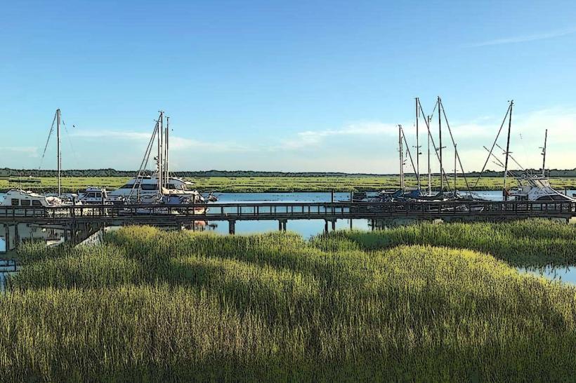
The island features a mix of maritime forest, tidal marshes, and estuarine waters. Dominant vegetation includes live oaks draped with Spanish moss, palmetto trees, and dense undergrowth. The coastline is characterized by sandy beaches and mudflats exposed at low tide. The interior consists of agricultural land and scattered residential areas.
Location & Access Logistics
St. Helena Island is situated approximately 15 miles east of Beaufort, South Carolina. Access is primarily via U.S. Highway 21 (Sea Island Parkway), which connects the island to the mainland. There are no direct public transportation routes to the island; travel is typically by private vehicle. Parking is available at designated public access points and some community centers, though it can be limited during peak seasons.
Historical & Ecological Origin
Historically, St. Helena Island was a significant center for cotton and rice cultivation, with plantations established in the 18th and 19th centuries. Following the Civil War, it became a key location for the Port Royal Experiment, a Union effort to transition formerly enslaved people to self-sufficiency. Ecologically, the island is part of the South Atlantic coastal plain, shaped by sea-level changes and sediment deposition over millennia, resulting in its current estuarine and maritime ecosystem.
Key Highlights & Activities
Activities include exploring the Penn Center National Historic Landmark District, which preserves the history of the African American community and the Port Royal Experiment. Birdwatching is a popular activity due to the diverse avian populations. Kayaking and fishing are possible in the tidal creeks and surrounding waters. Visiting the historic churches and community gathering places offers insight into local culture.
Infrastructure & Amenities
Restrooms are available at some public access points and community facilities, but are not universally present. Shade is provided by the natural tree canopy in forested areas. Cell phone signal (4G/5G) is generally available across most of the island, though it may be weaker in more remote sections. Limited food vendors and small general stores are located in the central community areas.
Best Time to Visit
The best months for visiting are April through June and September through November, offering mild temperatures and lower humidity. For photography, early morning and late afternoon provide optimal lighting conditions, particularly for capturing the interplay of light and shadow on the live oaks. Tidal conditions are important for water-based activities; check local tide charts for optimal kayaking or fishing times.
Facts & Legends
A notable historical oddity is the continued presence of Gullah culture, a unique African American heritage that has preserved distinct language, traditions, and crafts on the island for generations. Visitors seeking a specific tip should be aware that many roads are unpaved and can become muddy after rain, requiring careful navigation.
Nearby Landmarks
- Beaufort History Museum (12km Southwest)
- Parris Island Museum (18km Southwest)
- Hunting Island State Park (10km Southeast)
- Fort Fremont Historical Park (14km Southwest)