Landmark: Okatie River
City: Beaufort
Country: USA South Carolina
Continent: North America
Okatie River, Beaufort, USA South Carolina, North America
The Okatie River is a tidal estuary located in Beaufort County, South Carolina. It forms part of the larger ACE Basin estuarine system.
Visual Characteristics
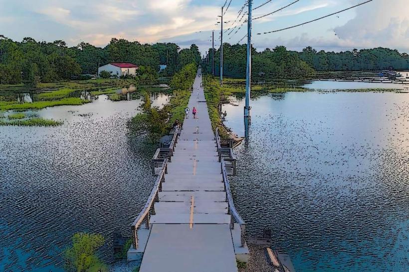
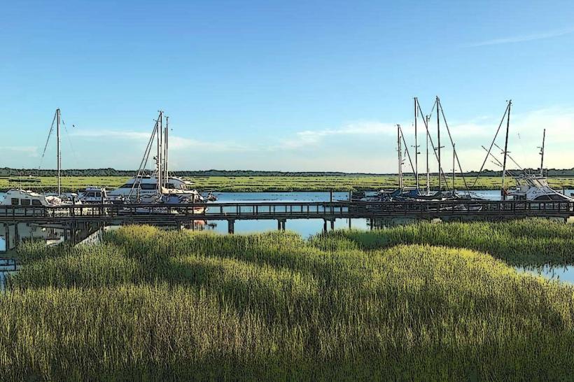
The river is characterized by its dark, tannin-stained waters, a result of decaying vegetation from surrounding marshlands. The banks are predominantly marsh grass, with scattered stands of live oak and pine trees. Tidal fluctuations are significant, exposing mudflats at low tide and inundating marsh areas at high tide. The river width varies, averaging approximately 100 meters in the main channel.
Location & Access Logistics
The Okatie River is accessible via US Highway 21, which crosses the river via the Okatie River Bridge. The nearest major city is Beaufort, approximately 25 kilometers to the southeast. Public access points include boat ramps located off SC Highway 170. Parking is available at these designated ramps, though capacity can be limited during peak usage times. No direct public transport services the river access points.
Historical & Ecological Origin
The Okatie River is a natural estuarine system formed by the confluence of freshwater runoff and tidal influence from the Atlantic Ocean. Its ecological origin is tied to the formation of the coastal plain, with its current morphology shaped by millennia of tidal action and sediment deposition. Historically, the river served as a transportation route for indigenous peoples and later for colonial settlements and agricultural transport.
Key Highlights & Activities
Activities include boating, fishing, and kayaking. The river supports a diverse population of fish species, including red drum and spotted seatrout. Birdwatching is also a primary activity, with numerous wading bird species present in the marsh habitat. Observation of marine mammals, such as bottlenose dolphins, is possible.
Infrastructure & Amenities
Designated boat ramps provide access. Restroom facilities are not consistently available at all access points. Shade is limited to natural tree cover along undeveloped banks. Cell phone signal strength varies significantly depending on location along the river, with 4G/5G coverage generally intermittent.
Best Time to Visit
For fishing, the early morning and late afternoon hours are optimal, particularly during outgoing tides. Spring and fall offer the most temperate weather conditions. High tide is generally preferred for kayaking and boating to ensure sufficient water depth and access to marsh areas.
Facts & Legends
The Okatie River is known for its strong tidal currents, which can pose a navigational challenge for smaller vessels. Local lore suggests that the river's dark color is due to the "black water" from the cypress swamps upstream, though scientific analysis confirms it is primarily tannins from marsh vegetation.
Nearby Landmarks
- Beaufort National Cemetery (10km Southeast)
- Parris Island Museum (12km South)
- Hunting Island State Park (20km Southeast)
- Fort Fremont Historical Park (8km South)