Landmark: Guayaguayare Beach
City: Mayaro
Country: Trinidad and Tobago
Continent: North America
Guayaguayare Beach, Mayaro, Trinidad and Tobago, North America
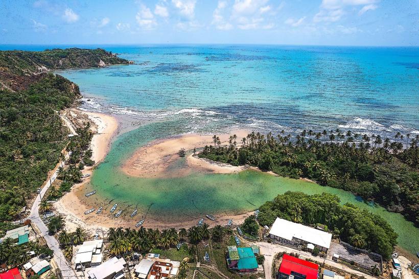
Guayaguayare Beach is a coastal area situated in the southeastern region of Trinidad, within the Mayaro district of Trinidad and Tobago.
Visual Characteristics
The beach features a wide expanse of light brown sand. The water is typically a muted blue-green. The shoreline is bordered by a dense growth of coconut palms and other tropical vegetation. The beach extends for approximately 3 kilometers.
Location & Access Logistics
Guayaguayare Beach is located approximately 60 kilometers southeast of Port of Spain. Access is via the Naparima Mayaro Road (Siparia Road) which transitions into the Mayaro Road. The final approach is via Guayaguayare Road. Parking is available in designated unpaved areas along the roadside adjacent to the beach. Public transport options are limited; local bus routes primarily serve the main road, requiring a significant walk to the beach itself.
Historical & Ecological Origin
The beach is a natural formation, part of the coastal erosion and deposition processes along Trinidad's southeastern coastline. Ecologically, it is a tropical coastal environment supporting a variety of plant and animal life, including nesting sea turtles during specific seasons.
Key Highlights & Activities
Activities include swimming, sunbathing, and beachcombing. The area is known for its relatively calm waters, suitable for wading. Birdwatching is possible in the adjacent vegetation. Fishing from the shore is also practiced by locals.
Infrastructure & Amenities
Basic amenities are minimal. There are no permanent restroom facilities. Shade is provided by natural tree cover. Cell phone signal (4G) is generally available but can be intermittent closer to the water's edge. No food vendors are permanently stationed at the beach; visitors typically bring their own provisions.
Best Time to Visit
The best time for photography is during the early morning or late afternoon when the sun angle provides softer light. The dry season, from January to May, offers the most favorable weather conditions with less rainfall. High tide can reduce the visible beach area.
Facts & Legends
Guayaguayare is believed to be named after a Carib chief. Local folklore suggests that the area was once a significant meeting point for indigenous tribes. During nesting season (typically March to August), the beach is a critical nesting ground for Leatherback turtles, and access may be restricted in certain areas to protect the nests.
Nearby Landmarks
- Mayaro Beach (2km North)
- Point Radix (8km Northeast)
- Manzanilla Beach (25km Northwest)
- Nariva Swamp (28km Northwest)