Landmark: Ibisi bya Huye
City: Huye
Country: Rwanda
Continent: Africa
Ibisi bya Huye, Huye, Rwanda, Africa
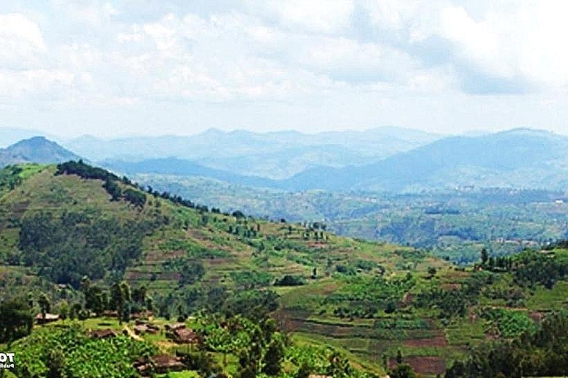
Ibisi bya Huye is a high-altitude mountain range and prominent topographical feature located in the Huye District of southern Rwanda. It serves as a critical water catchment area and a site of cultural significance overlooking the Huye urban center.
Visual Characteristics
The massif is characterized by steep, conical peaks rising to an elevation of approximately 2,400 meters. The terrain consists of dark volcanic soil and metamorphic rock, covered by a mosaic of high-altitude afro-montane vegetation, eucalyptus plantations, and terraced agricultural plots. During the rainy season, the peaks are frequently obscured by dense altitudinal mist and low-hanging cloud cover.
Location & Access Logistics
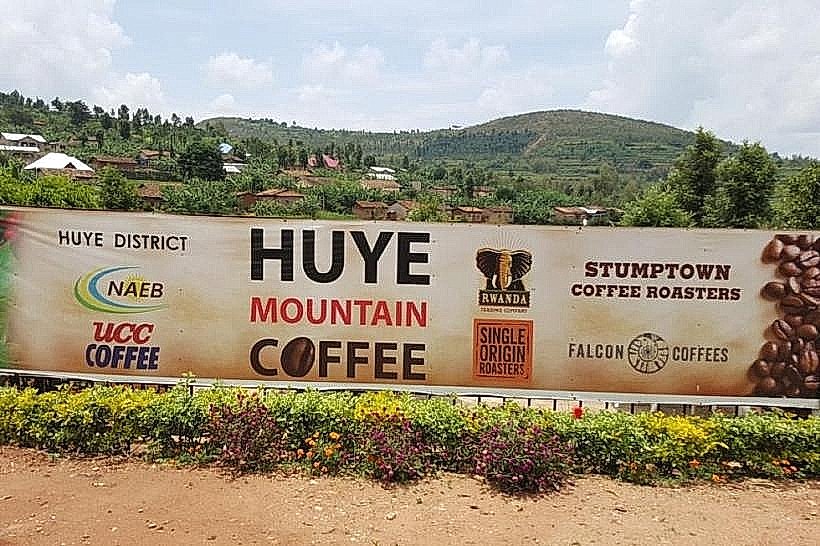
The range is situated 8km west of Huye (Butare) town. Access is primarily via the RN1 highway toward Nyamagabe, followed by unpaved secondary tracks leading to the base of the climbs. Hikers typically depart from the Huye Mountain Coffee station or the Sovu area. Motorcycle taxis provide transport to the trailheads from the Huye bus terminal, located 10km to the east.
Historical & Ecological Origin
Formed during the tectonic uplift of the Albertine Rift, the mountains consist of ancient crystalline basement rock. Historically, the peaks were considered sacred sites in pre-colonial Rwandan cosmology and served as natural defensive barriers. The ecosystem is part of the fractured forest corridor that once connected Nyungwe Forest to the central plateau.
Key Highlights & Activities
Summit trekking is the primary activity, offering 360-degree views of the Southern Province and distant views of the Burundi border. Birdwatching occurs along the forested mid-sections, where various sunbirds and raptors are sighted. The area is also utilized for high-altitude agricultural tours focusing on traditional tuber and grain cultivation.
Infrastructure & Amenities
Infrastructure on the mountain is non-existent; there are no paved paths, public restrooms, or permanent shelters on the upper slopes. Visitors must carry all necessary water and supplies. 4G cellular signal is available on the ridges facing Huye town but drops significantly in the western valleys. Shade is provided by natural tree clusters along the ascent.
Best Time to Visit
The dry seasons from June to August and December to February provide the most stable footing for steep ascents. Morning departures (06:00–07:00) are necessary to reach the summit before the afternoon heat and potential convective storms. Visibility for photography is highest immediately following a rain event when the atmosphere is clear of haze.
Facts & Legends
Local oral history identifies these mountains as a place of royal retreat and ritual. A specific tip for hikers: the weather at the summit can be 5°C to 10°C cooler than in Huye town, requiring wind-resistant clothing even during the dry season. The range is often the first point in the region to receive rainfall due to orographic lift.
Nearby Landmarks
Huye Mountain Coffee – 2.5km East
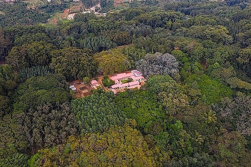
Arboretum of Ruhande – 7.5km East
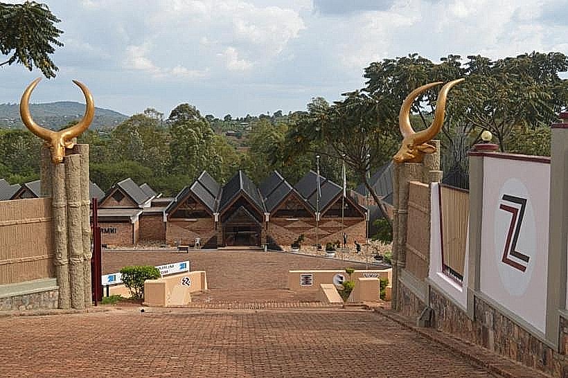
Ethnographic Museum of Rwanda – 8.2km East
University of Rwanda (Huye Campus) – 7.8km East
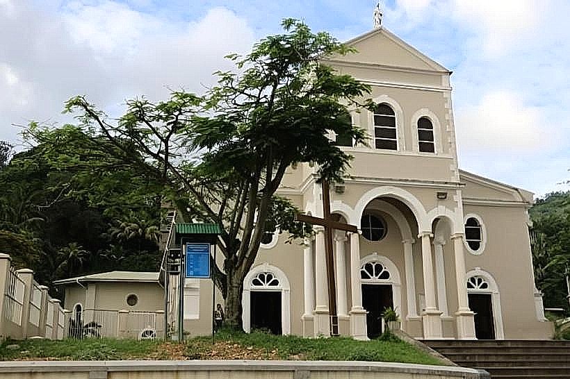
Sovu Monastery – 4.5km Northeast