Landmark: Kaolack Port
City: Kaolack
Country: Senegal
Continent: Africa
Kaolack Port, Kaolack, Senegal, Africa
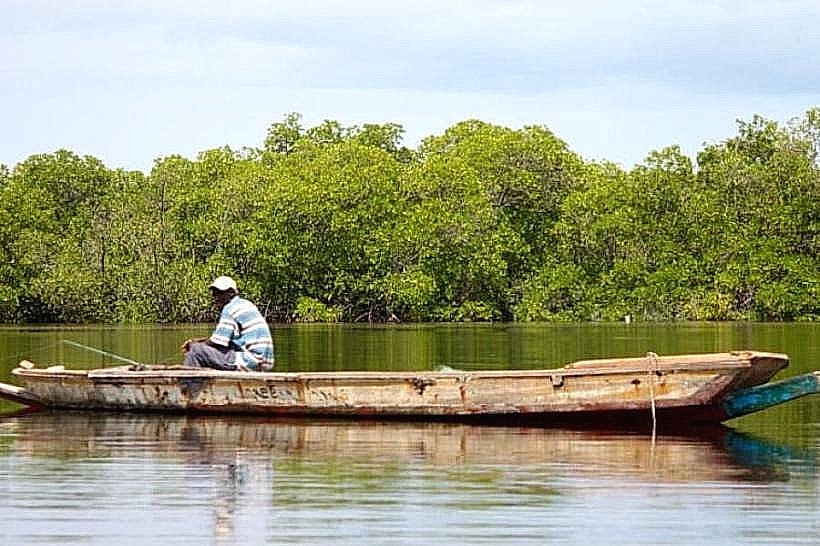
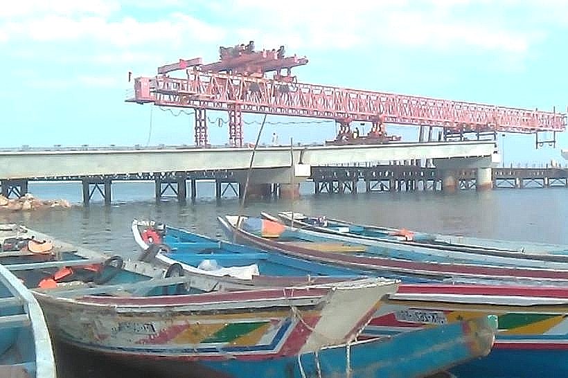
The Kaolack Port is a river terminal located on the northern bank of the Saloum River in the southern district of Kaolack, Senegal. It functions as a strategic maritime exit point for the regional salt and peanut industries, linking the inland Sine-Saloum production zones to international shipping lanes via the Atlantic Ocean.
Visual Characteristics
The port is defined by weathered concrete docks, large industrial warehouses with rusted corrugated iron roofs, and heavy-duty loading cranes. The riverfront is characterized by dark, silty water and mudflats that appear during low tide, alongside piles of harvested salt and stacks of agricultural sacks. Traditional wooden pirogues are frequently docked alongside larger steel-hulled transport vessels.
Location & Access Logistics
The facility is located at the southern edge of the city center, accessible via the N1 highway and the Rue du Port. It is situated approximately 1.2km west of the Kaolack Grand Market and 0.8km west of Place de l’Indépendance. Entry for commercial vehicles is through a designated security gate, while pedestrians can access the riverfront perimeter via local streets using yellow taxis or "calèches."
Historical & Ecological Origin
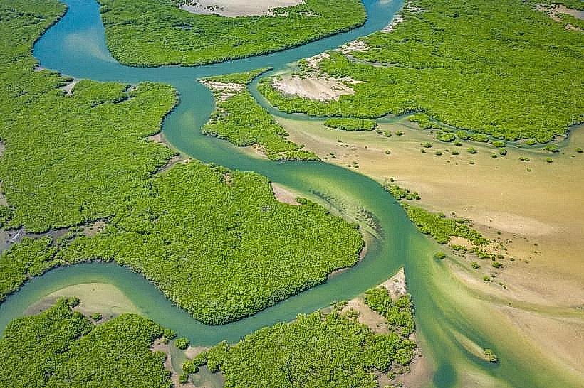
The port was formally established in the early 20th century by French colonial authorities to export groundnuts, which earned Kaolack the title of "the peanut capital of the world." Geologically, it is situated on the estuarine reach of the Saloum River, a waterway characterized by its "reverse estuary" hydrology where salinity increases upstream.
Key Highlights & Activities
Industrial activities include the loading of bulk salt and agricultural products onto cargo ships. The port also serves as a base for artisanal and commercial fishing fleets, with early morning fish landings being a primary logistical event. Guided boat tours in motorized pirogues often depart from the auxiliary docks for excursions into the Saloum Delta National Park.
Infrastructure & Amenities
The port features heavy-load concrete piers and industrial-grade storage sheds, though much of the infrastructure dates to the mid-20th century. There are no public restrooms or formal tourist amenities within the secure port zone. Shade is sparse, limited to the interiors of warehouses and the overhangs of administrative buildings. 4G/5G cellular coverage is consistently strong due to its central urban location.
Best Time to Visit
The most active period is between 07:00 and 10:00 when fishing boats return and manual labor for loading begins. For photography, the late afternoon (17:30 to 19:00) provides the best lighting as the sun sets over the Saloum River. Visitors should check local tide tables, as low tide significantly alters the visual landscape and vessel accessibility.
Facts & Legends
The port is said to be protected by "Mindiss," a powerful water deity in Serer mythology who is believed to reside in the depths of the river near the docks. A verified historical oddity is that during the height of the 1920s peanut boom, this river port was the busiest in all of French West Africa, occasionally surpassing the tonnage moved through Dakar.
Nearby Landmarks
Saloum River – 0.0km (Directly adjacent)
Place de l’Indépendance – 0.8km East
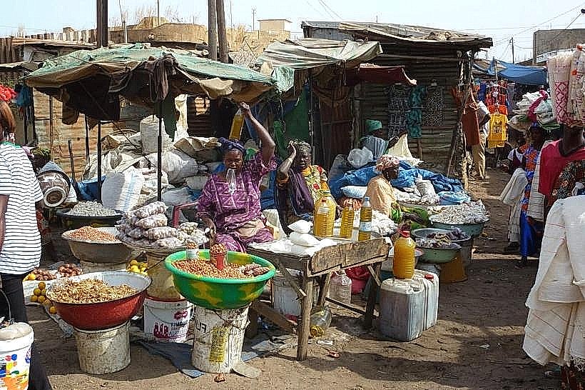
Kaolack Grand Market – 1.2km East
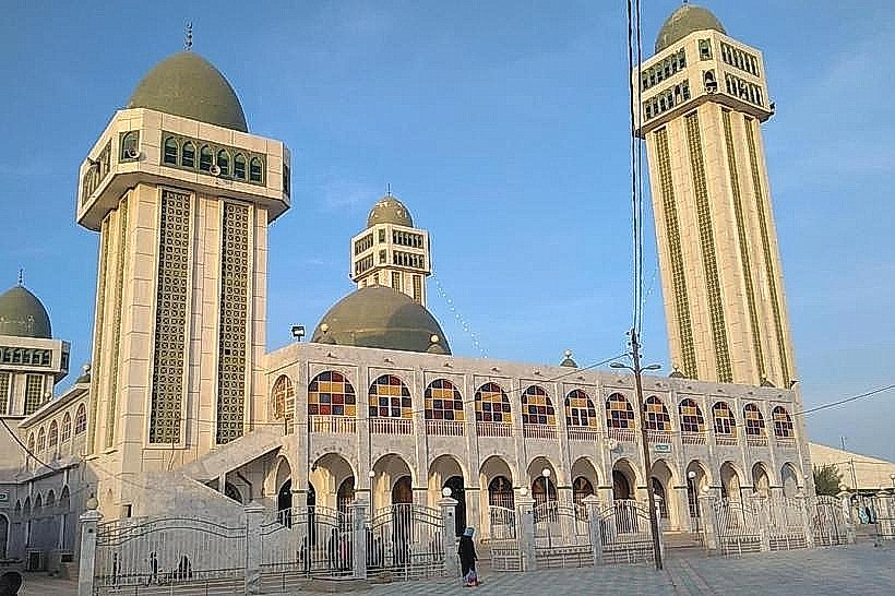
Cathédrale Saint-Théophile – 0.9km Southeast