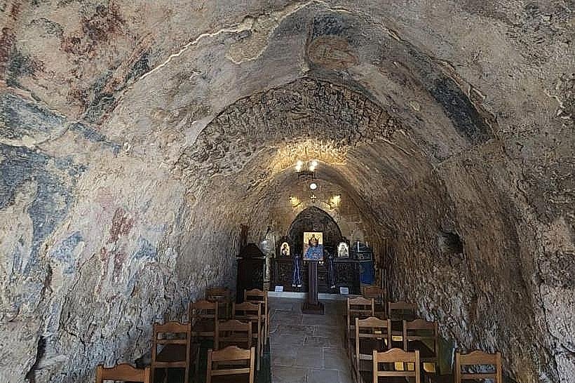
Landmark: Our Lady of the Wind Church
City: Anfeh
Country: Lebanon
Continent: Asia
Our Lady of the Wind Church, Anfeh, Lebanon, Asia
The Anfeh Peninsula, also known as Ras Anfeh, is a narrow limestone headland that extends 400 meters into the Mediterranean Sea within the El Koura District of the North Governorate, Lebanon. This coastal landform contains layered archaeological strata that preserve over 3,000 years of continuous maritime settlement and industrial activity.
Visual Characteristics
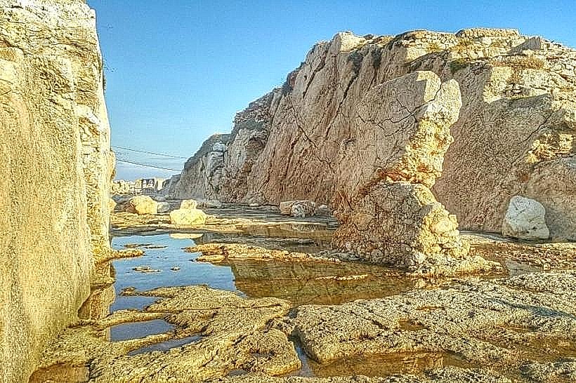
The Anfeh Peninsula features a flat, wind-swept topography composed of jagged quaternary marine limestone. The coastline is highly indented, displaying sharp rock shelves, natural sea caves, and deep salt-evaporation pans carved directly into the bedrock. The landward neck of the peninsula is bisected by a massive, deep vertical trench cut into the solid stone. Vegetation is sparse and restricted to salt-tolerant halophytic shrubs, wild caper bushes, and marine grasses growing within rock fissures, leaving the white and grey stone entirely exposed to the sea.
Location & Access Logistics
The site is situated 65 kilometers north of Beirut and 15 kilometers south of Tripoli. Access from Beirut is via the main North Coastal Highway, exiting west at the Anfeh interchange and driving through the old town center to the coast. Vehicles park on the unpaved gravel shoulders or municipal spaces at the base of the peninsula. Public transport options include coastal buses and vans operating along the Beirut-Tripoli highway corridor; passengers disembark at the Anfeh junction, followed by a 1.5-kilometer flat walk to the maritime site.
Historical & Ecological Origin
The Anfeh Peninsula was initially developed as a fortified maritime trading post by the Phoenicians, who exploited its natural double-harbor configuration. During the Crusader period, the site was heavily refortified as the Lordship of Nephin, at which time engineers excavated the 28-meter-wide, 10-meter-deep dry moat across the neck to isolate the castle from the mainland. Ecologically, the surrounding marine territory contains a rocky sub-littoral ecosystem characterized by exceptional water clarity, sustained by underwater freshwater springs emerging from the seabed.
Key Highlights & Activities
Exploring the deep rock-cut Crusader trench and the remains of the fortress gatehouse foundations.
Inspecting the ancient Phoenician rock-cut slipways and dry docks at the northern edge of the headland.
Walking the perimeter trails along the open limestone cliffs to observe the marine topography.
Examining the structural remains of medieval storage cisterns and wine presses carved into the bedrock.
Infrastructure & Amenities
The peninsula is maintained as an open-access archaeological and heritage zone. No ticketing booths, formal visitor centers, or public restrooms are located on the headland proper. Safety barriers are non-existent along the cliff perimeters. Due to the flat, unobstructed coastal landscape, cellular networks provide stable 4G and 5G coverage across the entire site. Commercial services, including seafood restaurants, public facilities, and shops, are located at the immediate base of the peninsula within a 200-meter walk.
Best Time to Visit
The ideal months for exploration are from April to November when the coastal paths remain dry and accessible. Photography is highly effective between 16:30 and 18:30, as the low afternoon sun casts deep shadows into the Crusader trench and illuminates the western sea-facing limestone cliffs.
Facts & Legends
Historical accounts from the 13th century reveal that when the Mamluk sultan Qalawun captured Nephin Castle in 1289, he completely dismantled the upper fortifications to prevent Crusader fleets from re-establishing a stronghold. Local folklore long claimed that the massive trench was excavated by a single army of giants in a single night, though modern archaeological analysis confirms it required generations of systematic stone-quarrying labor.
Nearby Landmarks
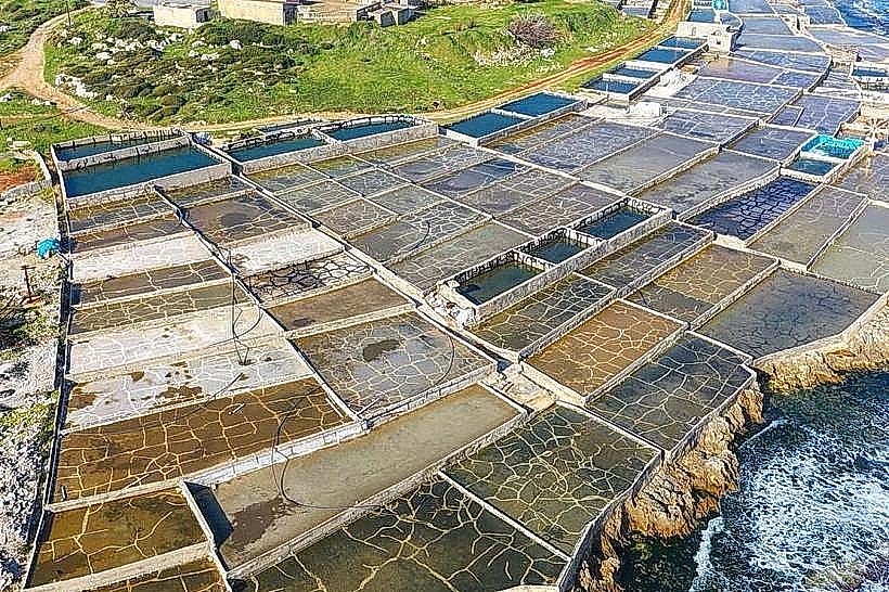
Anfeh Salt Marshes: 0.2km South
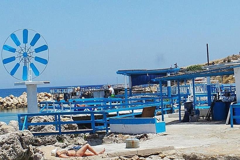
Taht el-Rih Beach: 0.3km West
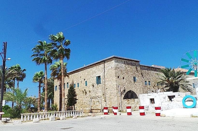
Our Lady of the Wind Church: 0.4km Southwest
Deir El Natour Monastery: 3.1km North