Landmark: Playa El Palmarcito
City: La Libertad
Country: El Salvador
Continent: North America
Playa El Palmarcito, La Libertad, El Salvador, North America
Playa El Palmarcito is a coastal area situated in the municipality of La Libertad, El Salvador.
This location serves as a surf break and a point of interest for coastal activities.
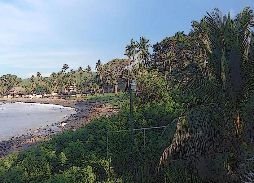
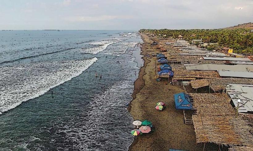
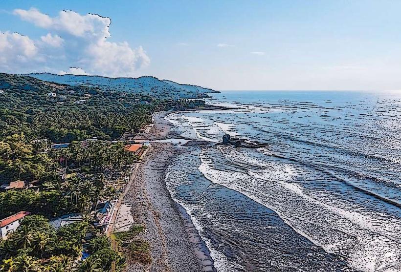
Visual Characteristics
The beach consists of dark volcanic sand. The shoreline is characterized by a series of point breaks and reef breaks. Vegetation is sparse along the immediate coastline, transitioning to more dense tropical foliage inland.
Location & Access Logistics
Playa El Palmarcito is located approximately 25 kilometers west of San Salvador. Access is via the CA-2 highway (Carretera Litoral). Turn south onto the unpaved road marked for El Palmarcito. Parking is available at informal lots near the beach, typically managed by local vendors. Public transportation options are limited; local buses serving the CA-2 route may stop near the turn-off, requiring a walk of approximately 1.5 kilometers to the beach.
Historical & Ecological Origin
The beach is a natural formation resulting from volcanic activity and coastal erosion. The consistent wave patterns are attributed to offshore bathymetry and prevailing wind conditions, making it a recognized surf spot.
Key Highlights & Activities
Surfing is the primary activity, with breaks suitable for intermediate to advanced surfers. Swimming is possible but requires caution due to currents and wave action. Beachcombing along the volcanic sand is also an option.
Infrastructure & Amenities
Basic amenities are present, including a limited number of small, open-air food stalls selling local snacks and beverages. Restrooms are available at some of these stalls, often requiring a small fee. Shade is minimal, primarily provided by the stalls. Cell phone signal (4G) is generally available.
Best Time to Visit
For surfing, the dry season (November to April) generally offers the most consistent swells. The best time of day for wave conditions is typically in the morning before the onshore winds pick up. Midday offers the harshest sunlight; early morning and late afternoon provide softer light.
Facts & Legends
Local surfers refer to the main break as "El Palmarcito," distinguishing it from larger, more exposed surf spots further west. The name "Palmarcito" translates to "little palm grove," though significant palm trees are not a dominant feature of the immediate beach area.
Nearby Landmarks
- El Tunco Beach (1.2km West)
- La Bocana Beach (2.5km West)
- El Zonte Beach (6.0km West)