Landmark: Sea of Galilee (Lake Kinneret)
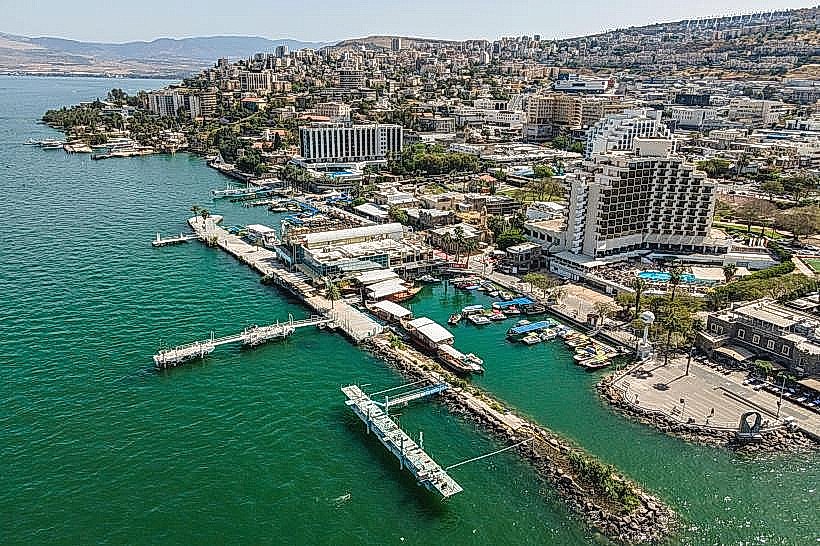
City: Tiberias
Country: Israel
Continent: Asia
Sea of Galilee (Lake Kinneret), Tiberias, Israel, Asia
The Sea of Galilee, also known as Lake Kinneret, is a freshwater lake located in northeast Israel within the Jordan Rift Valley. It is the lowest freshwater lake on Earth and the second-lowest lake in the world after the Dead Sea, serving as a primary water source and a significant biblical landmark.
Visual Characteristics
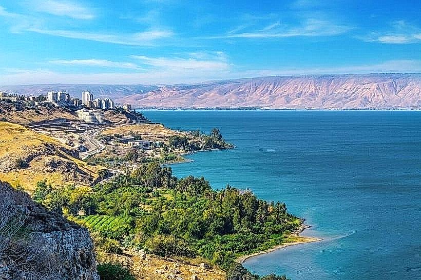
The lake is heart-shaped, spanning approximately 21km in length and 13km in width. The water color fluctuates between deep blue and turquoise depending on the sky and sediment levels. It is surrounded by the steep, basaltic slopes of the Golan Heights to the east and the limestone cliffs of the Galilee to the west. The shoreline features a mix of dark basalt pebbles, localized sandy stretches, and dense thickets of reeds and oleander bushes.
Location & Access Logistics
The lake is situated 160km north of Jerusalem and is primarily accessed via Route 90, which runs along the western shore, and Route 92 on the eastern side. The city of Tiberias serves as the main urban hub on the western bank. Public transport is available via Egged buses from Jerusalem and Tel Aviv to the Tiberias Central Bus Station. Access to specific beaches is provided through various entry points along the perimeter road, many of which have dedicated paved parking lots.
Historical & Ecological Origin
Geologically, the lake is a pull-apart basin formed by the Dead Sea Transform fault system. It is fed primarily by the Jordan River and underwater mineral springs. Historically, it was the center of the fishing industry in the Roman era and is the setting for many New Testament accounts. The lake's water levels are a critical ecological indicator for the region, monitored via a national measurement system.
Key Highlights & Activities
Water-based activities include swimming at authorized beaches, sailing, and motorized water sports in designated zones. The "Kinneret Trail" offers a partially completed 120km hiking path encircling the lake. Christian pilgrimage sites, such as Capernaum and the Mount of Beatitudes, are located on the northern shore. Commercial fishing continues to operate, focusing on "St. Peter’s Fish" (tilapia), which is served in numerous lakeside restaurants.
Infrastructure & Amenities
The shoreline is dotted with both public and private beaches equipped with restrooms, showers, and lifeguard stations. Shade is provided by eucalyptus and palm plantations in picnic areas. Full 5G cellular coverage is available throughout the basin. Food vendors, camping sites, and luxury hotels are concentrated in Tiberias and at various kibbutz-operated resorts around the perimeter.
Best Time to Visit
The optimal months for weather are April to June and September to November, when temperatures are moderate. Photography is most effective at sunrise from the western shore (Tiberias) or sunset from the eastern shore (Golan Heights). During the summer (July–August), temperatures frequently exceed 40°C, and the lake is subject to "Sharkia" winds-sudden, strong afternoon storms coming from the east.
Facts & Legends
A localized phenomenon involves sudden, violent storms caused by cool air dropping from the surrounding heights onto the warm lake surface. A unique local fact is the "Kinneret Boat," a 1st-century CE fishing vessel discovered in the mud during a drought in 1986, now preserved in a nearby museum. Jewish tradition suggests that "Miriam's Well," a miraculous water source that accompanied the Israelites in the desert, eventually settled in the depths of the Kinneret.
Nearby Landmarks
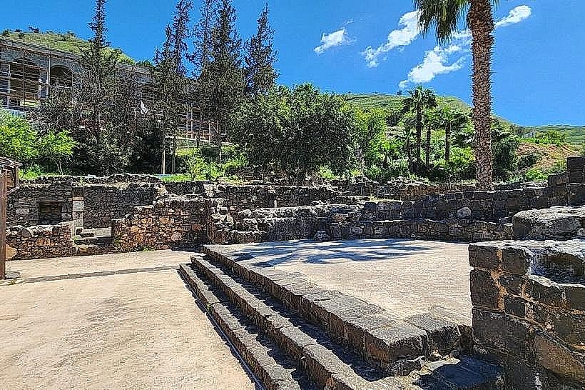
Capernaum (Kfar Nahum) – 0.5km North (Shoreline)
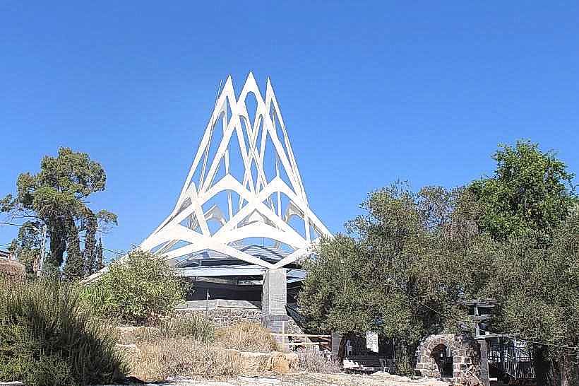
Mount of Beatitudes – 2.0km Northwest
Magdala Archaeological Park – 4.5km West
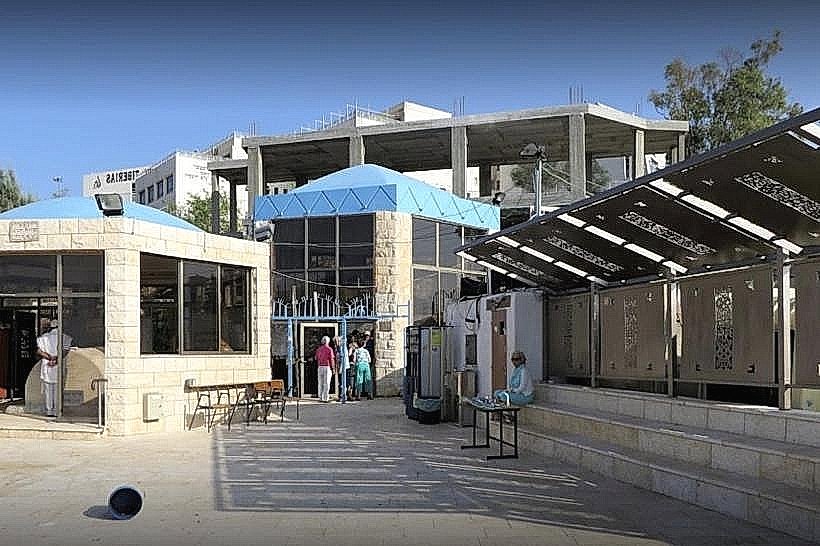
Yardenit Baptismal Site – 1.0km South (Outlet)
Kursi National Park – 0.1km East (Shoreline)