Landmark: Son Tra Peninsula
City: Da Nang
Country: Vietnam
Continent: Asia
Son Tra Peninsula, Da Nang, Vietnam, Asia
Son Tra Peninsula is a protected natural area located in Da Nang, Vietnam, characterized by its mountainous terrain and coastal environment.
It serves as a significant ecological zone and a recreational area for the city.
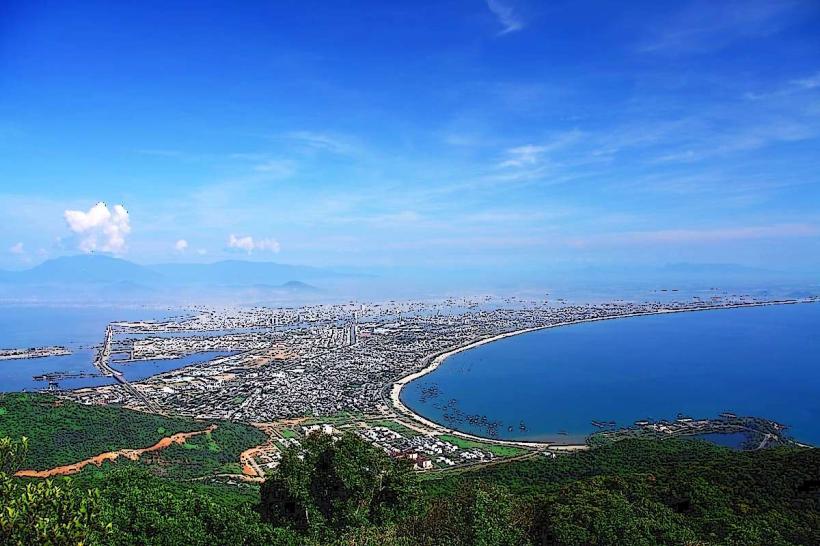
Visual Characteristics
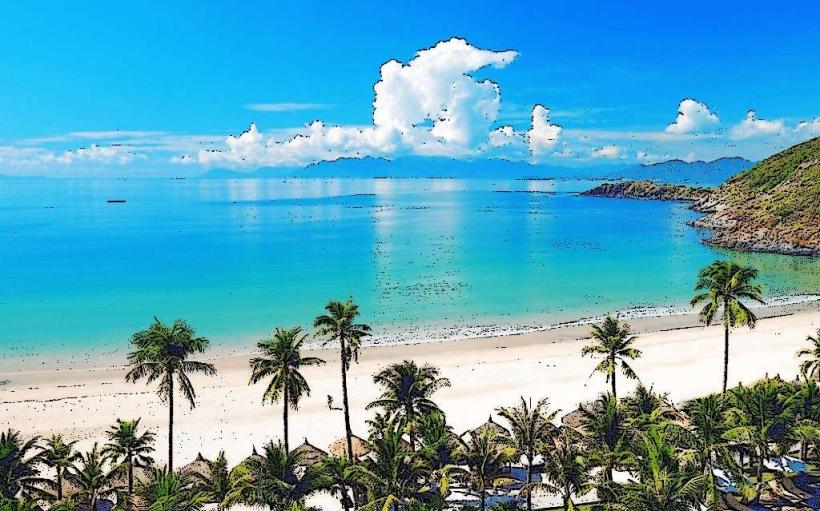
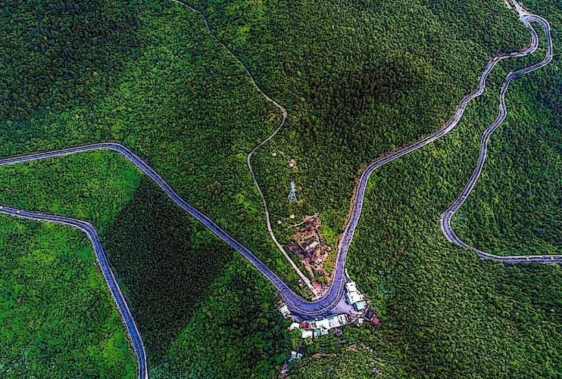
The peninsula features dense tropical forest covering steep hillsides that descend to the coastline. The vegetation is primarily evergreen, with a variety of tree species and undergrowth. The coastline consists of rocky outcrops and several sandy beaches, including Bai But, Bai Nam, and Bai Bac. The waters surrounding the peninsula are typically clear, with varying shades of blue and green depending on depth and light conditions. The elevation reaches approximately 693 meters at its highest point.
Location & Access Logistics
Son Tra Peninsula is situated approximately 10 kilometers northeast of Da Nang city center. Access is primarily via the Son Tra Road (also known as the Da Nang - Hoang Sa coastal road), which is a paved, winding route. Private vehicles (cars and motorbikes) are the most common mode of transport. Parking is available at designated areas, particularly near major attractions like the Linh Ung Pagoda and the Son Tra Observatory. Public transport directly to the peninsula is limited; however, local buses operate to the base of the peninsula, requiring onward travel by taxi or rented vehicle. Boat tours may also offer coastal views of the peninsula.
Historical & Ecological Origin
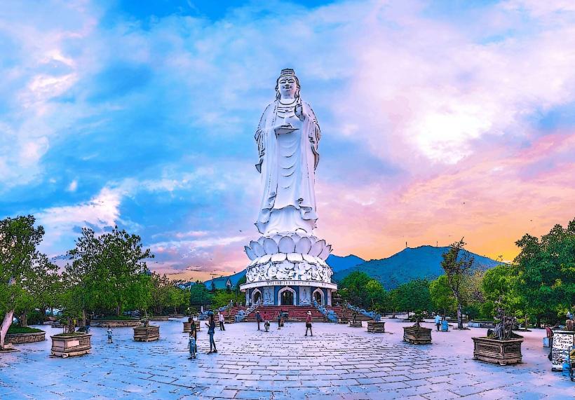
Son Tra Peninsula is a geological formation of granite, shaped by volcanic activity and coastal erosion over millennia. Ecologically, it is classified as a primary forest and a vital habitat for diverse flora and fauna. It is a protected area managed by the Son Tra Peninsula Management Board. Historically, the area has been used for defense purposes and as a strategic observation point. The Linh Ung Pagoda, a prominent structure on the peninsula, was constructed in the 21st century.
Key Highlights & Activities
Visitors can observe the Linh Ung Pagoda, which houses a large statue of the Goddess of Mercy. Hiking trails are available, offering access to viewpoints and different sections of the forest. Wildlife observation, particularly of the red-shanked douc langur, is a primary activity. Photography opportunities exist at various scenic overlooks. Swimming and sunbathing are possible at the accessible beaches. The Son Tra Observatory provides panoramic views of Da Nang city and the surrounding coastline.
Infrastructure & Amenities
Restrooms are available at key locations such as Linh Ung Pagoda and some beach access points. Shade is provided by natural tree cover in forested areas and by some man-made structures at popular spots. Cell phone signal (4G/5G) is generally available across most of the peninsula, though it may be intermittent in denser forest areas. Food vendors and small eateries are present near Linh Ung Pagoda and at some beach areas, offering local snacks and beverages.
Best Time to Visit
The best time of day for photography is generally in the early morning or late afternoon when the sunlight is softer and casts longer shadows. The dry season, from January to August, offers the most favorable weather conditions with less rainfall and lower humidity. High tide is not a specific requirement for most activities, but it can affect beach accessibility.
Facts & Legends
A local legend suggests that Son Tra Peninsula was once a separate island, connected to the mainland by a sandbar that formed over time. The peninsula is a critical sanctuary for the critically endangered red-shanked douc langur, making it a significant site for primate conservation efforts in Vietnam.
Nearby Landmarks
- Linh Ung Pagoda (0.2km West)
- My Khe Beach (3.5km South)
- Da Nang Museum (6.0km Southwest)
- Han Market (7.5km Southwest)
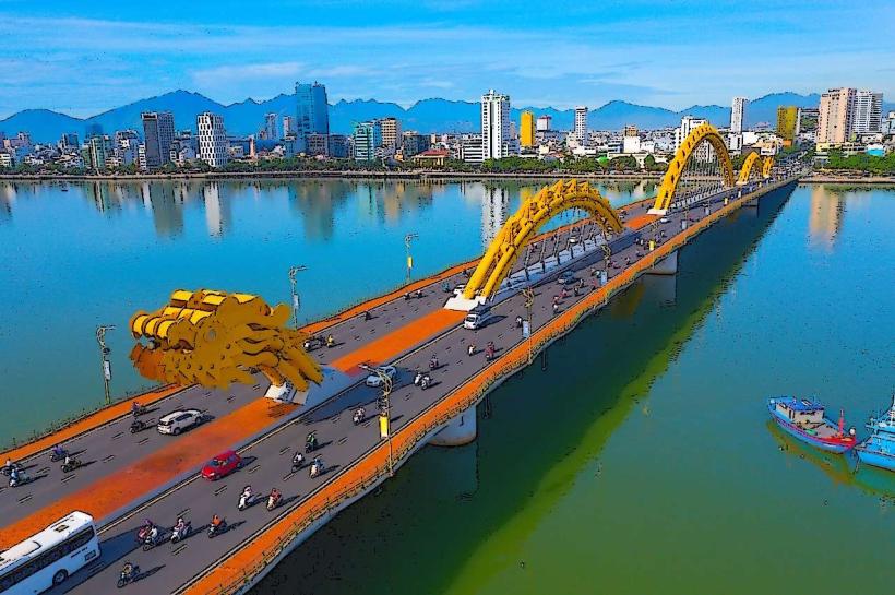
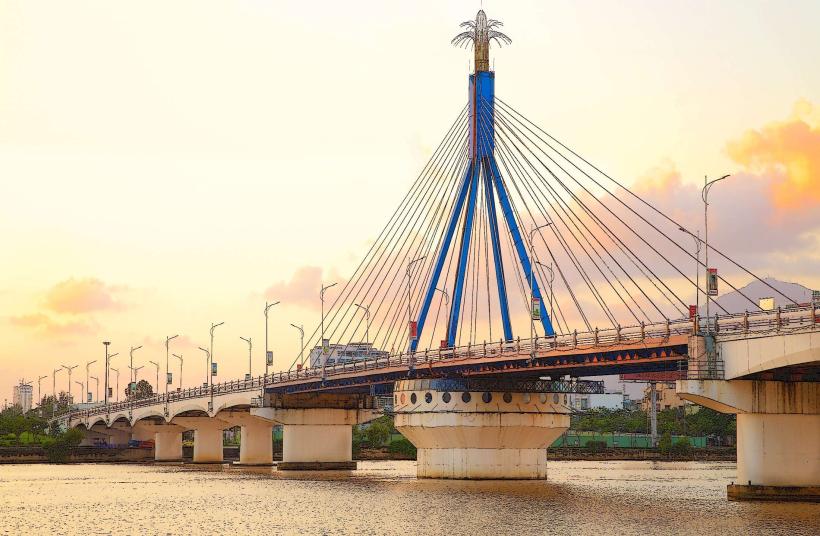
- Dragon Bridge (8.0km Southwest)