Landmark: Toma Plateau
City: East New Britain
Country: Papua New Guinea
Continent: Australia
Toma Plateau, East New Britain, Papua New Guinea, Australia
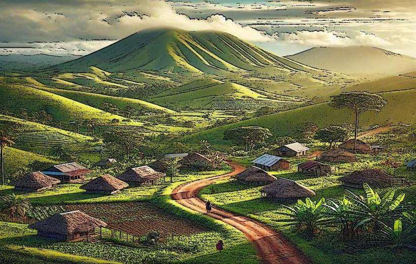
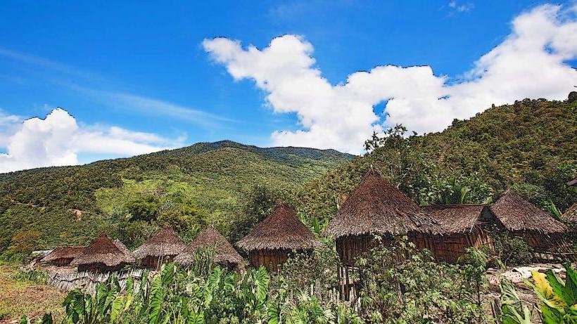
Toma Plateau is a highland region situated in the East New Britain province of Papua New Guinea. It is characterized by its elevated terrain and volcanic origins.
Visual Characteristics
The plateau exhibits a landscape dominated by rolling hills and volcanic soil, typically dark brown to black in color. Vegetation is dense, primarily consisting of tropical rainforest with a canopy reaching significant heights. Exposed rock formations are infrequent, with the surface largely covered by soil and flora. Elevation ranges from approximately 800 to 1200 meters above sea level.
Location & Access Logistics
Toma Plateau is located approximately 30 kilometers southwest of Kokopo, the provincial capital. Access is primarily via the Rabaul-Kokopo Road, turning onto the unpaved Toma Road. The journey from Kokopo takes approximately 1 to 1.5 hours by 4WD vehicle. Parking is informal and available at designated points along the main access routes. Public transport is limited to local hire vehicles.
Historical & Ecological Origin
The plateau is a product of volcanic activity, specifically the erosion and uplift associated with the nearby Mount Tavui caldera complex. Its ecological classification is tropical rainforest, supporting a diverse range of endemic flora and fauna. The area has been inhabited by indigenous communities for centuries, with evidence of traditional land use practices.
Key Highlights & Activities
Hiking is a primary activity, with several unmaintained trails traversing the plateau. Observation points offer panoramic views of the surrounding landscape and coastline. Birdwatching is possible due to the dense forest cover. Local guides can be arranged for more in-depth exploration of specific areas.
Infrastructure & Amenities
Basic infrastructure is minimal. There are no formal restrooms or designated shade structures. Cell phone signal is intermittent and generally unreliable. Food vendors are not present on the plateau itself; provisions should be carried from Kokopo.
Best Time to Visit
The best time for visiting is during the dry season, from June to September, to minimize the impact of heavy rainfall. The early morning hours, between 6:00 AM and 9:00 AM, offer optimal lighting conditions for photography due to the angle of the sun and potential for mist. There are no tidal considerations.
Facts & Legends
Local folklore suggests that the plateau was once the dwelling place of ancestral spirits. A specific point known as "Spirit Rock" is considered a sacred site, where offerings are sometimes left. The soil composition is rich in volcanic ash, contributing to its fertility.
Nearby Landmarks
- Mount Tavui (5km Northeast)
- Kokopo Town (30km Northeast)
- Rabaul Volcano Observatory (35km North)
- War Ram (38km North)
- Bita Paka War Cemetery (40km North)