Landmark: Baluan Island
City: Manus
Country: Papua New Guinea
Continent: Australia
Baluan Island, Manus, Papua New Guinea, Australia
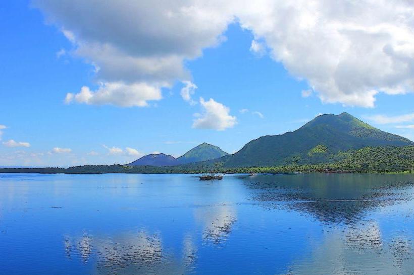
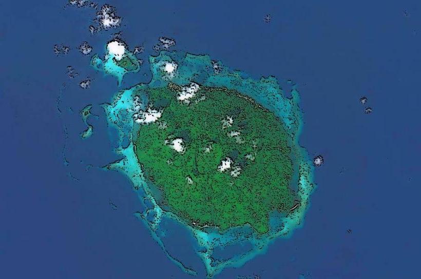
Baluan Island is a volcanic island situated in the Manus Province of Papua New Guinea.
It is part of the Admiralty Islands archipelago.
Visual Characteristics
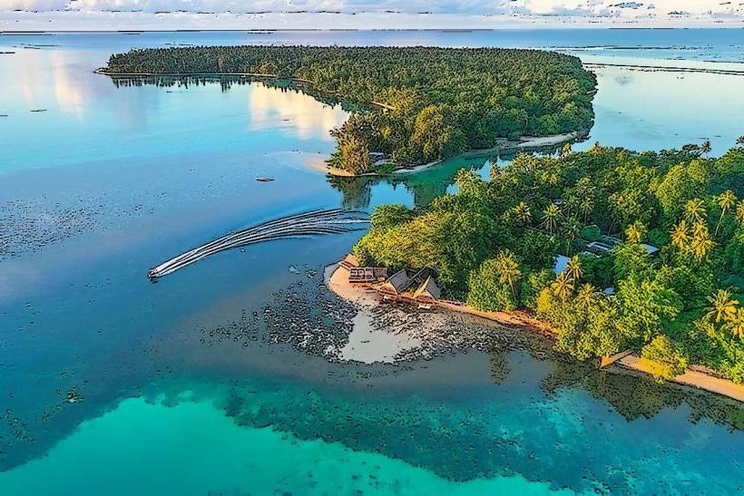
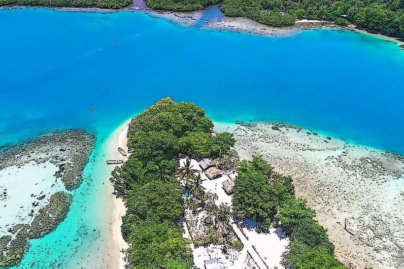
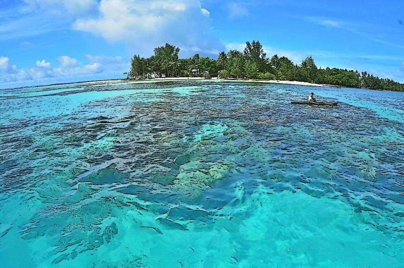
The island is characterized by its volcanic topography, featuring elevated terrain covered in dense tropical rainforest. The coastline consists of a mix of sandy beaches and rocky outcrops. The surrounding waters are typically clear, with varying shades of blue and green depending on depth and seabed composition.
Location & Access Logistics
Baluan Island is located approximately 40 kilometers southeast of Manus Island's main settlement, Lorengau. Access is primarily via boat or small aircraft. There are no regular ferry services; private boat charters or local fishing vessels are the most common means of transport from Manus Island. The journey can take between 2 to 4 hours depending on sea conditions. There are no established roads or vehicle access on the island itself.
Historical & Ecological Origin
Baluan Island is a stratovolcano, formed by volcanic activity over geological time. Its ecological classification is tropical rainforest island. Historically, the island has been inhabited by indigenous Papuan peoples for centuries, with evidence of early settlement patterns.
Key Highlights & Activities
Activities include exploring the island's interior via hiking trails, observing local flora and fauna, and engaging with the indigenous community. Snorkeling and diving are possible in the surrounding coral reefs, particularly on the western side of the island. Fishing expeditions can be arranged with local guides.
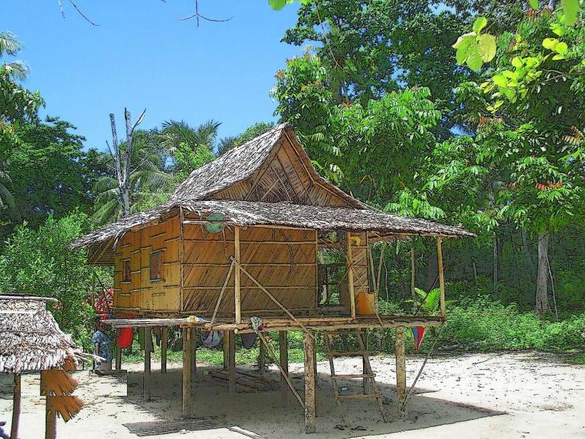
Infrastructure & Amenities
Basic infrastructure exists in the main village, including a small clinic and a primary school. Limited supplies may be available from local villagers. There are no formal tourist accommodations, restaurants, or shops. Cell phone signal is unreliable and generally absent outside of the main village area. Shade is provided by the dense forest canopy.
Best Time to Visit
The dry season, from June to September, offers the most favorable weather conditions with reduced rainfall. The best time of day for photography is generally in the morning or late afternoon when the sun's angle provides softer light. There are no specific tide requirements for most activities.
Facts & Legends
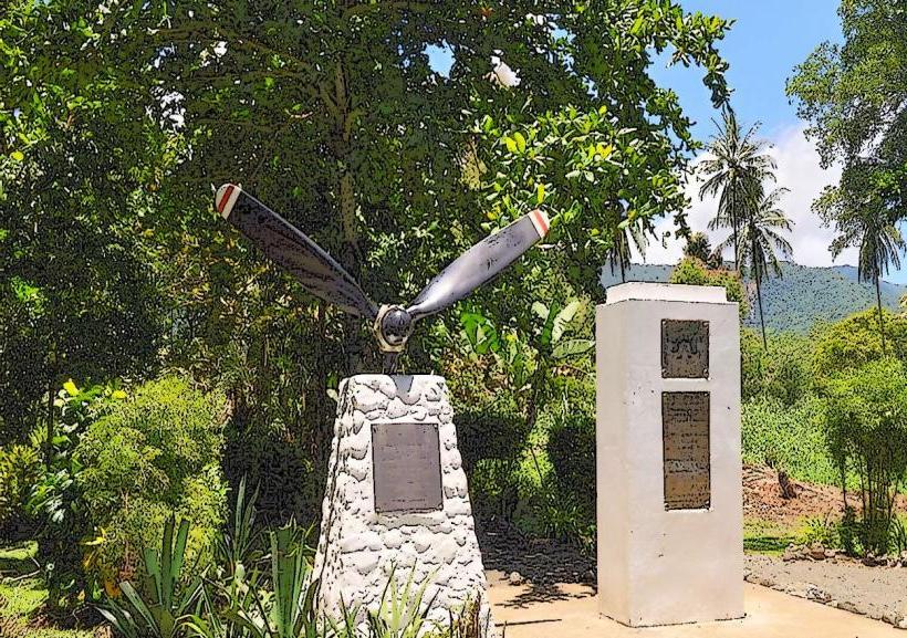
Local folklore speaks of ancient spirits residing within the island's volcanic peaks. A notable historical fact is the island's role as a strategic observation point during World War II, though no significant military installations remain.
Nearby Landmarks
- Manus Island (Lorengau) - 40km Northwest
- Lou Island - 25km Southwest
- Rambutyo Island - 35km Southeast
- Pak Island - 30km West