Landmark: Capitol Gorge
City: Torrey
Country: USA Utah
Continent: North America
Capitol Gorge, Torrey, USA Utah, North America
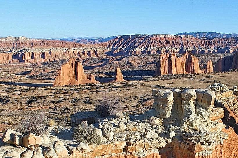
Capitol Gorge is a canyon located within Capitol Reef National Park near Torrey, Utah. It is a significant geological feature offering a route through the Waterpocket Fold.
Visual Characteristics
The gorge walls are composed of Navajo Sandstone, exhibiting cross-bedding patterns and varying shades of red, orange, and cream. The canyon floor is a mix of sand, gravel, and exposed bedrock. Vegetation is sparse, primarily consisting of desert shrubs and occasional juniper trees clinging to the slopes.
Location & Access Logistics
Capitol Gorge is accessed via the unpaved Capitol Gorge Road, which branches off the paved Scenic Drive within Capitol Reef National Park. The turnoff is approximately 12 miles south of the park's Fruita district. Capitol Gorge Road is a 4-mile (6.4 km) one-way dirt road suitable for passenger vehicles in dry conditions. Parking is available at the end of the road at the trailhead. No public transport services this location.
Historical & Ecological Origin
Capitol Gorge was carved by erosion over millions of years, primarily by water and wind acting upon the uplifted and faulted Navajo Sandstone of the Waterpocket Fold. Historically, it served as a route for early settlers and travelers through the region. The "Pioneer Register" on the gorge wall contains signatures and dates from 1880s travelers.
Key Highlights & Activities
Hiking is the primary activity. The main trail follows the canyon floor for approximately 2 miles (3.2 km) to the Pioneer Register. A short spur trail leads to the "Grand Wash" section. Observation of the geological strata and rock formations is a key activity. Photography is permitted.
Infrastructure & Amenities
Restrooms are available at the trailhead parking area. There is no shade along the hiking trail. Cell phone signal is unreliable to non-existent within the gorge. No food vendors are present within the gorge; visitors should carry their own provisions.
Best Time to Visit
The best time of day for photography is mid-morning or late afternoon when the sunlight casts shadows and highlights the rock colors. The best months for visiting are April, May, September, and October, avoiding the extreme heat of summer and potential winter closures due to snow. Access to Capitol Gorge Road is dependent on dry conditions; it can be impassable after rain.
Facts & Legends
The Pioneer Register, etched into the canyon wall, serves as a historical record of early passage. One notable entry is by John Wesley Powell's expedition members. The gorge's name is derived from its resemblance to the halls of a capitol building.
Nearby Landmarks
- Fruita Historic District (3.5km Northwest)
- Goosenecks Overlook (4.2km Southwest)
- Hickman Bridge Trailhead (3.8km Northwest)
- Panorama Point (3.1km Northwest)