Landmark: Grand Wash
City: Torrey
Country: USA Utah
Continent: North America
Grand Wash, Torrey, USA Utah, North America
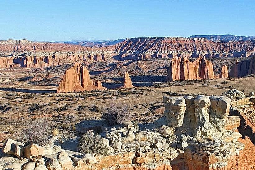
Grand Wash is a significant geological canyon located near Torrey, Utah, USA. It is a prominent feature within Capitol Reef National Park.
Visual Characteristics
Grand Wash is characterized by towering sandstone cliffs, primarily composed of Navajo Sandstone. The canyon walls exhibit distinct cross-bedding patterns and range in color from pale pink to deep red, depending on the light and mineral content. The canyon floor is a mix of sand, gravel, and exposed bedrock, with intermittent water flow during certain seasons. Vegetation is sparse, consisting mainly of desert shrubs and hardy trees like junipers and pinyon pines clinging to the cliff faces and canyon floor.
Location & Access Logistics
Grand Wash is accessible from the scenic drive within Capitol Reef National Park. The entrance to Grand Wash is located approximately 10 miles south of the park's visitor center. The road leading into the canyon is paved for the initial section, transitioning to a well-maintained gravel road suitable for most passenger vehicles. Parking is available at designated pull-offs and trailheads along the canyon floor. No public transport services operate directly within the canyon.
Historical & Ecological Origin
Grand Wash is a result of long-term erosion by water and wind acting upon the Navajo Sandstone, a geological formation dating back to the Jurassic period. The canyon's formation is part of the larger Waterpocket Fold, a monocline that uplifted and tilted the rock layers. Historically, the canyon served as a route for early settlers and prospectors traversing the region. Its ecological origin is tied to the arid desert environment of southern Utah, supporting specialized plant and animal life adapted to extreme conditions.
Key Highlights & Activities
Hiking is the primary activity. The Grand Wash Trail follows the canyon floor for approximately 4.5 miles one-way, offering access to narrow sections and towering walls. A popular short hike leads to the "Hickman Bridge" viewpoint. Photography is recommended during early morning and late afternoon for optimal lighting on the sandstone formations. Rock scrambling is possible in designated areas, but caution is advised due to loose rock.
Infrastructure & Amenities
Restrooms are available at the trailhead parking area at the canyon entrance. Shade is limited within the canyon itself, primarily found under overhangs or within narrow sections of the cliffs. Cell phone signal is generally unreliable within Grand Wash, with intermittent 4G/5G coverage possible near the park entrance. No food vendors are present within the canyon; visitors should carry all necessary provisions.
Best Time to Visit
The best time of day for photography is during the golden hours, approximately one hour after sunrise and one hour before sunset, when the light accentuates the colors of the sandstone. The most favorable months for visiting are April, May, September, and October, offering moderate temperatures. Summer months (June-August) can experience extreme heat. Flash floods are a risk during monsoon season (July-September), making it crucial to check weather forecasts before entering the canyon.
Facts & Legends
A notable historical oddity is the presence of petroglyphs found on some canyon walls, attributed to the Fremont culture, indicating ancient human presence. A practical tip for visitors is to be aware of potential flash flood conditions; if rain is observed or forecast, exit the canyon immediately.
Nearby Landmarks
- Capitol Reef National Park Visitor Center (16km North)
- Fruita Historic District (15km North)
- Goosenecks Overlook (18km Southeast)
- Cassidy Arch Trailhead (12km North)
- Capitol Gorge (11km North)