Landmark: Cook's Bay
City: Moorea
Country: French Polynesia
Continent: Australia
Cook's Bay, Moorea, French Polynesia, Australia
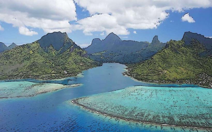
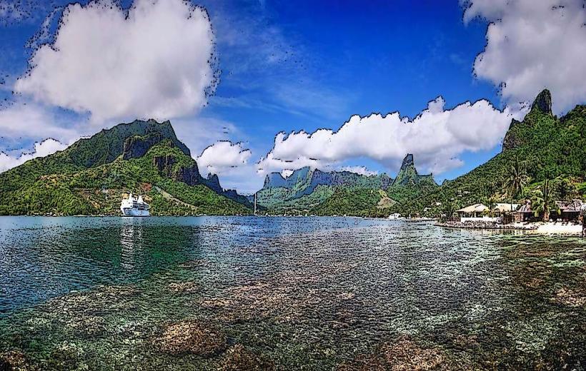
Cook's Bay is a significant inlet located on the northern coast of Moorea, French Polynesia. It is one of the island's two main bays, characterized by its deep, sheltered waters.
Visual Characteristics
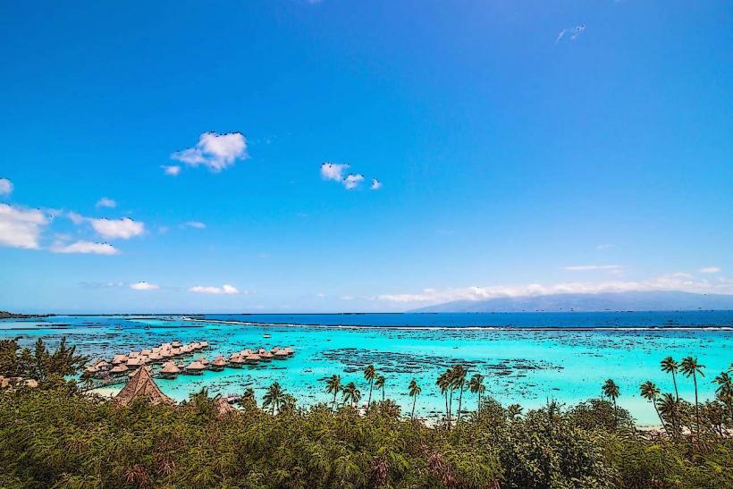
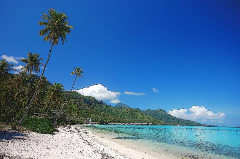
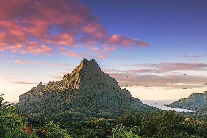
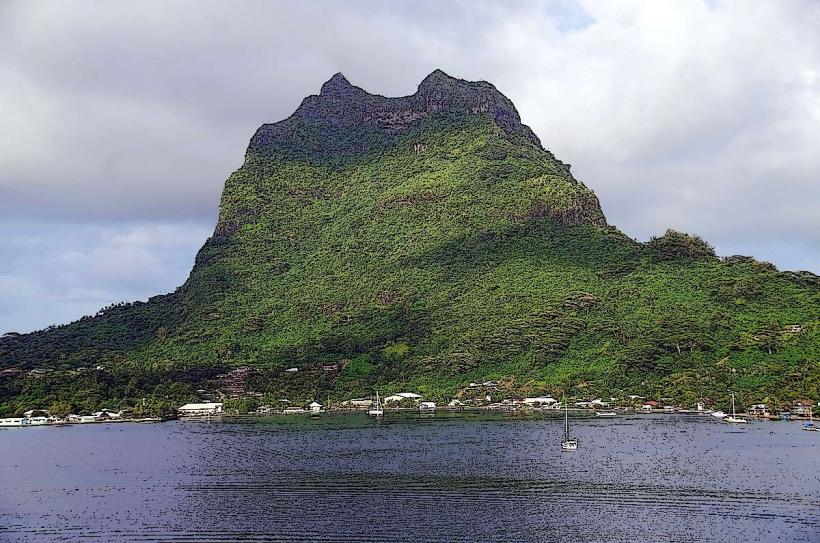
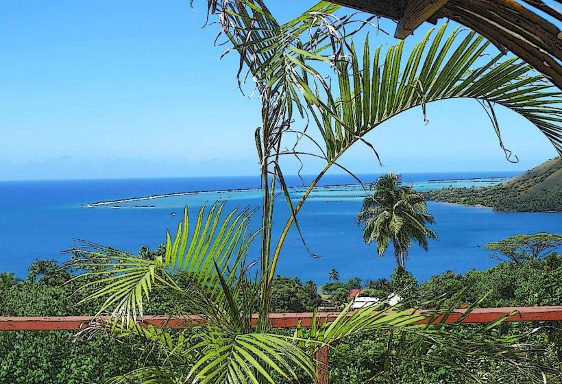
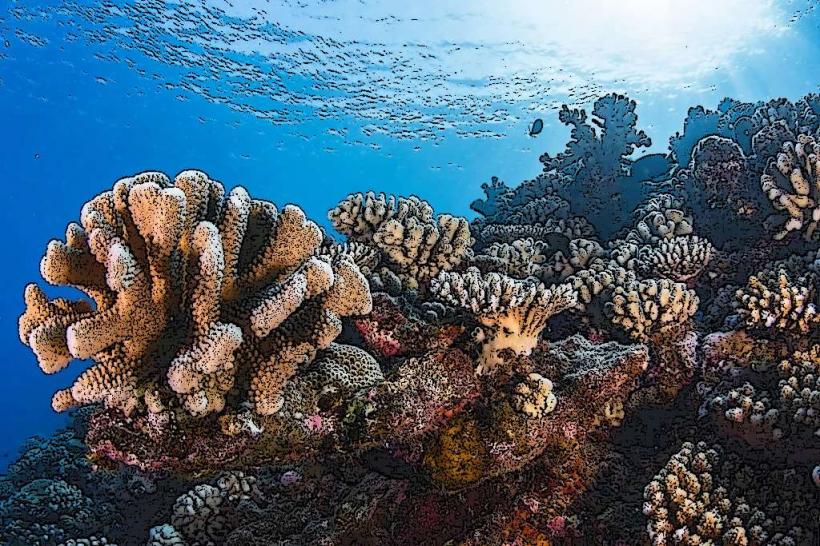
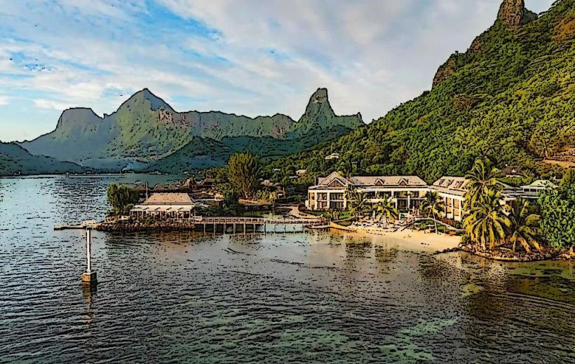
The bay is a deep, U-shaped indentation in the coastline, approximately 1.5 kilometers long. Steep, verdant volcanic cliffs rise directly from the water's edge on either side, reaching elevations of over 400 meters. The water within the bay is a deep blue, transitioning to lighter turquoise near the shore. The seabed is primarily sand and coral formations. Dense tropical vegetation covers the slopes of the surrounding mountains.
Location & Access Logistics
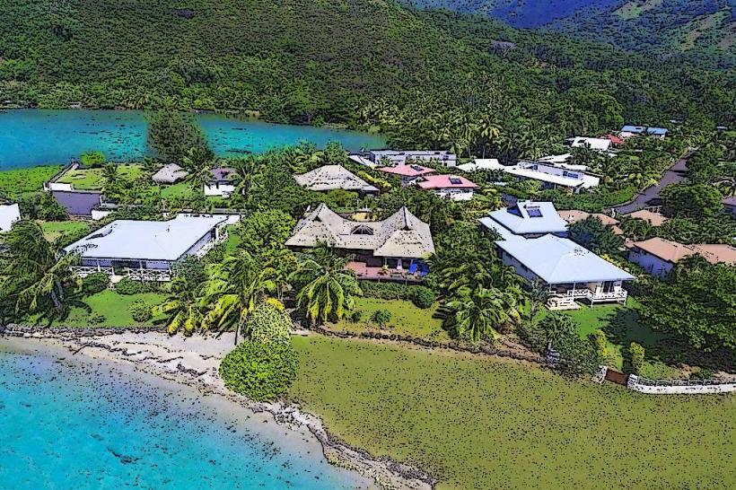
Cook's Bay is situated on the north shore of Moorea, approximately 10 kilometers west of the ferry terminal at Vaiare. Access is via the main island road, Route Principale 1. The road encircles the bay, providing direct vehicular access. Parking is available at designated pull-offs along the road. Public transport options include local buses that follow Route Principale 1, with stops at various points around the bay.
Historical & Ecological Origin
Cook's Bay is a drowned river valley, formed by the erosion of volcanic rock over millions of years. The bay's current shape is a result of sea-level rise after the last glacial period. It was named after Captain James Cook, who visited the island in 1774.
Key Highlights & Activities
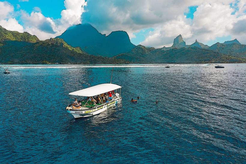
Boat tours offering snorkeling and diving excursions operate within the bay. Visitors can observe marine life, including reef sharks and rays. Kayaking and paddleboarding are possible in the calm waters. Hiking trails are present on the surrounding slopes, offering elevated views of the bay.
Infrastructure & Amenities
Restrooms are available at a small public park located on the eastern side of the bay. Shade is provided by trees in the park area. Cell phone signal (4G) is generally available. Food vendors are not permanently stationed within the bay, but small restaurants and snack bars are located along the main road nearby.
Best Time to Visit
The best time of day for photography is generally mid-morning or late afternoon when the sun angle provides optimal lighting on the cliffs and water. The dry season, from May to October, offers the most favorable weather conditions with lower humidity and less rainfall. High tide is not a critical factor for access or most activities.
Facts & Legends
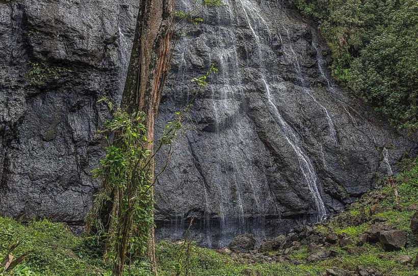
Local lore suggests that the bay was once a sacred place for ancient Polynesian chiefs. A specific point on the western cliff face is said to be where chiefs would observe the arrival of canoes. A unique tip for visitors is to look for the waterfall that cascades down the western cliff face after significant rainfall; it is often only visible for a short period.
Nearby Landmarks
- Opunohu Bay (0.8km East)
- Belvedere Lookout (2.5km Southwest)
- Moorea Tropical Garden (3.1km West)
- Marae Ahu'oa (3.5km West)
- Mount Rotui (4.2km Southwest)