Landmark: Emlembe Mountain Peak
City: Piggs Peak
Country: Eswatini
Continent: Africa
Emlembe Mountain Peak, Piggs Peak, Eswatini, Africa
The Emlembe Mountain Peak is the highest mountain in Eswatini, situated along the dramatic Drakensberg escarpment on the border shared with South Africa. Rising to an absolute elevation of 1,862 meters above sea level, the peak serves as a prominent geographic landmark and a critical international boundary point in the rugged northwest highlands of the Hhohho region.
Visual Characteristics
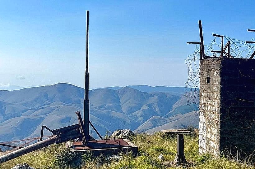
The peak is characterized by steep, rugged rock faces, sweeping alpine grasslands, and deep montane valleys that drop precipitously into the low-lying plains. The geology consists of ancient metamorphic formations belonging to the Barberton Greenstone Belt, displaying exposed layers of weathered quartzites and schists. The vegetation is adapted to high-altitude climates, dominated by resilient mountain grasses, low-lying shrubs, and pockets of indigenous mist-belt forest tucked into sheltered ravines. The summit is frequently enveloped in thick, moving cloud banks and dense mist blankets that drastically alter horizontal visibility within minutes.
Location & Access Logistics
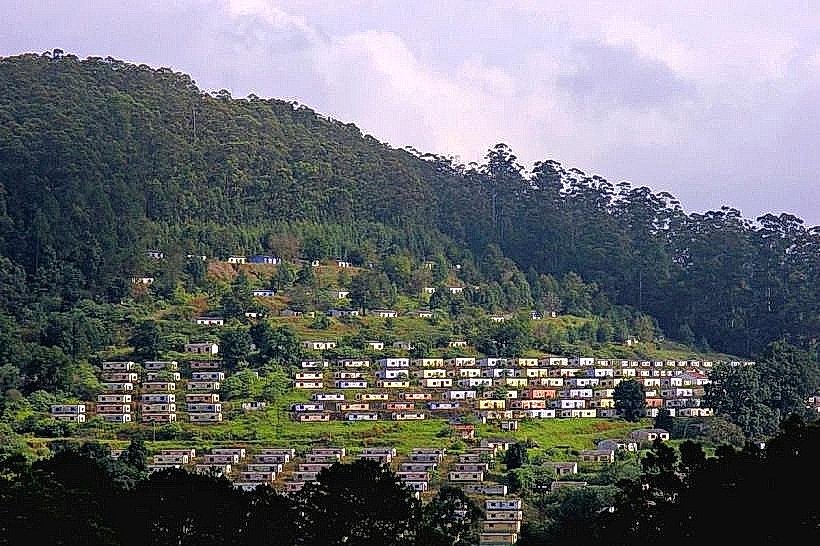
The mountain is located approximately 15 kilometers west of the town of Piggs Peak, situated directly adjacent to the historic mining village of Bulembu. Accessing the base of the trail involves traveling from Piggs Peak along the unpaved and winding R40 road toward Bulembu, a route that features rough gravel and steep gradients best navigated with a high-clearance vehicle. Public transport users can board a local kombi from the Piggs Peak Central Market to Bulembu village, from where the remaining distance to the summit must be covered via a strenuous, unpaved 5-kilometer hiking trail. Parking is available at the designated gravel lots within Bulembu village.
Historical & Ecological Origin
Emlembe was formed during the Archean Eon as part of one of the oldest mountain ranges on Earth, containing rock structures that have remained geologically stable for over three billion years. Historically, the mountain served as a geographical barrier and a strategic look-out point during early tribal migrations and regional territorial conflicts. The name "Emlembe" translates to "The Place of the Spider" in siSwati, referencing the steep, web-like patterns of the deep ravines scoring the mountain's flanks. The ecology is highly specialized, acting as a protected sanctuary for rare, endemic alpine flora and vulnerable bird species adapted specifically to montane grassland biomes.
Key Highlights & Activities
Hiking and technical trail scrambling to the 1,862-meter summit mark the primary activities at the site. The standard trekking route ascends through alpine ridges, offering expansive panoramic views across the Barberton Makhonjwa Mountains in South Africa and the rolling hills of northern Eswatini on clear days. Bird-watching is common along the lower montane forests, with opportunities to spot high-altitude species like the vulnerable blue swallow and the Cape vulture. High-altitude landscape photography is a core focus from the rocky outcrops near the summit marker.
Infrastructure & Amenities
The mountain remains an unmanaged wilderness area with zero commercial infrastructure along the trails or at the summit. Paved walking tracks and public restrooms are non-existent, requiring hikers to utilize the basic amenities available 5 kilometers away in Bulembu village. Natural shade is completely absent along the exposed ridges and summit meadows, leaving hikers fully exposed to intense solar radiation and high winds. Cellular network reception is highly erratic, showing sporadic 3G or 4G signals near the peak from both Swazi and South African networks, but dropping completely within the deep valleys.
Best Time to Visit
The peak is accessible 24 hours a day, but trekking should be confined to early daylight hours. The optimal window for climbing and photography is from 06:00 to 11:00 during the dry winter months of May to August, when the atmosphere is clearest and the risk of severe mountain thunderstorms is minimized. The summer rainy season from November to March yields vibrant green landscapes but brings extreme heat, thick midday mountain mists that obscure trails, and hazardous lightning strikes along the exposed ridges.
Facts & Legends
A verified geographical reality of Emlembe is that it sits within the Barberton Makhonjwa Mountains, which contain some of the oldest, most exceptionally preserved volcanic and sedimentary rocks on the planet, providing scientists with an unparalleled geological archive of Earth's early surface conditions. Local mountain lore includes narratives warning hikers about the unpredictable behavior of the summit mists, which are traditionally said to be controlled by ancestral mountain spirits who rapidly deploy the thick fog to disorient and turn back travelers who enter the upper crags without a respectful and quiet demeanor.
Nearby Landmarks
Bulembu Museum and Ghost Town: 4.8km East
Bulembu Canopy Tour: 5.0km East
Peak Timbers Industrial Plantation: 12.0km East
Piggs Peak Central Market: 15.0km East
Phophonyane Falls Nature Reserve: 18.5km East