Landmark: Maguga Dam Viewpoint
City: Piggs Peak
Country: Eswatini
Continent: Africa
Maguga Dam Viewpoint, Piggs Peak, Eswatini, Africa
The Maguga Dam Viewpoint is a dedicated structural observation platform and civic rest stop positioned on a high southern ridge overlooking the Komati River valley in the Hhohho region of northwest Eswatini. Operating as a formal tourism asset managed by the Komati Basin Water Authority (KOBWA), the site functions as the primary educational and photographic staging area for viewing the Maguga Dam Wall engineering complex.
Visual Characteristics
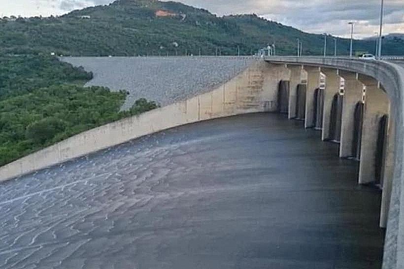
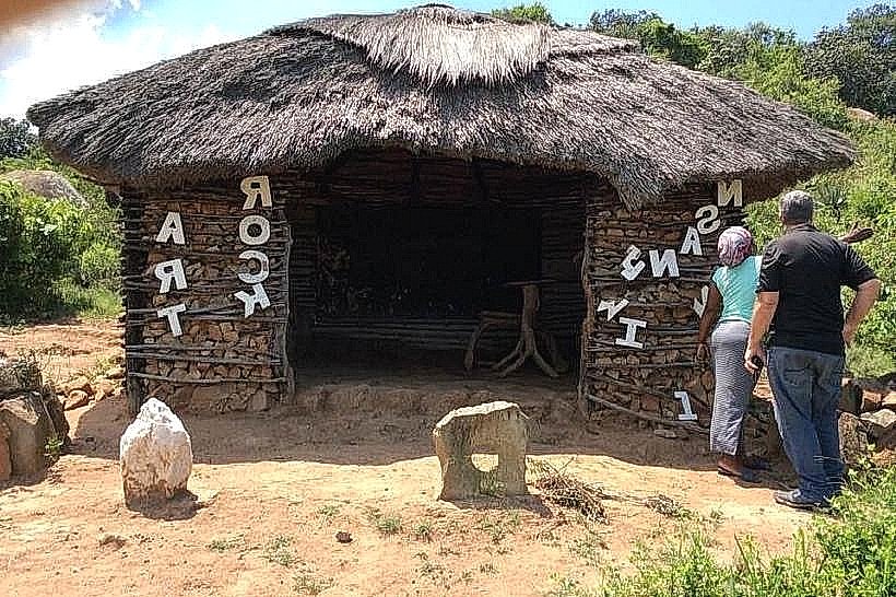
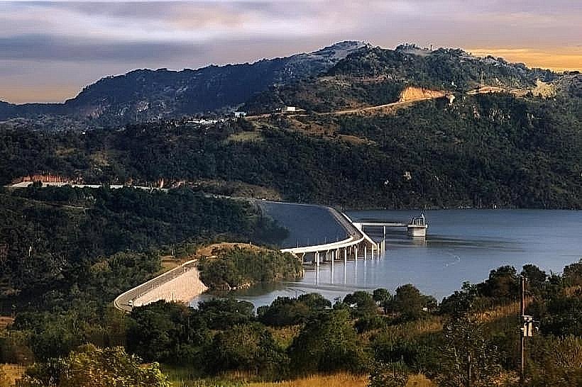
The landmark features a terraced, stone-paved plaza built into the natural granite hillside, enclosed by heavy metal safety railings and low stone retaining walls. The central architectural element is an open-air information pavilion constructed from local ironstone masonry pillars and a high-pitched thatch roof. Large, weatherproof educational panels detailing the construction matrices of the dam project are mounted along the internal walls. The vantage point looks directly down on the curved rockfill face of the dam, the labyrinth spillway, and the expansive reservoir winding through the northern montane topography.
Location & Access Logistics
The viewpoint is situated directly off the paved MR19 road, approximately 15 kilometers south of the town of Piggs Peak and 35 kilometers north of Mbabane. Drivers can access the turn-off via the MR1 highway, navigating onto the MR19 scenic loop, which leads directly to the wide entrance of the facility. Public transport users can board any regional bus or kombi traveling the route between Mbabane and Piggs Peak via the dam, requesting a direct drop-off at the viewpoint gates. The site incorporates a fully paved, secure asphalt parking lot designed to accommodate private cars, utility vehicles, and overland tour buses.
Historical & Ecological Origin
The viewpoint was formally designed and opened to the public in 2001, coinciding with the completion of the adjacent 115-meter-high Maguga Dam Wall. The primary purpose of the facility was to provide an engineered, high-elevation safety perimeter for engineers, state dignitaries, and the public to observe the water management system without interfering with the security or operation of the hydroelectric infrastructure below. The surrounding landscape consists of highveld-middleveld transition bushveld, which was carefully preserved during the construction phase to prevent slope erosion into the Komati gorge.
Key Highlights & Activities
Conducting panoramic photographic documentation of the engineering works and the 332-million-cubic-meter reservoir is the primary activity at the site. Reading and studying the engineering diagrams and historical records displayed inside the central pavilion provides a comprehensive educational look into regional water economics. Visitors can browse the adjacent craft market stalls to interact with local artisans and purchase hand-carved wooden figures, Swazi stone sculptures, and woven textiles.
Infrastructure & Amenities
The facility is equipped with modern, fully plumbed public restroom facilities maintained under strict municipal standards. The structural thatch pavilion and smaller stone gazebos provide complete shade from solar radiation, though the open observation terraces remain fully exposed to weather elements. Cellular network coverage is exceptional across the plaza, delivering highly stable 4G and 5G signals from local telecommunications grids. A full-service restaurant and a series of formalized curio vendor booths operate directly on the perimeter of the viewpoint lot.
Best Time to Visit
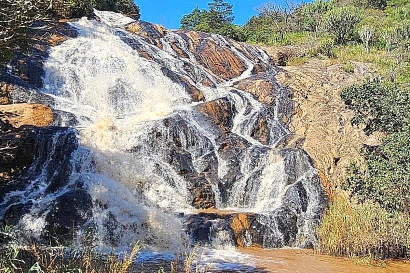
The viewpoint complex is open daily during daylight hours, typically from 08:00 to 17:00. The optimal time for photography is during the late afternoon from 15:30 to 17:00, when the low-angled sun casts a warm light directly across the rockfill embankment and illuminates the depth of the downstream canyon. Visiting during the summer wet season between December and February maximizes the chance of observing massive water sheets cascading over the concrete spillway below, while the winter months from May to August offer the most comfortable walking temperatures.
Facts & Legends
A verified historical oddity displayed at the viewpoint records that the construction of the dam required the relocation of several ancient gravesites and historical homesteads; these operations were executed via strict cultural protocols and traditional ceremonies overseen by local chiefs to maintain spiritual harmony before the valley was flooded. Local tour guides frequenting the deck often share the narrative of the Nsangwini rock art sites located deeper in the gorge, noting that the modern observation platform looks directly over a valley that served as a sacred hunting ground for San hunter-gatherers thousands of years before the first concrete foundations were poured.
Nearby Landmarks
Maguga Dam Wall: 0.3km North
Komati River Gorge Trails: 1.2km South
Maguga Power Station: 1.8km Southwest
Phophonyane Falls Nature Reserve: 14.8km Northwest
Piggs Peak Central Market: 15.3km North