Landmark: Maguga Dam Wall
City: Piggs Peak
Country: Eswatini
Continent: Africa
Maguga Dam Wall, Piggs Peak, Eswatini, Africa
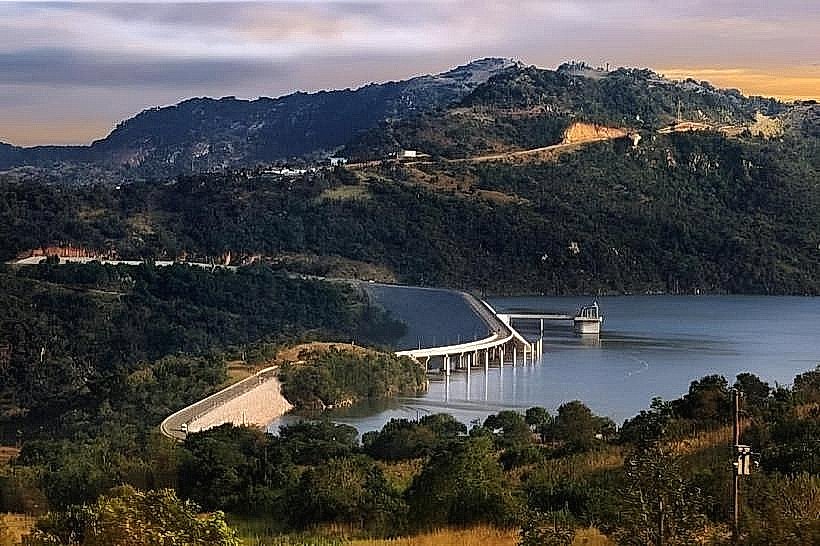
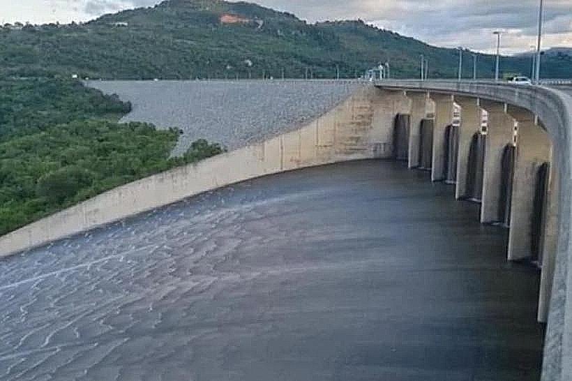
The Maguga Dam Wall is a massive engineering structure and civil infrastructure landmark spanning the Komati River in the Hhohho region of northwest Eswatini. Operating as the centerpiece of the Komati River Basin Development Project, the dam wall serves a critical role in regional water resource management, flood control, and hydroelectric power generation for both Eswatini and South Africa.
Visual Characteristics
The landmark is a massive, curved clay-core rockfill embankment dam wall that rises 115 meters above the riverbed and stretches 870 meters along its crest. The exterior face of the wall is constructed from millions of tons of dark gray, graded rock fragments, giving it a rugged, geometric, and textured appearance that contrasts with the smooth, reinforced concrete of the adjacent spillway structures. The vast reservoir behind the wall forms an expansive deep blue body of water winding through the steep, rocky valleys, while the downstream side features a massive concrete labyrinth spillway designed to handle extreme flood discharge.
Location & Access Logistics
The dam wall is situated along the paved MR19 road, approximately 15 kilometers south of the town of Piggs Peak and roughly 35 kilometers north of Mbabane. Drivers can easily access the crest view via the MR1 highway, turning onto the scenic MR19 dam loop road which crosses directly over the top of the wall. Public transport commuters can board a bus or kombi traveling between Mbabane and Piggs Peak via the dam route, requesting to disembark at the main Maguga viewpoint transit stop. A formal paved parking lot with dedicated parking bays for private cars and tour buses is available at the Maguga Dam Viewpoint complex on the southern ridge.
Historical & Ecological Origin
Construction of the dam wall began in 1998 and was formally completed in 2001 under the joint administration of the Komati Basin Water Authority (KOBWA), a bilateral treaty entity established between the governments of Eswatini and South Africa. The primary purpose of the wall was to create a 332-million-cubic-meter reservoir to provide reliable irrigation water for the regional sugar cane industry and to drive a 20-megawatt subterranean hydroelectric power station. The flooding of the valley altered the local riverine ecology, prompting extensive conservation programs to relocate endemic plant species and monitor the micro-climate changes within the Komati gorge.
Key Highlights & Activities
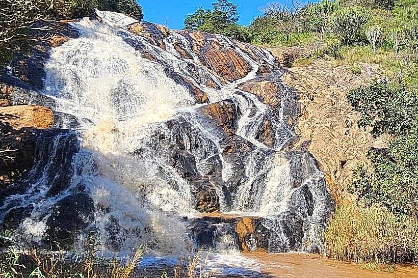
Walking or driving along the public roadway on the crest of the wall provides an uninhibited panoramic view of the steep Komati River Gorge on one side and the vast reservoir on the other. Educational viewing of the massive labyrinth spillway-a specialized zig-zag concrete design that maximizes water discharge during heavy rains-is a primary focus for visitors at the southern viewpoint. Boat cruises, fresh-water angling for largemouth bass, and bird-watching are popular recreational activities operated from the nearby lakeside resort docks.
Infrastructure & Amenities
The main Maguga Dam Viewpoint complex features modern, fully plumbed public restrooms and a paved information center. The viewing platforms are equipped with structural stone pavilions that provide complete shade from the sun, whereas the pedestrian paths across the top of the dam wall are entirely exposed to weather elements. Cellular network signal strength is exceptional across the site, with reliable 4G and 5G connectivity available along the crest. A restaurant and craft kiosks selling local Swazi woodcarvings and textiles operate at the main viewpoint overlooking the wall.
Best Time to Visit
The public viewpoint and crest road are accessible daily during daylight hours. The optimal time for photography is during the late afternoon from 15:30 to 17:00, when the low-angled sun casts a warm light across the rockfill face of the wall and highlights the depth of the downstream gorge. Visiting during the summer rainy season from December to February increases the likelihood of witnessing the spectacular sight of water rushing over the concrete spillway cascades, though the winter dry months from May to August provide the most comfortable walking temperatures.
Facts & Legends
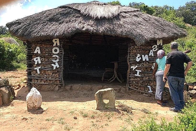
A verified engineering oddity of the Maguga Dam Wall is its labyrinth spillway, which is highly rated globally for its specific design efficiency, allowing it to discharge immense volumes of water over a narrower physical footprint than a conventional flat spillway. Local community history notes that during the construction phase, ancient San rock art sites scattered among the boulders of the gorge had to be meticulously cataloged, protected, or digitally salvaged before the rising waters of the reservoir permanently submerged the old canyon walls, preserving a hidden tribal archive beneath the modern lake.
Nearby Landmarks
Maguga Viewpoint Restaurant: 0.3km South
Komati River Gorge Trails: 1.5km South
Maguga Power Station: 2.0km Southwest
Phophonyane Falls Nature Reserve: 14.5km Northwest
Piggs Peak Central Market: 15.0km North