Landmark: Fairyland Loop Trail
City: Bryce Canyon City
Country: USA Utah
Continent: North America
Fairyland Loop Trail, Bryce Canyon City, USA Utah, North America
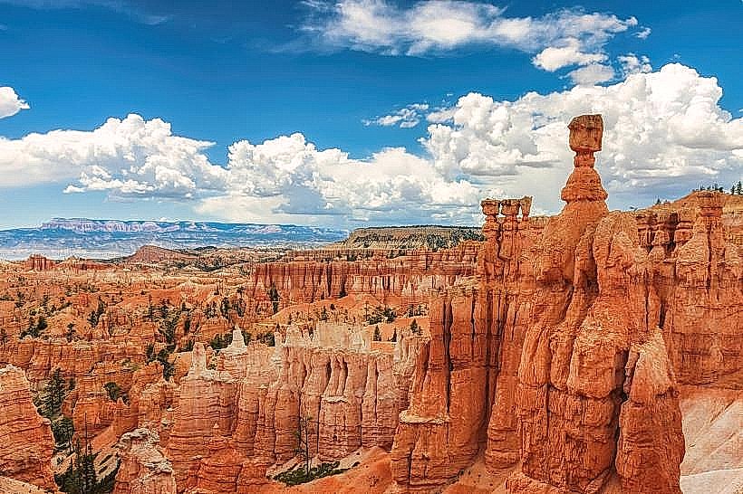
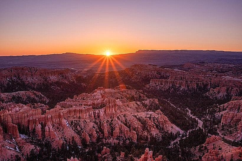
The Fairyland Loop Trail is a 12.4 km (7.7 mile) hiking trail located in Bryce Canyon National Park, Utah, USA.
Visual Characteristics
The trail traverses hoodoos, which are irregular columns of rock formed by erosion. These formations exhibit colors ranging from white and pink to red and orange. The trail descends into a canyon, offering views of amphitheaters filled with these spires. Vegetation consists primarily of Ponderosa pine and juniper trees at higher elevations, transitioning to desert scrub in the canyon bottom.
Location & Access Logistics
The trailhead is situated 4.8 km (3 miles) north of the Bryce Canyon National Park Visitor Center along the park's scenic drive. Parking is available at the trailhead, which can accommodate approximately 20 vehicles. No public transport services directly access the trailhead. The nearest major airport is Salt Lake City International Airport (SLC), located approximately 400 km (250 miles) northwest.
Historical & Ecological Origin
The hoodoos are formed through a process of differential erosion. The Pink Member of the Claron Formation, composed of limestone and mudstone, is susceptible to weathering. Frost wedging and rainwater runoff carve away softer rock, leaving behind the more resistant fins and spires. The trail itself was established to provide access for hikers to observe these geological features.
Key Highlights & Activities
Hiking the full loop is the primary activity. Specific points of interest include the Tower Bridge formation and the Chinese Wall. The trail involves significant elevation changes, with descents and ascents of approximately 200 meters (650 feet).
Infrastructure & Amenities
No restrooms or potable water are available directly at the trailhead or along the trail. Shade is limited, primarily found under Ponderosa pines at higher elevations. Cell phone signal is intermittent to non-existent along most of the trail.
Best Time to Visit
For optimal lighting on the hoodoos, early morning or late afternoon is recommended. The best months for hiking are May, June, September, and October, avoiding the extreme heat of summer and potential snow in winter. The trail is generally accessible year-round, but snow and ice can make sections hazardous from November through April.
Facts & Legends
The Paiute people, who historically inhabited the region, believed that the hoodoos were ancient people who were turned into stone by the trickster spirit Coyote. A specific tip for visitors is to carry at least 2 liters of water per person, as the arid environment and strenuous nature of the hike require significant hydration.
Nearby Landmarks
- Bryce Point (1.5km Southwest)
- Sunrise Point (2.0km Southwest)
- Inspiration Point (2.5km Southwest)
- Sunset Point (3.0km Southwest)
- Bryce Canyon Lodge (3.5km Southwest)