Landmark: Navajo Loop Trail
City: Bryce Canyon City
Country: USA Utah
Continent: North America
Navajo Loop Trail, Bryce Canyon City, USA Utah, North America
The Navajo Loop Trail is a 1.3-mile (2.1 km) loop trail located in Bryce Canyon National Park, Utah, USA.
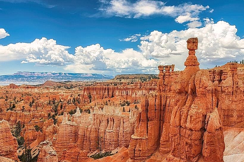
It descends into the canyon, offering close-up views of hoodoos.
Visual Characteristics
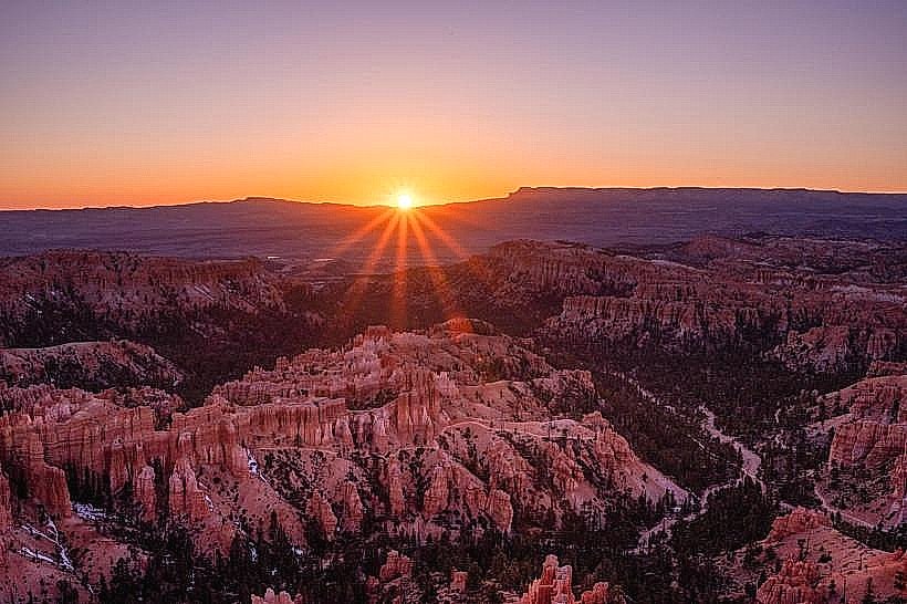
The trail is primarily composed of compacted dirt and sand. It features steep switchbacks carved into the canyon walls. The dominant geological formations are hoodoos, which are tall, thin spires of rock. The rock colors range from pale orange to deep red, with white limestone caps. Vegetation is sparse, consisting mainly of pinyon pines and junipers clinging to the canyon sides.
Location & Access Logistics
The trailhead is located at the Bryce Amphitheater, approximately 2 miles (3.2 km) south of Bryce Canyon City along Scenic Drive. Parking is available at the Sunset Point parking area, which can accommodate approximately 50 vehicles. During peak season (typically April through October), shuttle bus service operates within the park, with a stop at Sunset Point. Access is also possible from Sunrise Point via the Queen's Garden Trail, forming a longer loop.
Historical & Ecological Origin
The Navajo Loop Trail was constructed in the early 20th century by prospectors and later improved by the Civilian Conservation Corps. Its original purpose was to provide access to the canyon floor for exploration and resource extraction. Ecologically, the hoodoos are formed by differential erosion of the Claron Formation, a sequence of limestone and mudstone layers. The forces of frost wedging, rain, and streamflow have sculpted these unique rock spires over millions of years.
Key Highlights & Activities
Hiking the loop is the primary activity. Key features include Wall Street, a narrow section of the trail with tall Douglas fir trees, and Two Bridges, a natural rock formation. The trail descends approximately 600 feet (183 meters). Photography is a common activity due to the unique geological formations and lighting conditions.
Infrastructure & Amenities
Restrooms are available at the Sunset Point trailhead. There is limited natural shade along the trail, particularly during midday. Cell phone signal (4G/5G) is generally unreliable within the canyon. No food vendors are present directly on the trail; food services are available at the Bryce Canyon Lodge and in Bryce Canyon City.
Best Time to Visit
For photography, early morning or late afternoon provides the best lighting for the hoodoos. The best months for hiking are May through October, avoiding winter snow and ice. The trail is accessible year-round, but conditions can be hazardous in winter. High tide is not applicable as this is a terrestrial trail.
Facts & Legends
The trail's name, "Navajo," is a misnomer; the Navajo people did not inhabit this specific area. The name was likely applied by early settlers. A specific tip for visitors is to consider hiking the loop in a clockwise direction from Sunset Point to descend Wall Street, which can be steeper and more challenging to ascend.
Nearby Landmarks
- Sunrise Point (0.2km North)
- Bryce Point (1.5km North)
- Inspiration Point (1.0km North)
- Paria View (2.5km Southwest)
- Fairyland Loop Trailhead (2.0km North)