Landmark: Mossy Cave Trail
City: Bryce Canyon City
Country: USA Utah
Continent: North America
Mossy Cave Trail, Bryce Canyon City, USA Utah, North America
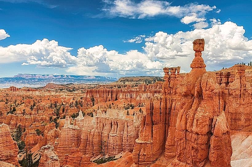
Mossy Cave Trail is a short, accessible hiking path located within Bryce Canyon National Park in Utah, USA. It leads to a unique geological feature characterized by a rock alcove with dripping water and moss growth.
Visual Characteristics
The trail itself is a dirt path, approximately 0.5 miles (0.8 km) in length, with some gravel sections. The primary feature is a rock alcove formed by erosion. Water seeps from the sandstone above, creating a constant drip that supports a dense growth of moss and ferns on the alcove walls. Small seasonal waterfalls are present, particularly during spring melt or after rainfall. The surrounding vegetation consists of Ponderosa pines and junipers.
Location & Access Logistics
Mossy Cave Trail is situated along Highway 12, approximately 10 miles (16 km) east of Bryce Canyon City. Access is via a designated parking area directly off Highway 12. The parking area is small and can fill quickly during peak seasons. There are no public transport services directly to the trailhead. The trail is at an elevation of approximately 7,000 feet (2,134 meters).
Historical & Ecological Origin
The alcove is a result of differential erosion of the Navajo Sandstone. The water seeping through the porous sandstone carries dissolved minerals, which contribute to the formation of small mineral deposits. The moss and ferns thrive in the consistently moist microclimate created by the seeping water. Historically, this area was part of the larger geological processes that formed Bryce Canyon's hoodoos.
Key Highlights & Activities
The primary activity is walking the trail to view the moss-covered alcove and seasonal waterfalls. The trail is generally flat with minimal elevation gain, making it suitable for most visitors. Photography of the unique water-formed features is a common activity. The trail is an out-and-back route.
Infrastructure & Amenities
A small, unpaved parking area is available. There are no restrooms or potable water sources at the trailhead. Cell phone signal is intermittent to non-existent. No food vendors are located at the trailhead; visitors should bring their own supplies.
Best Time to Visit
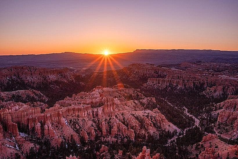
The trail is accessible year-round, but conditions can vary. In winter, ice can form on the trail and alcove, requiring caution. Spring and early summer offer the best chance to see active water flow and lush moss growth. Mid-day offers direct sunlight on the alcove, while early morning or late afternoon can provide softer lighting for photography. High tide is not applicable to this location.
Facts & Legends
The "cave" is not a true cave but an erosional alcove. The water source is groundwater that percolates through the sandstone layers. A specific tip for visitors is to listen for the sound of dripping water, which can help locate the alcove even before it is visually apparent.
Nearby Landmarks
- Rim Trail (0.5km West)
- Bryce Point (8km West)
- Inspiration Point (9km West)
- Sunrise Point (9.5km West)
- Sunset Point (10km West)