Landmark: Mar Lodj Island
City: Fatick
Country: Senegal
Continent: Africa
Mar Lodj Island, Fatick, Senegal, Africa
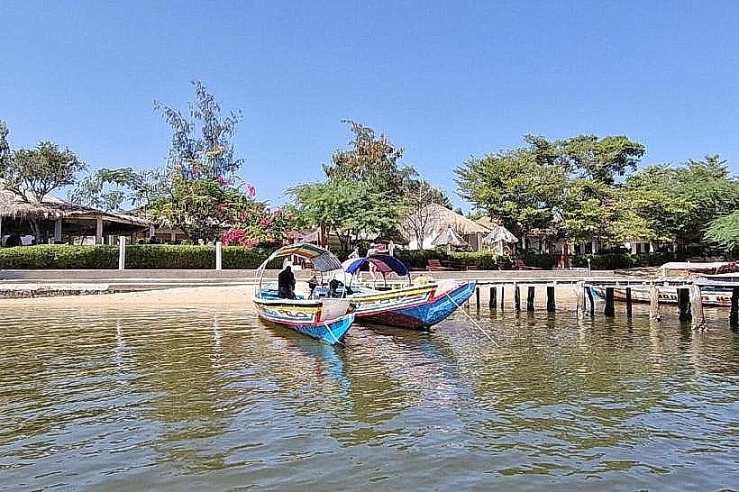
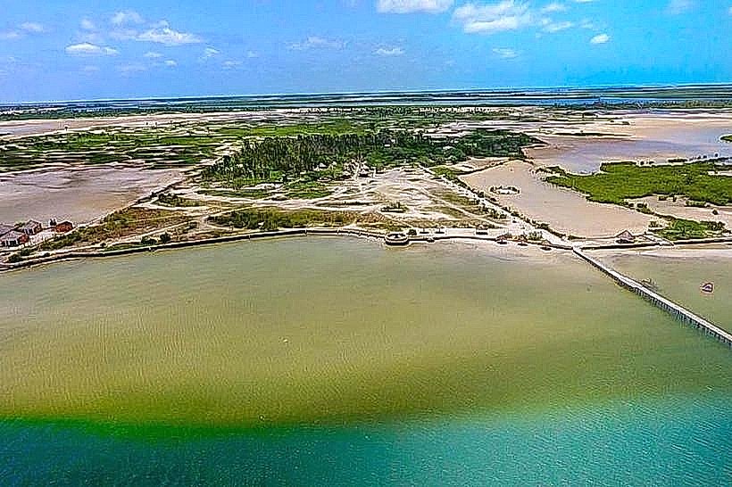
Mar Lodj Island is a 150-square-kilometer landmass located in the Saloum Delta, near the Atlantic coast of the Fatick Region. It is a fluvial-maritime island accessible only by boat, situated within the Sine-Saloum UNESCO Biosphere Reserve.
Visual Characteristics
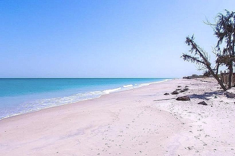
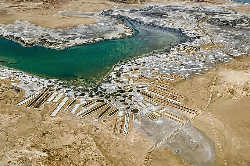
The island is a low-lying, flat territory characterized by a mix of sandy soils, vast "tannes" (salt flats), and sudano-sahelian savanna. Vegetation consists primarily of dense clusters of rônier palms, ancient baobabs, and sprawling cheese trees (kapok). The perimeter is defined by a network of "bolongs" (saltwater creeks) and dense mangrove forests with exposed aerial roots.
Location & Access Logistics
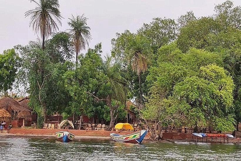
The island is located approximately 150km south of Dakar. Access is primarily through the village of Ndangane, where motorized wooden pirogues depart for the 20-minute crossing to the island's main docks. There are no paved roads on the island; internal transport is conducted via horse-drawn carriages (calèches) or on foot along sandy tracks.
Historical & Ecological Origin
Mar Lodj was formed by the accumulation of alluvial deposits and sand at the confluence of the Sine and Saloum rivers. It has been inhabited for centuries by the Serer people, who utilized the island's relative isolation for protection and traditional agriculture. The island’s ecology is defined by its position in a "reverse estuary," where water salinity levels remain high year-round.
Key Highlights & Activities
Artisanal fishing and the gathering of mangrove oysters are central activities. Visitors can navigate the surrounding bolongs by pirogue for birdwatching, specifically to see herons, pelicans, and flamingos. The island is also known for its traditional wrestling matches and the "Tree of Three Religions," a site where a baobab, a cheese tree, and a palm tree have grown together, serving as a local symbol of inter-religious harmony.
Infrastructure & Amenities
Infrastructure is concentrated in three main villages: Mar Fafako, Mar Lotie, and Mar Soulou. Several eco-lodges provide basic accommodation, pit latrines, and bucket showers. There is no central electrical grid; most facilities rely on solar power. 4G cellular signal is available but can be inconsistent in the interior. Potable water is primarily sourced from local boreholes.
Best Time to Visit
The dry season from November to May is the most suitable time for travel, as the island's sandy paths are dry and bird activity is at its peak. Photography is best in the early morning (07:30–09:00) when the salt flats reflect the light or during the late afternoon (17:00–18:30) to capture the silhouettes of the rônier palms.
Facts & Legends
Local Serer tradition holds that the island is inhabited by "Pangool" (ancestral spirits) who reside in specific sacred groves. A unique historical feature is the use of the "talking drum" or tama to communicate between the island's villages, a practice that continues for announcing communal events or funerals.
Nearby Landmarks
Ndangane Village – 4.5km East (across the water)
Saloum Delta National Park – 2.0km South
Foundiougne – 15.0km Southeast
Joal-Fadiouth Shell Island – 35.0km North