Landmark: Palmarin Beach
City: Fatick
Country: Senegal
Continent: Africa
Palmarin Beach, Fatick, Senegal, Africa
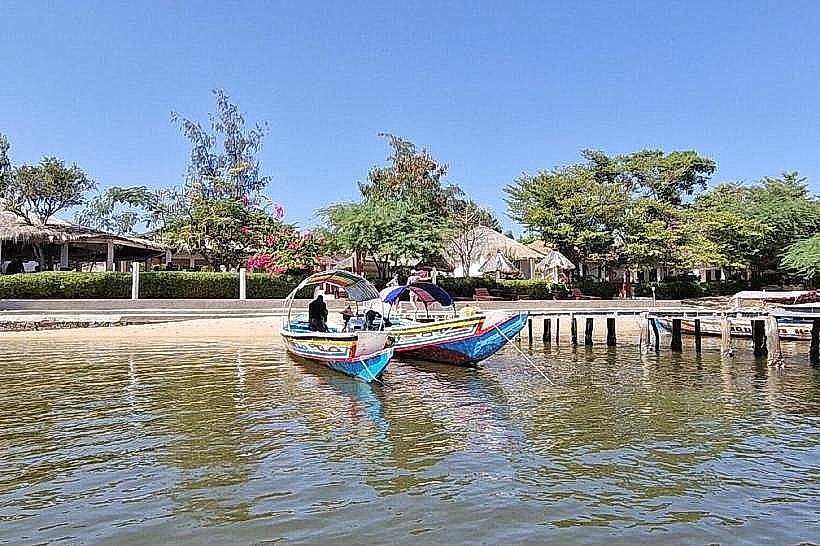
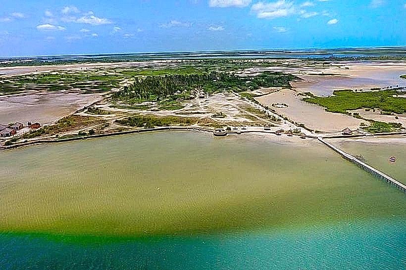
Palmarin Beach is a coastal landmark situated on the Sangomar Peninsula in the Fatick Region, where the Atlantic Ocean meets the Saloum Delta. This geographical point serves as a critical nesting ground for sea turtles and a primary center for artisanal maritime activities within the Sine-Saloum biosphere.
Visual Characteristics
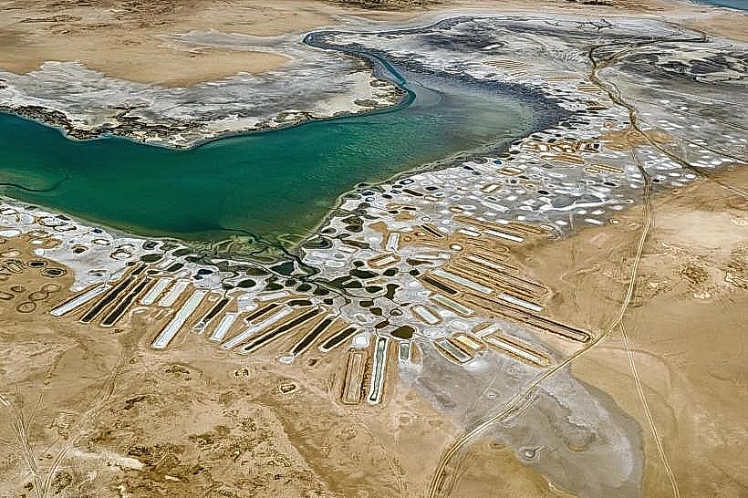
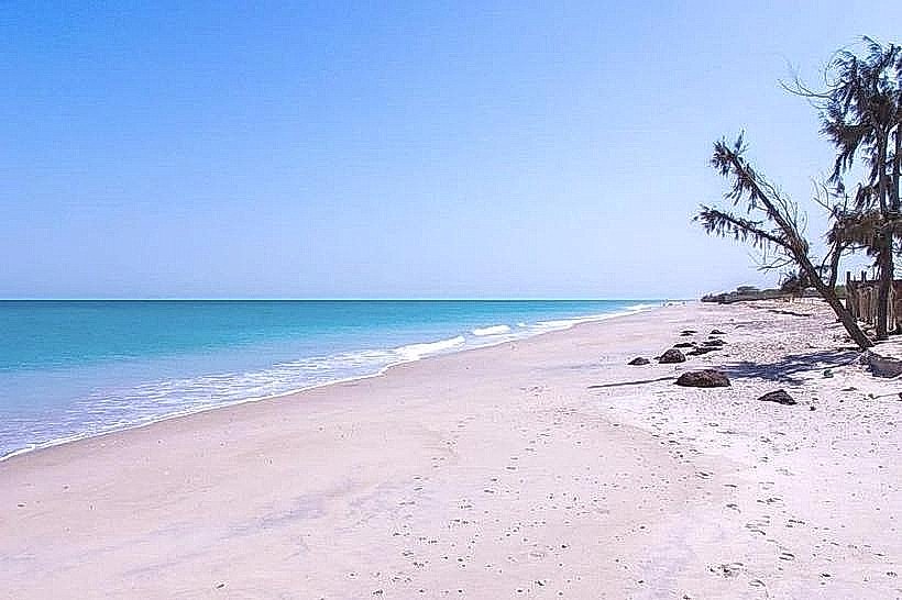
The beach features a wide expanse of fine, pale ochre sand transitionally bordered by saltwater lagoons and mangroves. The Atlantic side is characterized by moderate surf and a lack of significant elevation, while the landward side contains "tannes" or barren salt flats that change color from white to pink depending on salt concentration. Stands of coconut palms and tall rônier palms provide the only vertical breaks in the low-lying coastal horizon.
Location & Access Logistics
The site is located approximately 140km south of Dakar and 45km west of the city of Joal-Fadiouth. Access is via the paved R20 coastal road that runs the length of the peninsula. Public transport is available through "sept-place" bush taxis departing from Mbour or Joal. Within the village of Palmarin, the beach is accessible by foot or horse-drawn carriage from the main road.
Historical & Ecological Origin
The peninsula is a dynamic sandy spit formed by longshore drift and sediment deposits from the Saloum River. Historically, the area was settled by the Serer people who utilized the unique environment for a combination of fishing and salt harvesting. In 1970, the surrounding area was integrated into the protected zones of the Sine-Saloum Delta to preserve its role as a migratory bird corridor.
Key Highlights & Activities
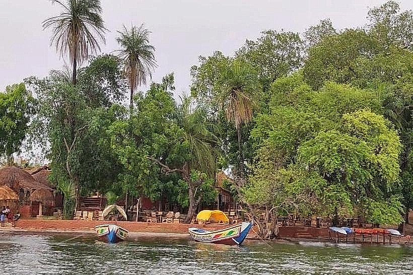
Artisanal fishing is the primary activity, with large, brightly painted wooden pirogues launching from the shore daily. Visitors can observe traditional salt harvesting in the nearby lagoons, where salt is raked into pyramidal piles. Seasonal sea turtle monitoring occurs between June and October. The calm waters of the landward lagoons are utilized for manual pirogue excursions through the mangrove channels.
Infrastructure & Amenities
Infrastructure consists of several eco-lodges and small guest houses positioned behind the primary dune line. These facilities offer basic restrooms and shaded seating. There are no public changing rooms or lifeguard services on the main beach. 4G cellular signal is functional but can be intermittent near the water’s edge. Food and water are available from small vendors located in the nearby Palmarin-Fadiouth village clusters.
Best Time to Visit
The optimal time for weather is the dry season from November to May. For photography, the late afternoon (17:30–19:00) provides clear views of the Atlantic sunset and the silhouettes of rônier palms. High tide is required for pirogue navigation into the secondary mangrove channels, while low tide is best for walking along the expansive salt flats.
Facts & Legends
Local Serer tradition holds that the "tannes" of Palmarin are protected by water spirits, and certain areas of the beach are historically reserved for sacred rituals. A verified historical oddity is the presence of ancient shell middens buried beneath the sand, remnants of prehistoric shellfish processing that shaped the peninsula's topography over thousands of years.
Nearby Landmarks
Sangomar Point – 5.0km South
Palmarin Salt Flats – 0.5km East
Djifer Fishing Port – 12.0km South
Joal-Fadiouth Shell Island – 45.0km North