Landmark: San Rafael Swell
City: Green River
Country: USA Utah
Continent: North America
San Rafael Swell, Green River, USA Utah, North America
The San Rafael Swell is a large geological anticline located in central Utah, USA, near the city of Green River.
Visual Characteristics
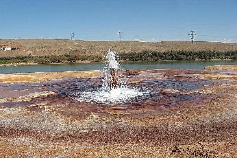
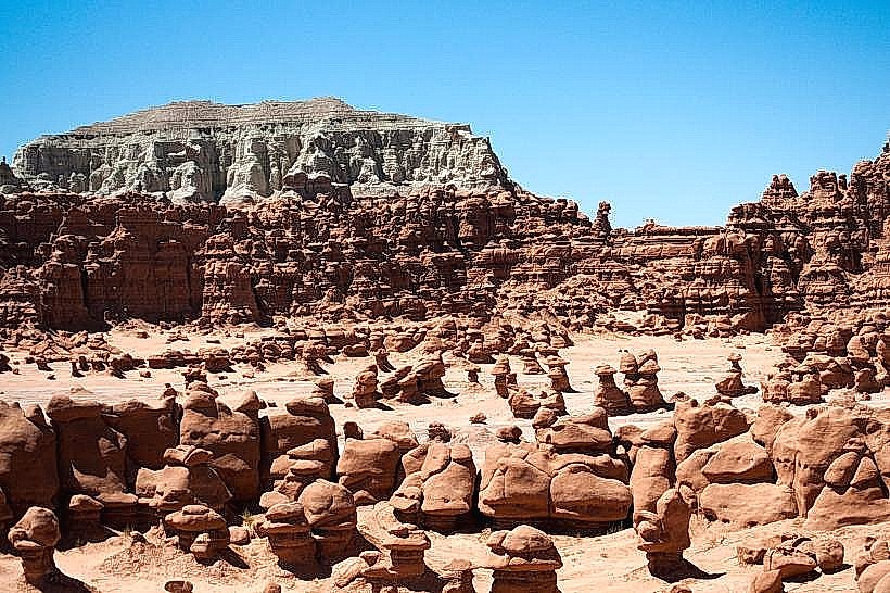
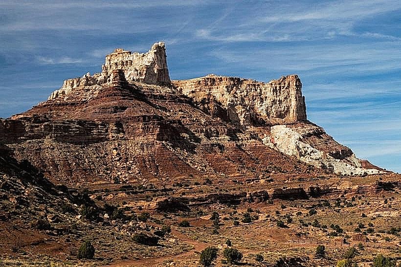
The Swell is characterized by extensive canyon systems, mesas, buttes, and exposed rock layers displaying a range of sedimentary rock colors including red, orange, and tan. The terrain is arid, with sparse desert vegetation such as sagebrush, juniper, and pinyon pine. Elevation varies significantly across the region.
Location & Access Logistics
The San Rafael Swell is accessible via Interstate 70 (I-70) which bisects the area. Major access points include exits 116 (UT-24 junction) and 131 (UT-153 junction). From Green River, take I-70 West for approximately 30 miles to reach the eastern edge of the Swell. Unpaved roads, such as the San Rafael Road and various BLM routes, provide access to interior canyons. Parking is generally available at trailheads and designated viewpoints. No public transport services operate within the Swell itself.
Historical & Ecological Origin
The San Rafael Swell is a geological formation resulting from the uplift of sedimentary rock layers, creating an anticline. This process occurred over millions of years, exposing rock strata from the Permian to the Cretaceous periods. The area is classified as a high desert ecosystem, supporting flora and fauna adapted to arid conditions.
Key Highlights & Activities
Activities include hiking in canyons such as Little Wild Horse Canyon and Goblin Valley State Park (adjacent to the Swell). Off-road vehicle use is permitted on designated routes. Rock climbing and canyoneering are popular in specific areas. Scenic drives are available on I-70 and unpaved access roads. Stargazing is a notable activity due to low light pollution.
Infrastructure & Amenities
Restrooms are available at some developed viewpoints and trailheads along I-70 and UT-24. Shade is limited to natural rock overhangs and sparse vegetation. Cell phone signal is intermittent and generally unavailable in canyon bottoms and remote areas. Food vendors are not present within the Swell; services are available in Green River and Hanksville.
Best Time to Visit
The best months for visiting are April through May and September through October, when temperatures are moderate. Summer months (June-August) can experience extreme heat, making daytime activities challenging. Early morning and late afternoon offer optimal lighting for photography due to the angle of the sun on the rock formations.
Facts & Legends
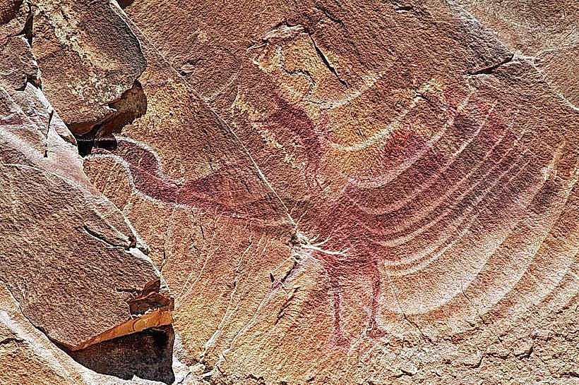
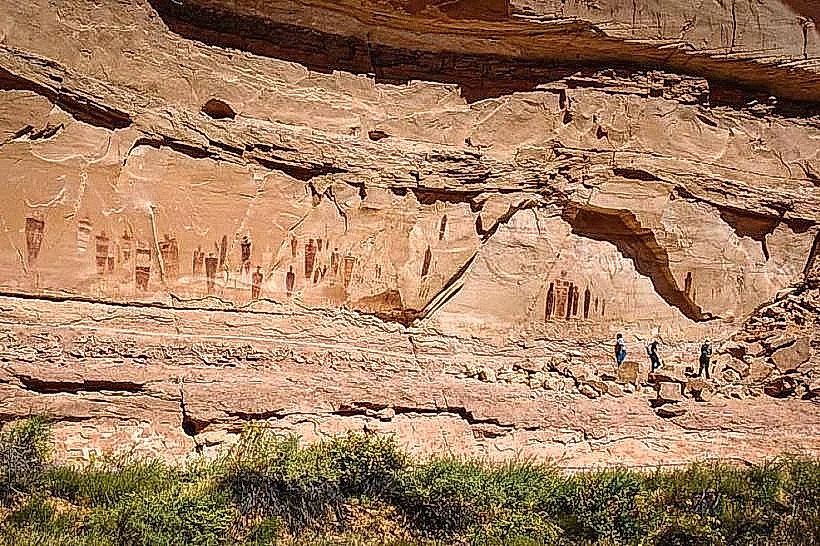
The Swell contains numerous petroglyphs and pictographs left by ancestral Puebloans and Fremont cultures, indicating long-term human presence. One specific area, known as the "Goblin Valley," features unique hoodoo rock formations that resemble figures, leading to local folklore about them being ancient statues.
Nearby Landmarks
- Goblin Valley State Park (15km Southwest)
- Little Wild Horse Canyon (20km Southwest)
- Green River City (45km East)
- Arches National Park (70km Northeast)
- Capitol Reef National Park (80km West)