Landmark: Fosu Lagoon
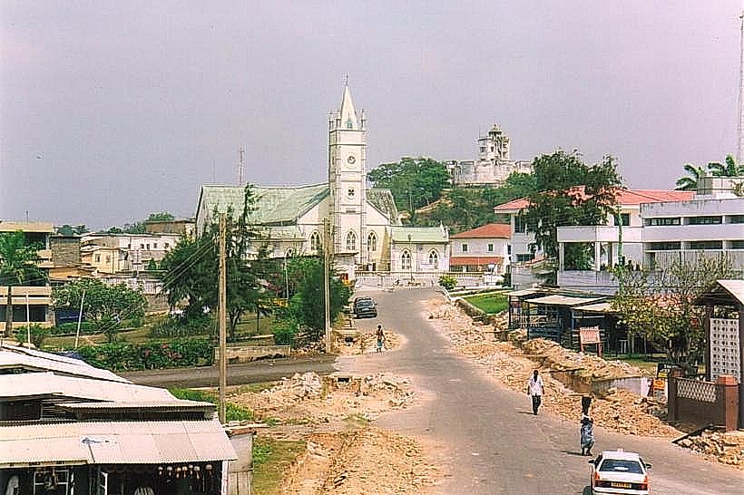
City: Cape Coast
Country: Ghana
Continent: Africa
Fosu Lagoon, Cape Coast, Ghana, Africa
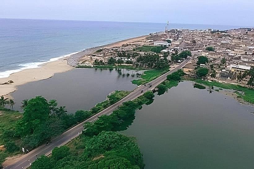
Fosu Lagoon is an enclosed body of brackish water located in the western sector of Cape Coast, Ghana. It serves as a critical ecological boundary between the central urban district and the University of Cape Coast, separated from the Atlantic Ocean by a narrow sandbar.
Visual Characteristics
The lagoon is characterized by a mix of open water and dense mangrove swamps along its northern and western perimeters. The water typically appears dark green or opaque due to high sediment and organic content. The surrounding landscape features low-lying marshlands, stands of white mangroves, and a narrow strip of sandy beach where the lagoon occasionally breaches into the sea.
Location & Access Logistics
The site is located adjacent to the N1 highway (Accra-Takoradi Road) in the Bakaano area. It is approximately 2km west of Cape Coast Castle. Access is possible via the Bakaano-Elmina road which runs alongside the southern edge of the water. Visitors can use private vehicles or public "tro-tros" from Kotokuraba Market, alighting at the Bakaano Roundabout. Footpaths provide limited access to the water's edge near the bridge and the local shrines.
Historical & Ecological Origin
Fosu Lagoon is a coastal wetland ecosystem formed by the entrapment of the Fosu River's discharge. It is traditionally considered sacred and is inhabited by the tutelary deity of Cape Coast, Nana Fosu. Historically, the lagoon provided a natural defense barrier for the town. Ecologically, it acts as a nursery for various fish species and a habitat for migratory birds, though it faces ongoing environmental challenges from urban runoff and siltation.
Key Highlights & Activities
The primary cultural activity is the "Bakatue" ritual, part of the annual Fetu Afahye festival, where the Omanhen (paramount chief) lifts a ban on fishing in the lagoon. For researchers and birdwatchers, the northern banks offer opportunities to observe local avian life. Canoe rides are occasionally conducted by local fishermen, though primary activities remain focused on traditional observance and ecological study.
Infrastructure & Amenities
Infrastructure around the lagoon is minimal. There are no formal visitor centers or public restrooms directly on the banks. Shade is provided by scattered trees and small local structures along the Bakaano road. 4G/5G cellular signal is strong throughout the area due to its proximity to the city center and the university. Food and retail services are concentrated at the nearby Bakaano Roundabout.
Best Time to Visit
The lagoon is best visited during the Fetu Afahye festival in the first week of September to witness the Bakatue ceremony. For photography and nature viewing, the early morning hours (06:30–08:30) provide the best light and cooler temperatures. The dry season from November to February is ideal for walking the perimeter paths, as water levels are lower and the surrounding ground is firmer.
Facts & Legends
According to Fante tradition, the lagoon is the home of a powerful spirit that protects the people of Cape Coast; consequently, fishing is strictly prohibited every Tuesday out of respect for the deity. A local legend states that the lagoon's water level rises and falls not just with the tides, but in response to the spiritual state of the community, signaling prosperity or impending hardship.
Nearby Landmarks
Bakaano Roundabout – 0.2km East
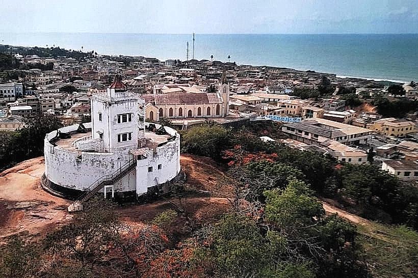
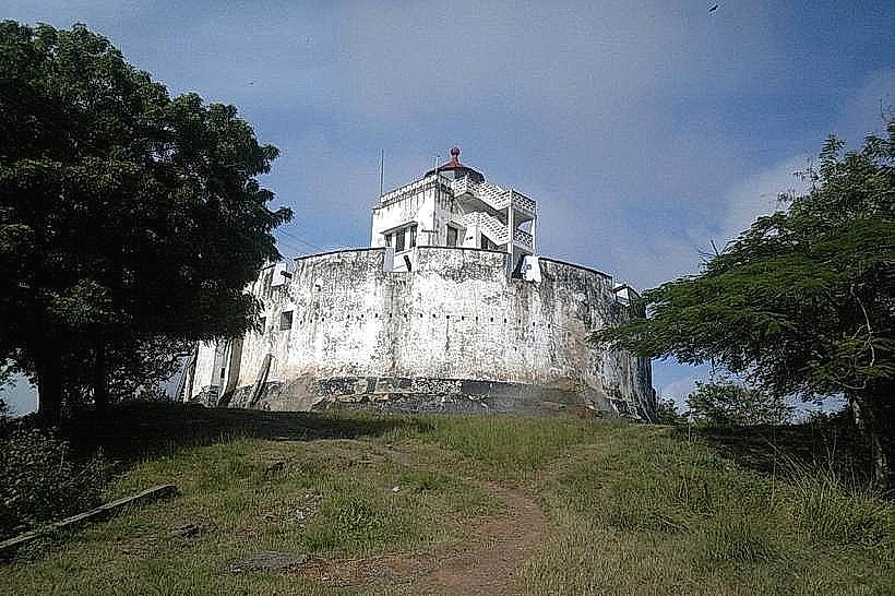
Fort Victoria – 0.4km Southeast
University of Cape Coast (South Campus) – 1.2km West
Adisadel College – 1.5km Northeast
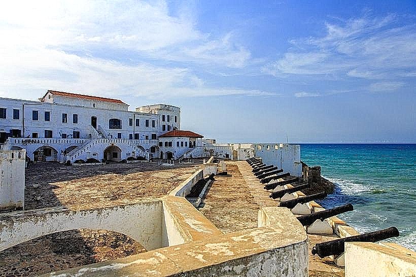
Cape Coast Castle – 2.0km East