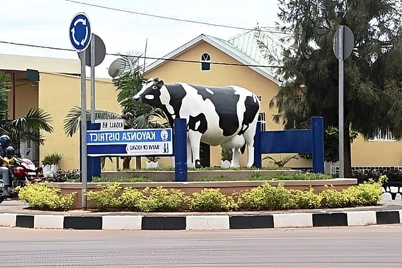
Landmark: Kayonza Roundabout
City: Kayonza
Country: Rwanda
Continent: Africa
Kayonza Roundabout, Kayonza, Rwanda, Africa
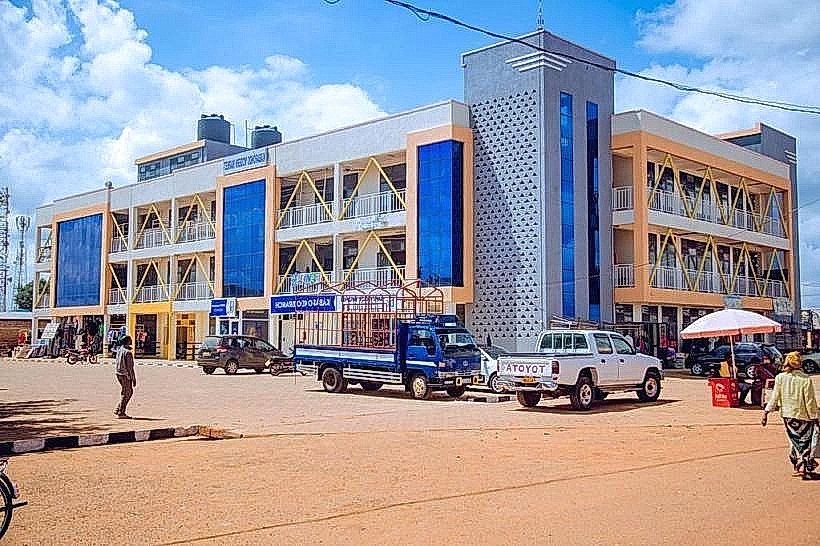
The Kayonza Roundabout, officially known as the Kayonza Junction, is the most critical inland transport node in Eastern Rwanda. It serves as the primary tri-point connecting the capital city of Kigali to the borders of Tanzania and Uganda.
Visual Characteristics
The roundabout is a large-scale circular traffic island featuring paved asphalt lanes and high-capacity drainage systems. The central island is landscaped with low-maintenance ornamental shrubs and often serves as a site for large-scale corporate or national billboards. The perimeter is defined by high-density commercial activity, characterized by two-story concrete buildings, multi-colored storefronts, and a constant flow of heavy-duty transit trucks and inter-city buses.
Location & Access Logistics
The junction is located in the center of Kayonza town, approximately 75km east of Kigali. It is the intersection of three major national highways:
RN3 West: To Kigali.
RN3 East: To the Rusumo Border (Tanzania).
RN24 North: To the Kagitumba Border (Uganda) and Akagera National Park.
Access is continuous 24/7. It is the central terminus for all public transport in the district, with the main bus park located 100 meters to the west.
Historical & Ecological Origin
Geographically, the roundabout sits on the flat, semi-arid plains of the eastern plateau, characterized by granite-based soils. Historically, it evolved from a simple colonial-era crossroads into a modern engineered junction to manage the massive increase in East African Community (EAC) trade. It marks the symbolic "Gateway to the East," where the mountainous terrain of central Rwanda flattens into the savanna landscapes typical of the Akagera basin.
Key Highlights & Activities
Transit Hub: The primary staging point for travelers heading to Akagera National Park or the Tanzania border.
Commercial Exchange: The immediate vicinity is a major retail zone for "Igitenge" textiles, hardware, and wholesale agricultural goods.
Street Food Culture: Renowned for roadside vendors selling roasted maize, brochettes, and local "Kayonza" milk products to passengers in transit.
Banking & Services: Most major Rwandan banks and mobile money headquarters for the Eastern Province are clustered around this circle.
Infrastructure & Amenities
The area features street lighting, paved sidewalks, and a high concentration of 4G and 5G cellular towers. Within a 200-meter radius, there are numerous pharmacies, restaurants, and fuel stations. While the roundabout itself offers no shade, the surrounding commercial verandas provide cover from the intense eastern sun. Public restrooms are located within the adjacent bus terminal.
Best Time to Visit
The junction is most active between 06:00 and 20:00. For travelers, the early morning (07:00–09:00) is the peak time for catching regional buses. For those seeking to observe the scale of international logistics, the late afternoon (16:00–18:00) sees the highest volume of long-haul fuel and cargo trucks passing through from the Tanzanian coast.
Facts & Legends
Local drivers refer to the Kayonza Roundabout as the "Compass of Rwanda" because it is nearly impossible to travel to any eastern destination without passing through it. A specific tip for visitors: it is a high-traffic zone; pedestrians should use the designated crossings, and travelers should be aware that bus conductors often use the roundabout as a final "call point" for passengers heading toward the border.
Nearby Landmarks
Kayonza Main Market – 0.2km West
Kayonza Bus Terminal – 0.1km West
Women's Opportunity Center – 2.0km West
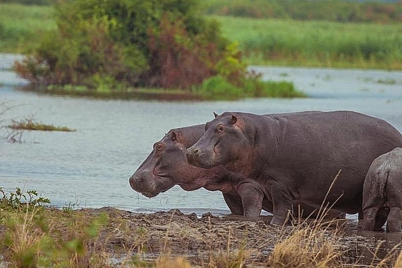
Akagera National Park South Gate – 35km East
Imigongo Art Center – 50km Southeast