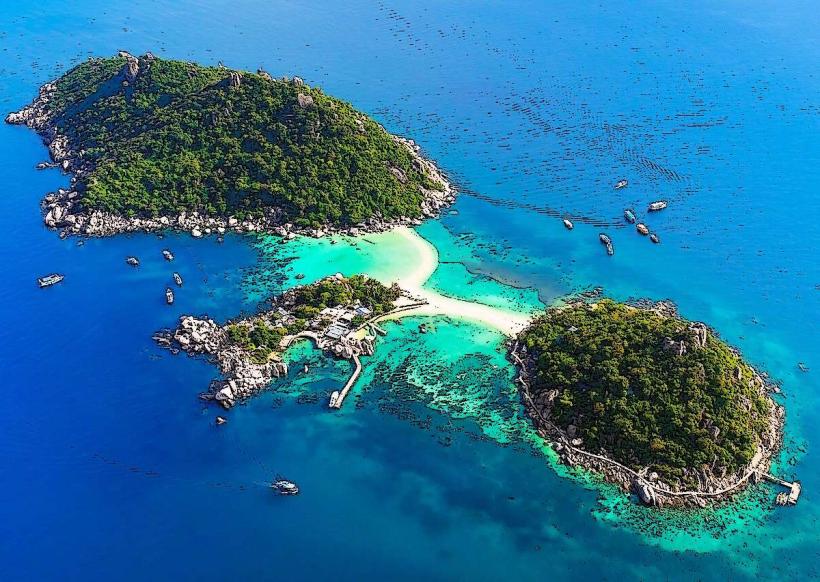
Landmark: Koh Nang Yuan
City: Koh Tao
Country: Thailand
Continent: Asia
Koh Nang Yuan, Koh Tao, Thailand, Asia
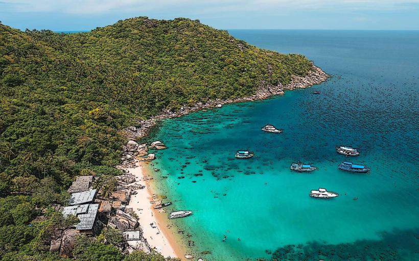
Koh Nang Yuan is a small archipelago located off the coast of Koh Tao in the Gulf of Thailand.
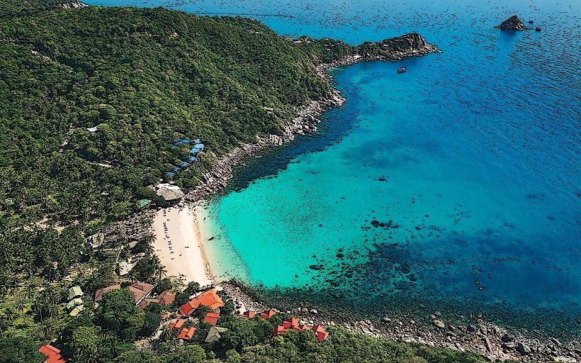
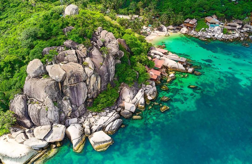
It consists of three islands connected by a sandbar.
Visual Characteristics
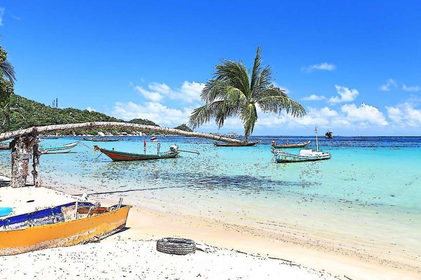
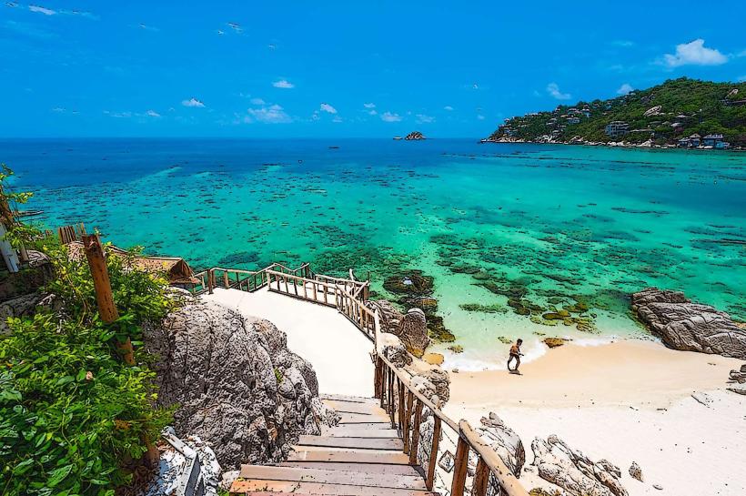
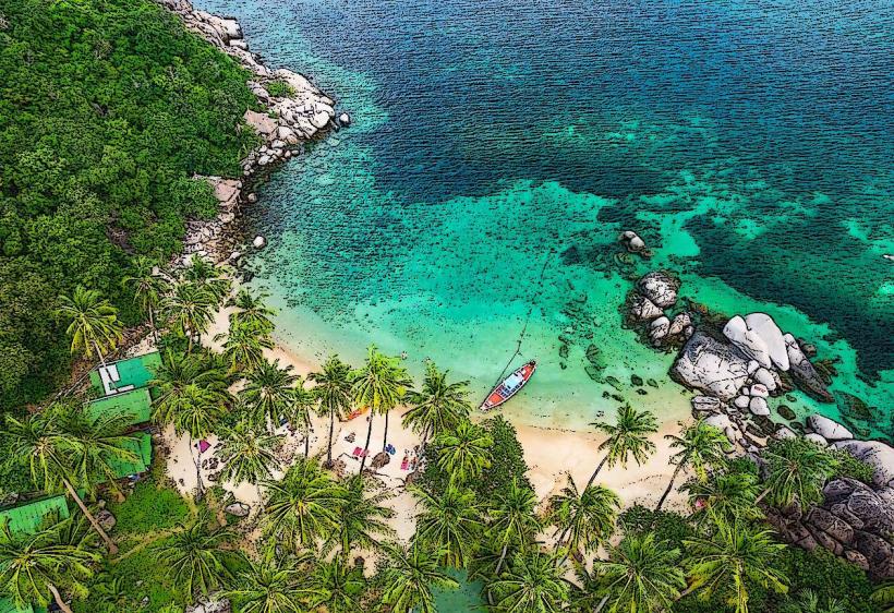
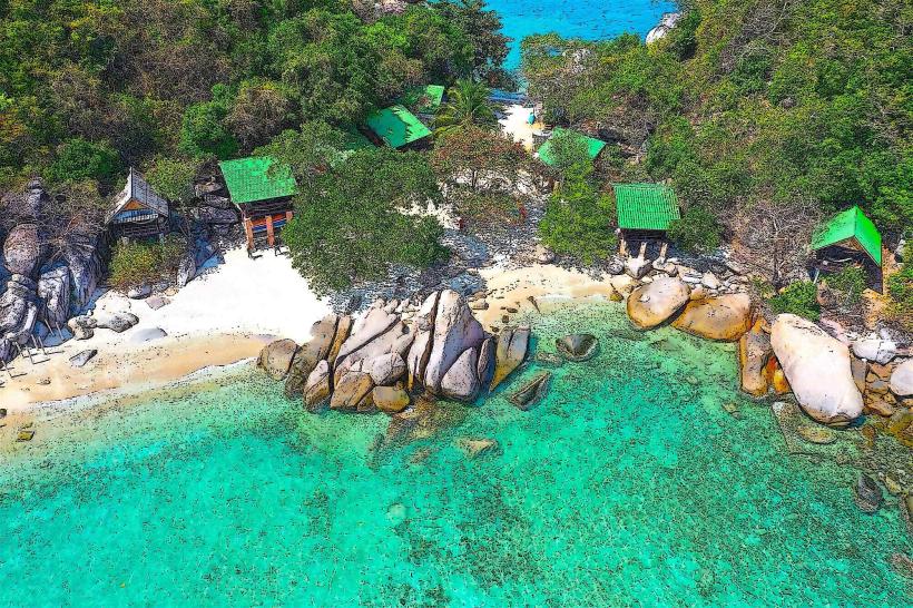
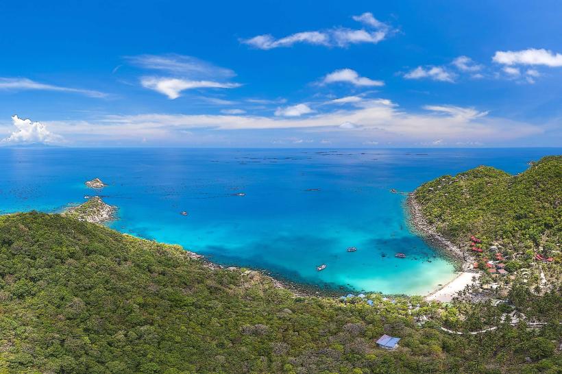
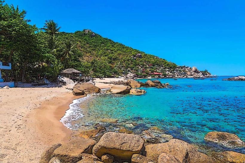
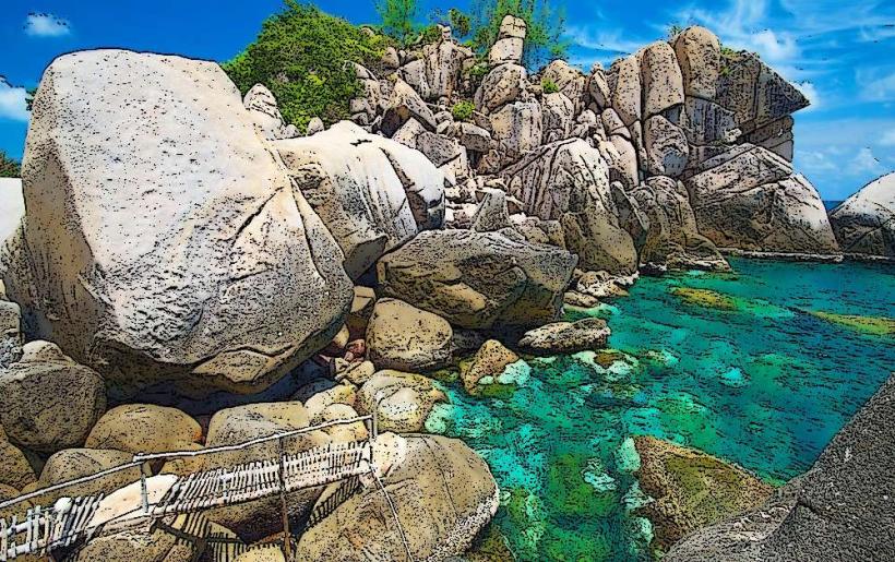
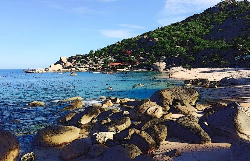
The islands are characterized by steep, jungle-covered hillsides. The beaches are composed of fine, white sand. The water surrounding the islands is clear and exhibits shades of turquoise and blue. Large, weathered granite boulders are present along the shorelines and in the shallow waters.
Location & Access Logistics
Koh Nang Yuan is situated approximately 1.5 kilometers northwest of Koh Tao. Access is exclusively by boat. Longtail boats and speedboats can be hired from various piers on Koh Tao, including Mae Haad and Sairee Beach. The journey typically takes 10-20 minutes. There is no vehicle access to the island. A small entrance fee is collected upon arrival for non-Thai nationals.
Historical & Ecological Origin
Koh Nang Yuan is a natural geological formation. The islands are primarily composed of granite. The unique sandbar connecting the islands is a result of tidal deposition and erosion processes over millennia.
Key Highlights & Activities
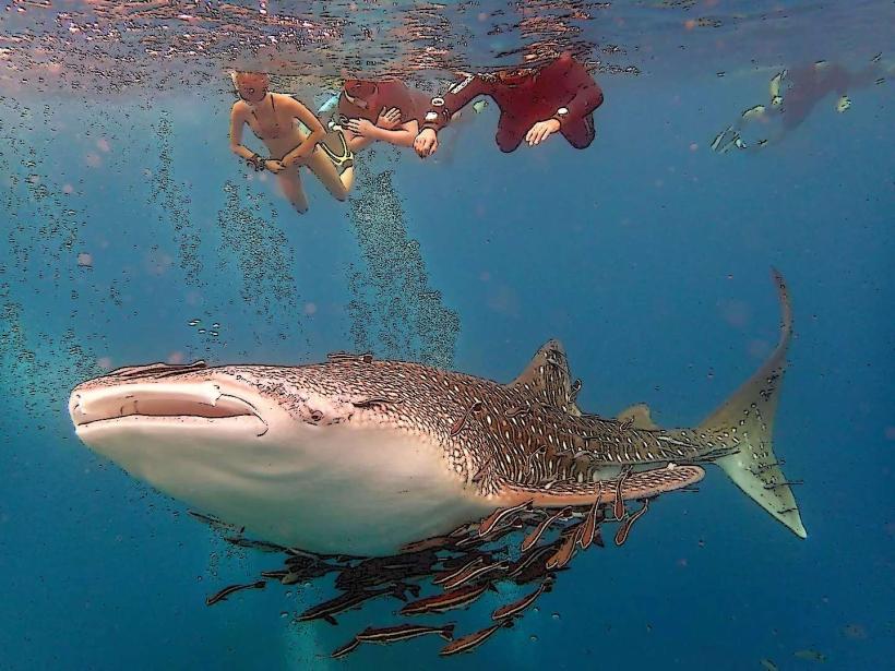
Snorkeling is a primary activity, with coral reefs accessible directly from the shore. Hiking to the viewpoint on the main island offers panoramic views of the three islands and the surrounding sea. Swimming and sunbathing are also common. Kayaking is available for exploring the coastline.
Infrastructure & Amenities
A single resort, The Nang Yuan Dive Resort, is located on the main island and provides a restaurant and bar. Public restrooms are available near the resort. Shade is provided by natural vegetation and some man-made structures. Cell phone signal (4G) is generally available, though it can be intermittent in certain areas.
Best Time to Visit
The best time for clear water visibility for snorkeling is during the dry season, from December to April. The water temperature is consistently warm year-round. Mid-morning offers good lighting for photography of the sandbar. High tide is not a requirement for accessing the sandbar, but low tide can expose more of it.
Facts & Legends
The sandbar that connects the three islands is often referred to as the "Dragon's Tail." It is a prominent feature that is most visible during low tide.
Nearby Landmarks
- Koh Tao (0.5km Southeast)
- Shark Bay (2km Southwest)
- Ao Leuk (2.5km South)
- Tanote Bay (3km South)