Landmark: Tanote Bay
City: Koh Tao
Country: Thailand
Continent: Asia
Tanote Bay, Koh Tao, Thailand, Asia
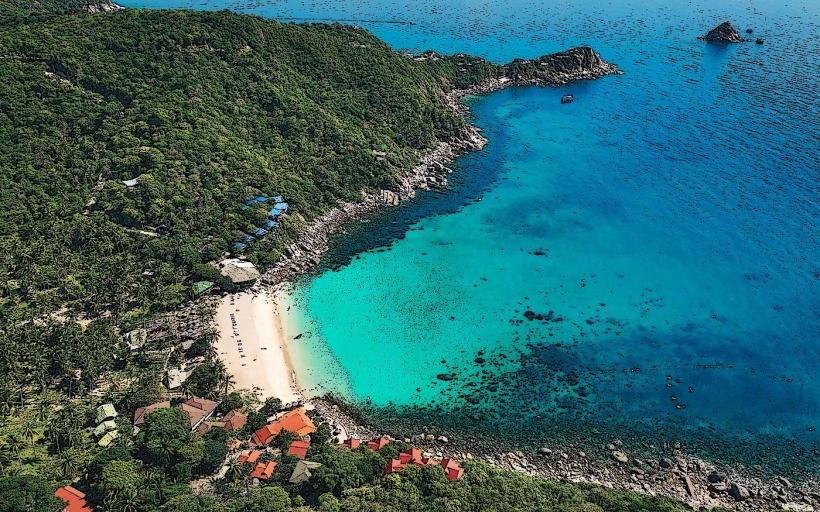
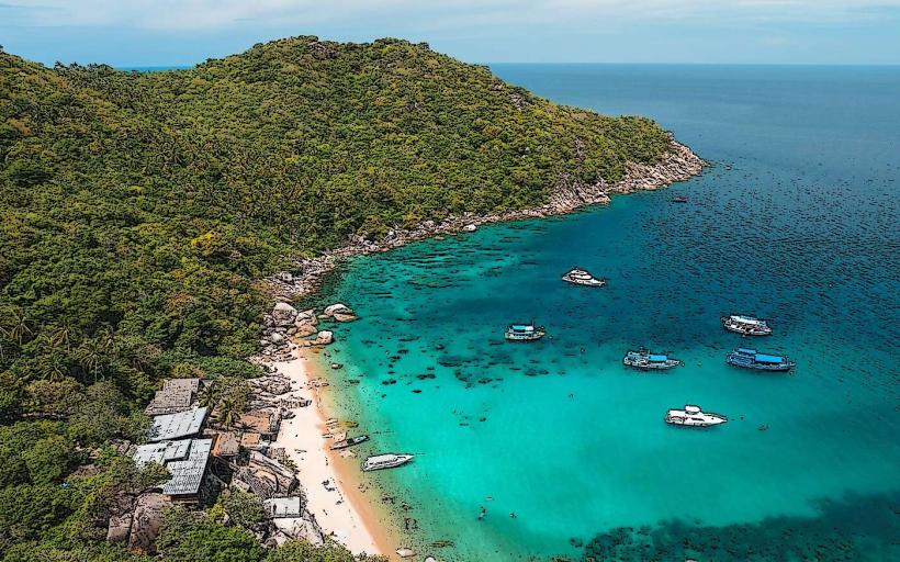
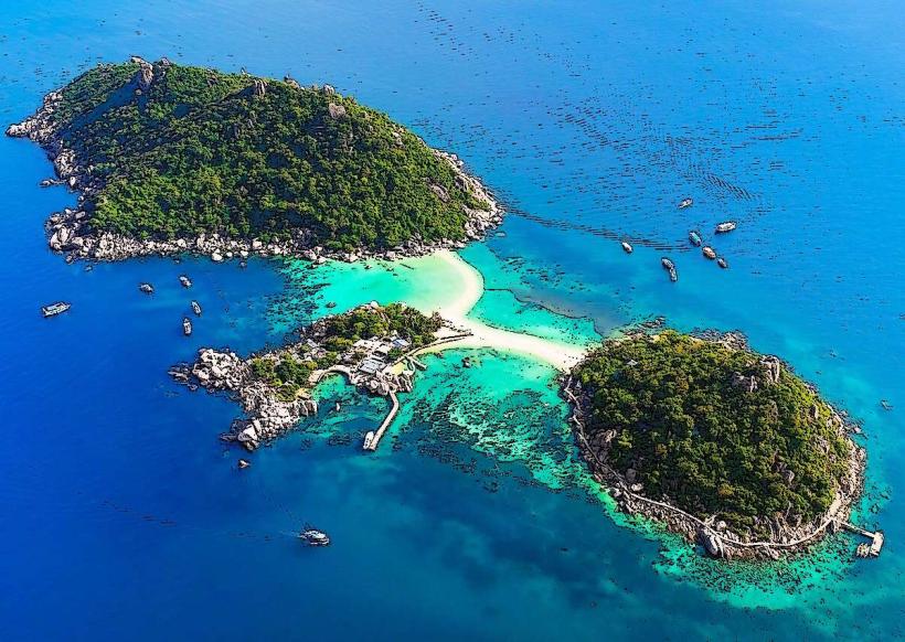
Tanote Bay is a coastal inlet located on the eastern side of Koh Tao, an island in the Gulf of Thailand.
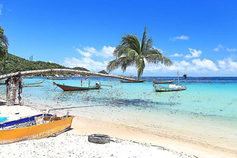
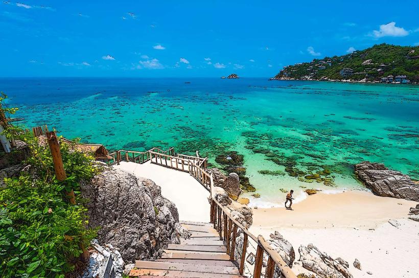
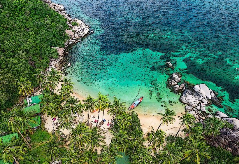
This bay is characterized by its clear, turquoise waters and a shoreline composed of coarse sand and scattered granite boulders.
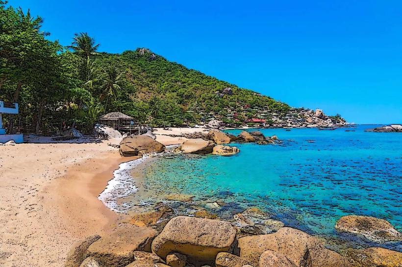
Visual Characteristics
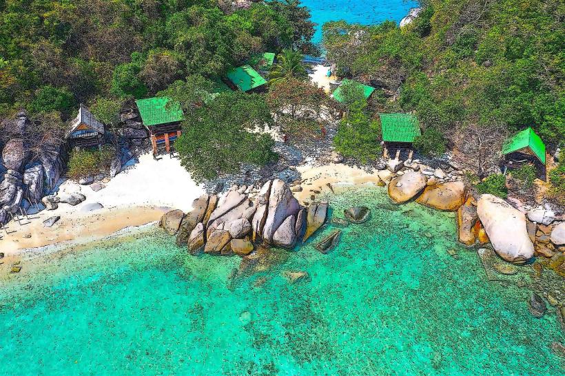
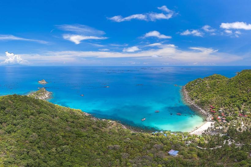
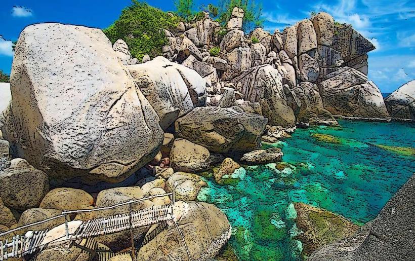
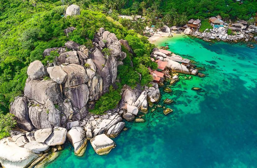
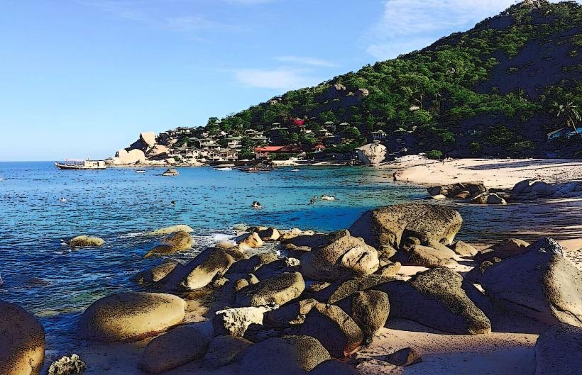
The bay features a crescent-shaped beach approximately 200 meters in length. The sand is a mix of coarse grains and small pebbles. Large, weathered granite formations are present along the shoreline and extend into the water. The water clarity is generally high, with depths increasing gradually. Surrounding the bay are steep, jungle-covered hills.
Location & Access Logistics
Tanote Bay is situated on the eastern coast of Koh Tao. It is approximately 4 kilometers from the main pier at Mae Haad. Access is via a paved road that branches off the main island road. The final section of the road leading directly to the bay is steep and can be challenging for standard rental scooters; 4x4 vehicles are recommended for easier access. Parking is available in a designated area near the beach, though space can be limited during peak times. There are no direct public bus routes to Tanote Bay; transport typically involves private taxis or rental vehicles.
Historical & Ecological Origin
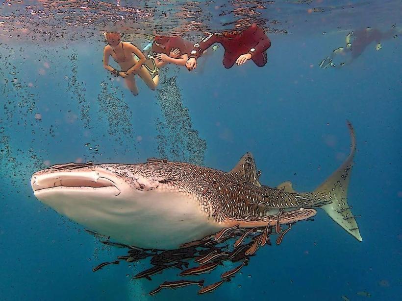
Tanote Bay is a natural geological formation, part of the granite island of Koh Tao, which emerged from the sea millions of years ago. The bay's current form is a result of coastal erosion and weathering of the surrounding rock. Ecologically, it is a marine environment supporting coral reefs and diverse fish populations, typical of the Gulf of Thailand.
Key Highlights & Activities
Snorkeling is a primary activity, with coral reefs accessible from the shore. Swimming is possible within the bay. Rock climbing is available on the granite formations surrounding the bay. Hiking trails lead from the bay into the surrounding hills. Diving excursions often include Tanote Bay as a dive site.
Infrastructure & Amenities
Basic amenities are available at Tanote Bay. There are a small number of beachfront restaurants and bars offering food and drinks. Restrooms are typically located at these establishments. Shade is provided by natural vegetation and some man-made structures. Cell phone signal (4G) is generally available, though it can be intermittent in certain areas.
Best Time to Visit
The best time for clear water visibility for snorkeling and diving is during the dry season, from December to April. The water temperature is consistently warm year-round. For photography, early morning and late afternoon offer softer lighting conditions. High tide is generally preferable for accessing the full extent of the snorkeling areas.
Facts & Legends
A notable feature of Tanote Bay is a large, submerged rock formation known locally as "The Shark Rock," which is a popular snorkeling and diving point. It is named for its shape rather than the presence of sharks. The bay is also known for its relatively deep waters close to shore.
Nearby Landmarks
- Aow Leuk (1.2km South)
- Chalok Baan Kao Bay (3.5km Southwest)
- Sairee Beach (4.0km Northwest)
- Mango Bay (4.5km North)