Landmark: Manti-La Sal National Forest
City: Monticello
Country: USA Utah
Continent: North America
Manti-La Sal National Forest, Monticello, USA Utah, North America
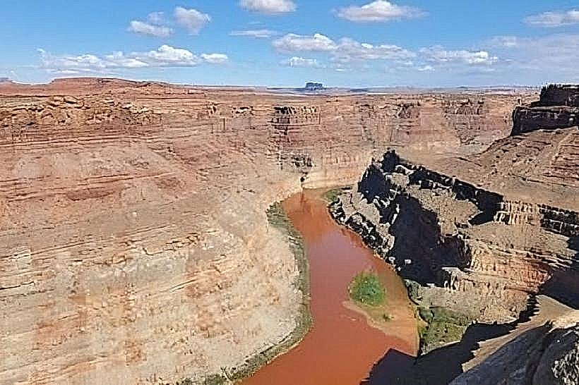
Manti-La Sal National Forest is a large protected area in central and southeastern Utah, USA. It encompasses diverse ecosystems ranging from high mountain peaks to arid desert canyons.
Visual Characteristics
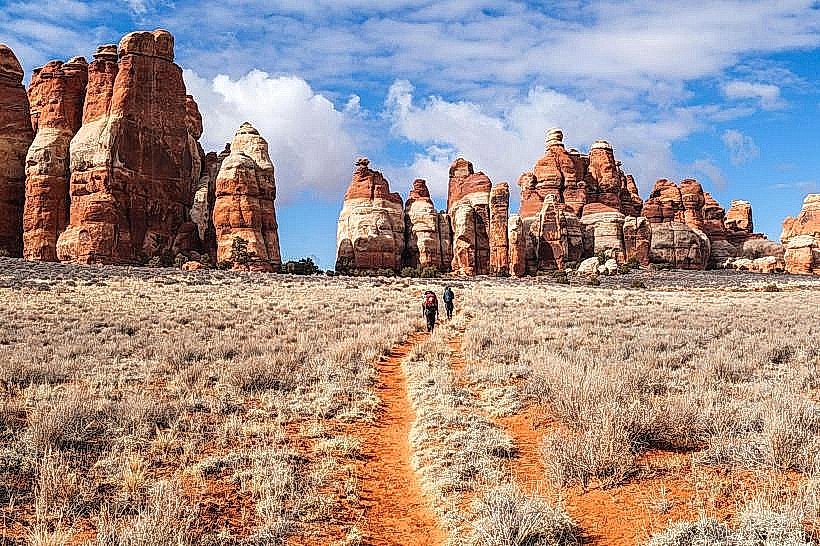
The forest exhibits varied topography. Elevations range from approximately 6,000 feet to over 13,000 feet. Lower elevations feature pinyon-juniper woodlands and sagebrush steppe. Higher elevations are characterized by dense coniferous forests, including Engelmann spruce, subalpine fir, and ponderosa pine. Alpine meadows are present above the treeline. Rock formations include sandstone cliffs and volcanic extrusions.
Location & Access Logistics
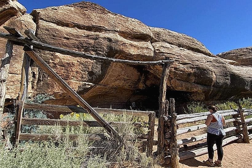
The forest is accessible from multiple points. The main administrative offices are located in Monticello, Utah, at 551 East 400 South. Access roads include State Route 191 (connecting to Moab and Blanding) and State Route 24 (connecting to Hanksville). Numerous unpaved forest service roads provide access to interior areas; these may require high-clearance or 4WD vehicles, especially during wet or snowy conditions. Monticello is approximately 250 miles southeast of Salt Lake City. Parking is available at designated trailheads and campgrounds; dispersed parking is permitted in some areas where safe and not obstructing access.
Historical & Ecological Origin
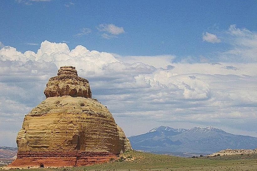
Manti-La Sal National Forest was established as the Manti National Forest in 1903 and the La Sal National Forest in 1906. They were combined in 1949. The forest's geological history includes uplift of the Colorado Plateau, volcanic activity in the La Sal Mountains, and erosion shaping the canyons. Ecologically, it represents a transition zone between the Great Basin, Colorado Plateau, and Rocky Mountains, supporting a wide array of plant and animal species.
Key Highlights & Activities
Activities include hiking on designated trails such as the Warner Lake Trail (easy, 1.2 miles roundtrip) and the La Sal Crest Trail (strenuous, variable length). Horseback riding is permitted on many trails. Fishing is available in alpine lakes and streams. Hunting is permitted during designated seasons. Scenic drives are possible on roads like the La Sal Mountain Loop Road (seasonal access). Winter activities include cross-country skiing and snowshoeing in higher elevations.
Infrastructure & Amenities
Restrooms are available at developed campgrounds and some popular trailheads. Shade is abundant in forested areas. Cell phone signal is intermittent and generally unavailable in remote sections of the forest. Limited food services and supplies are available in nearby towns like Monticello and Moab; visitors should carry sufficient provisions.
Best Time to Visit
The best time for visiting higher elevations is from June through September, when most roads and trails are snow-free. Lower elevations are accessible year-round, though winter conditions can impact access. Mid-day offers the most direct sunlight for photography in canyons. For alpine lakes, late spring and early summer offer peak water levels.
Facts & Legends
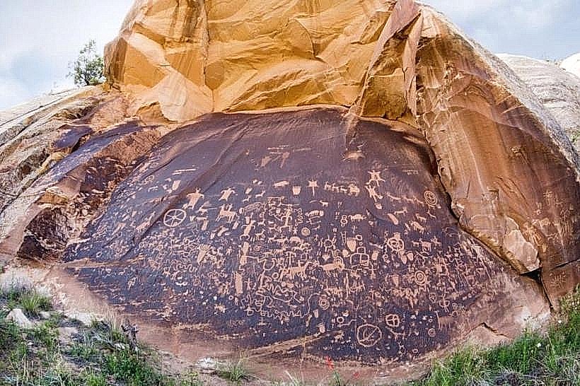
The La Sal Mountains are volcanic in origin, a rare feature within the predominantly sedimentary Colorado Plateau. Local folklore includes tales of prospectors searching for precious metals in the more remote canyon systems.
Nearby Landmarks
- Arches National Park (30km Northwest)
- Canyonlands National Park (40km West)
- Natural Bridges National Monument (60km South)
- Mesa Verde National Park (Colorado) (100km Southeast)
- San Juan River (15km South)