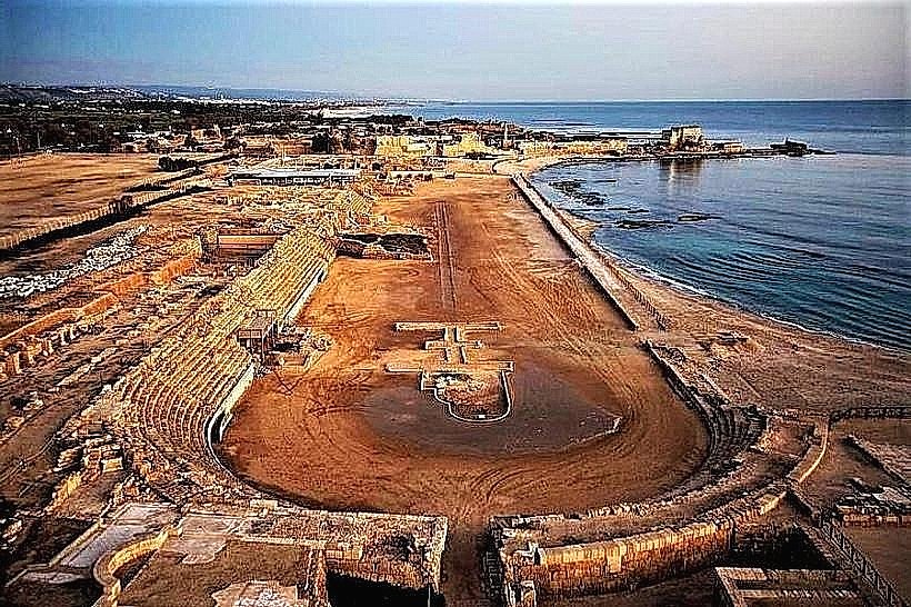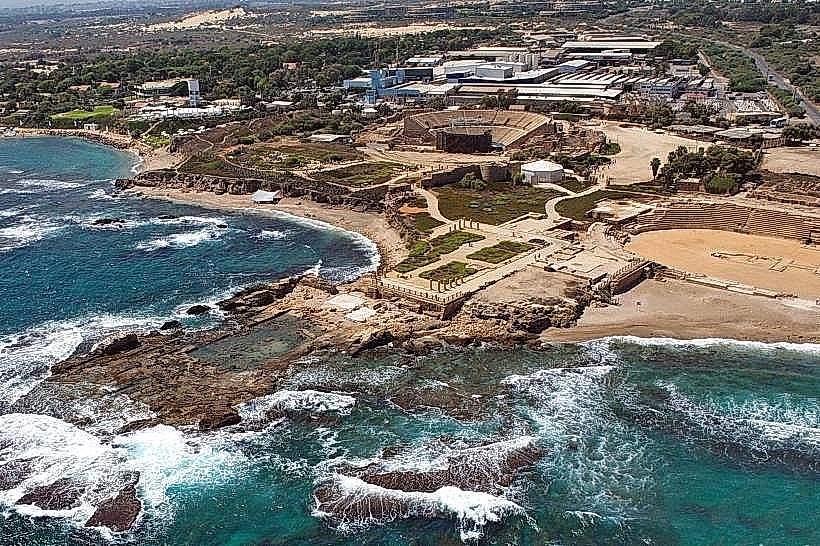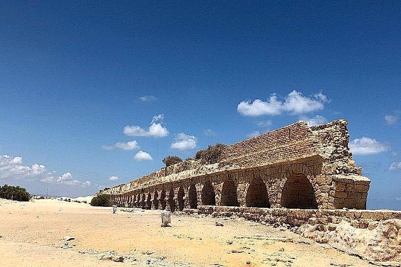
Landmark: Caesarea Aqueduct
City: Caesarea
Country: Israel
Continent: Asia
Caesarea Aqueduct, Caesarea, Israel, Asia
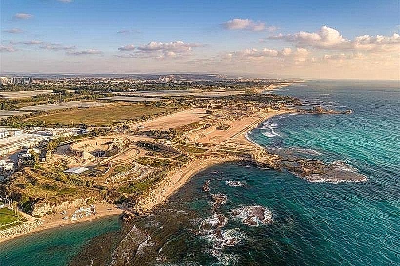
The Roman Aqueduct is an ancient engineering landmark situated on the Mediterranean shoreline north of Caesarea-national-park_caesarea" class="underline">Caesarea National Park. It served as the primary water supply system for the Roman provincial capital, transporting fresh water from the springs of the Carmel range to the city.
Visual Characteristics
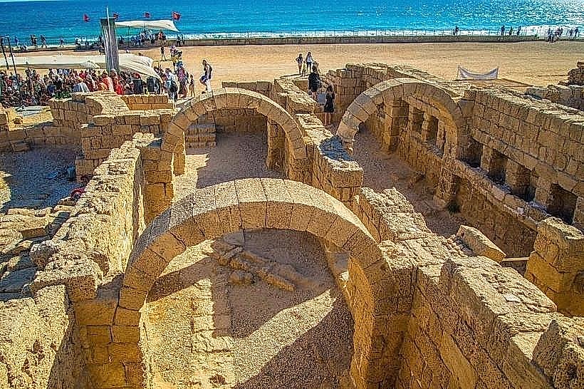
The structure is a massive elevated arcade built from local kurkar sandstone, consisting of dozens of uniform stone arches. Over time, the shifting shoreline has partially buried the lower sections in sand dunes, while the upper arches remain exposed against the backdrop of the sea. The aqueduct features two distinct, parallel channels that were constructed at different periods to meet the city's growing water demands.
Location & Access Logistics
The aqueduct is located on the public beach of Caesarea, approximately 2.5km north of the archaeological park's main entrance. Access is via a paved road leading to a large, unpaved free parking area directly adjacent to the beach. Unlike the main national park, this section of the coastline is open to the public without an entry fee and is accessible 24 hours a day.
Historical & Ecological Origin
The high-level aqueduct was commissioned by Herod the Great in the 1st century BCE to bring water from the Shuni springs, roughly 10km away. As the city expanded, the Roman Legions (specifically the Tenth Legion) added a second parallel channel during the reign of Hadrian in the 2nd century CE. The system relied entirely on gravity, utilizing a precise and consistent downward slope of approximately 20cm per kilometer.
Key Highlights & Activities
Coastal Exploration: Visitors can walk alongside several hundred meters of the preserved structure and pass underneath the arches to reach the water.
Photography: The site is a premier location for sunset photography, as the sun aligns with the gaps in the stone arches.
Swimming: The "Aqueduct Beach" is a popular swimming spot, though it is an unmonitored beach with significant currents.
Archaeological Inspection: Close observation reveals Latin inscriptions and stamps from the Roman legions responsible for the construction and maintenance of the stone blocks.
Infrastructure & Amenities
The site is largely undeveloped compared to the national park. Amenities are limited to the parking area and a few basic trash receptacles. There are no permanent restrooms or changing facilities on this specific stretch of beach. 5G cellular signal is strong and stable. Visitors should bring their own water and shade, as the area is entirely exposed.
Best Time to Visit
Late afternoon (one hour before sunset) is the optimal time for visiting to capture the horizontal light passing through the arches. During the summer, early morning visits provide a cooler environment for walking along the sand. The site is a popular destination for weekend crowds, so midweek visits are recommended for a more tranquil experience.
Facts & Legends
A local historical fact is that the aqueduct eventually failed due to a combination of coastal erosion and the gradual calcification of the water channels, which narrowed the pipes until they became impassable. According to local lore, the sheer scale of the arches led medieval travelers to believe the structure was built by giants rather than Roman engineers.
Nearby Landmarks
Caesarea National Park: 2.5km South
Ralli Museums: 2.2km Southeast
Birds Mosaic: 3.2km Southeast
Taninim River Nature Reserve: 3.0km North
Jisr az-Zarqa: 1.8km North