Landmark: Jezzine Waterfall
City: Jezzine
Country: Lebanon
Continent: Asia
Jezzine Waterfall, Jezzine, Lebanon, Asia
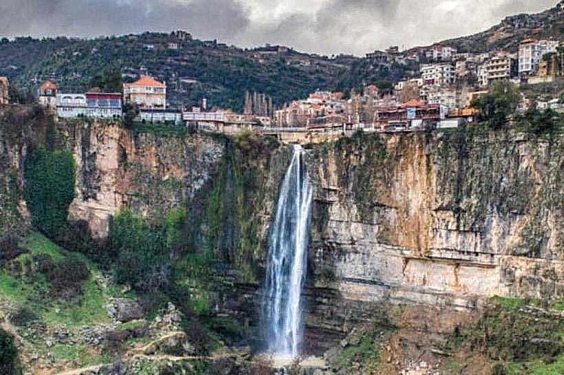
The Jezzine Waterfall (Shallal Jezzine) is a seasonal, high-altitude waterfall located directly on the edge of the mountain town of Jezzine, within the Jezzine District of the South Governorate, Lebanon. Dropping approximately 74 meters, it ranks as one of the tallest waterfalls in Lebanon and the Middle East, serving as a prominent geological landmark and a primary driver of regional ecotourism.
Visual Characteristics
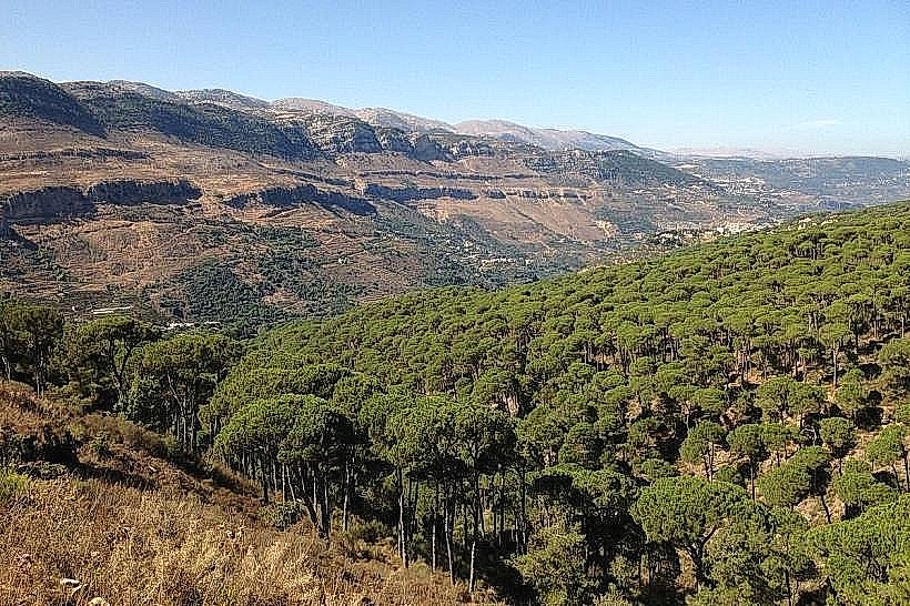
The waterfall is defined by its dramatic plunge over a sheer, vertical limestone cliff face into a deep, verdant ravine known as the Wadi Jezzine. Situated at an elevation of roughly 950 meters above sea level, the surrounding landscape features a stark contrast between the urban, red-tiled roof architecture of Jezzine perched on the cliff rim and the wild, densely forested mountain slopes below. The water volume fluctuates from a rushing torrent during peak flow to a narrow stream, feeding a valley floor rich with pine forests, olive groves, and wild Mediterranean vegetation.
Location & Access Logistics
The site is located approximately 70 kilometers south of Beirut and 30 kilometers east of Sidon (Saida). Access from the capital is via the southern coastal highway to Sidon, turning inland onto the regional highway ascending eastward through Kfar Hatta and Roum directly into central Jezzine. Panoramic views of the falls are accessible from municipal sidewalks and designated roadside viewpoints along the main entrance boulevard. A paved municipal parking zone operates near the town center. Public transit consists of regional buses from Sidon to Jezzine, requiring a short walk to reach the prime canyon viewpoints.
Historical & Ecological Origin
The waterfall is fed by the seasonal runoff and natural karst springs of the adjacent Mount Niha ridge, a southern continuation of the Mount Lebanon range. Geologically, the sheer cliff was formed by tectonic faulting along the Dead Sea Transform system, exposing thick layers of hard, Jurassic-era limestone that resist rapid erosion. Historically, the strategic position of the cliff and its abundance of freshwater sources made Jezzine a crucial mountain stronghold and transit node connecting the maritime trading hub of Sidon to the internal Beqaa Valley.
Key Highlights & Activities
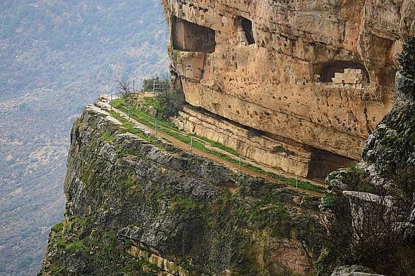
Primary activities focus on landscape photography from the clifftop promenades and dining at panoramic restaurants overlooking the drop. Experienced hikers can descend via rugged, steep dirt footpaths into the valley floor to reach the plunge pool base. The location is also an entry point to the Fakhreddine Grotto, a historic cave tunnel network cut into the cliff face near the top of the waterfall where Emir Fakhreddine II sought refuge from Ottoman forces in the early 17th century.
Infrastructure & Amenities
The cliff rim area is fully integrated into Jezzine's municipal tourist infrastructure, offering paved observation decks, safety railings, and street lighting. Public restrooms are available inside the numerous commercial establishments bordering the ravine. Shade is plentiful inside the town's restaurants and cafes but limited on the exposed public viewing bridges. Cellular network coverage (4G/5G) is exceptionally strong and stable. Complete dining, lodging, and retail services-including shops selling Jezzine's traditional, hand-crafted firebird cutlery-are located within a 500-meter radius of the main falls viewpoint.
Best Time to Visit
The absolute optimal period to view the waterfall at maximum volume is during the winter and early spring months, specifically from January to April, when mountain snowmelt and heavy seasonal rainfall peak. By late summer and autumn (August to October), the waterfall frequently dries up completely due to the seasonal drop in the karst water table. For photography, late afternoon provides soft, warm lighting that accentuates the texture of the limestone cliffs without creating high-contrast shadows inside the deep ravine.
Facts & Legends
A verified geological detail is that the water plunging over the cliff directly recharges the localized river system of the Aouali River, which travels westward to supply municipal water to the coastal plains of South Lebanon. Local historical lore claims that the deep, inaccessible cave systems running horizontally beneath the waterfall's upper crest were used for centuries by local inhabitants to store grain, ammunition, and treasures during periods of foreign military occupation, using specialized pulley systems to hoist goods directly up the cliff face.
Nearby Landmarks
Fakhreddine Grotto: 0.3km East (built into the cliff face)
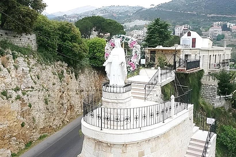
Lady of the Waterfall Shrine (Saydet el-Challal): 0.5km West
Bkassine Pine Forest (Largest in the Mediterranean): 4.5km Northwest
Our Lady of Machmoucheh Monastery: 6.0km North
Niha Fort (Chakif Tiro Roman Cave Fortress): 9.0km Northeast