Landmark: Malolotja Nature Reserve
City: Mbabane
Country: Eswatini
Continent: Africa
Malolotja Nature Reserve, Mbabane, Eswatini, Africa
Malolotja Nature Reserve is a protected montane wilderness area located in northwestern Eswatini, along the boundary of the South African border escarpment. It encompasses 18,000 hectares of rugged Highveld terrain, protecting some of the oldest geologic formations and highest waterfalls in the country.
Visual Characteristics
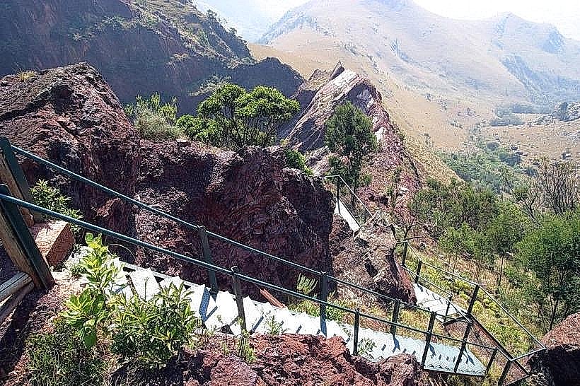
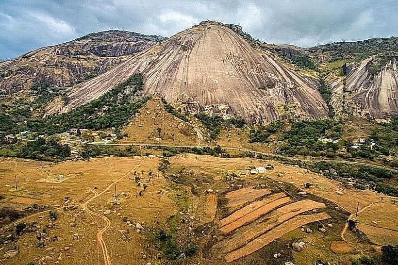
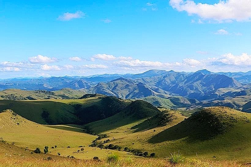
The reserve features a dramatic, highly fractured landscape dominated by quartzite ridges, deep river gorges, and open rolling grasslands. Elevations range from 615 meters to 1,829 meters above sea level at Ngwenya Mountain, the reserve's highest point. The vegetation consists of sparse Afromontane forests tucked into deep ravines, extensive sour bushveld grasslands, and unique protea and cycad colonies clinging to rocky slopes. The Malolotja River cuts through the center of the reserve, plunging 89 meters down a sheer rock face to form the multi-tiered Malolotja Falls.
Location & Access Logistics
The main entrance gate is located roughly 35 kilometers northwest of Mbabane via the MR1 highway, which connects the capital to Piggs Peak. The drive from central Mbabane takes approximately 30 to 45 minutes on fully paved roads up to the reserve entrance turnoff. Public transport is available via local minibuses running between Mbabane and Piggs Peak, with a drop-off point on the main highway, requiring a 1-kilometer walk to the reception office. Secure parking is provided inside the reserve at the main camp, reception area, and designated picnic sites.
Historical & Ecological Origin
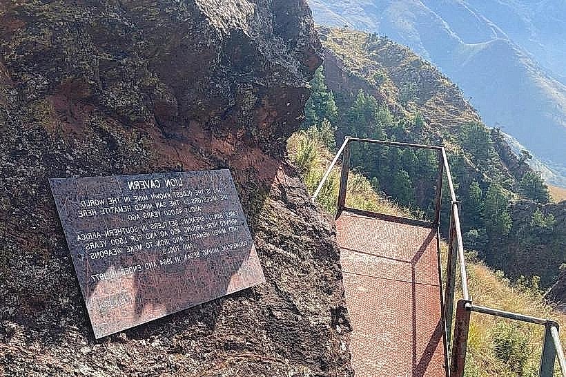
Proclaimed as a protected area in 1977, the reserve protects ancient rocks belonging to the Barberton Greenstone Belt, dating back over 3 billion years. Within its borders lies the Ngwenya Mine, officially recognized as the oldest known mining site on Earth, where San and later iron-age people extracted red ochre and iron ore starting around 43,000 BC. Ecologically, it preserves a pristine high-altitude mist belt grassland and forest mosaic, serving as a critical habitat for threatened bird species, including the blue swallow, bald ibis, and Cape vulture.
Key Highlights & Activities
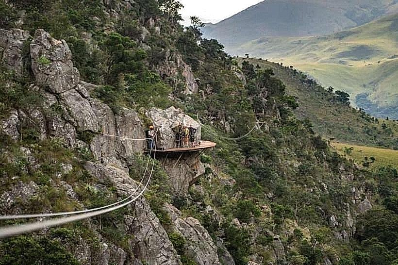
Hiking is the primary recreational activity, supported by a 200-kilometer network of wilderness trails ranging from short day walks to multi-day backpacking loops. The reserve features a canopy tour zip-line course suspended over the Majolomba River gorge, providing aerial views of the forest ecosystem. Guided excursions to the ancient Ngwenya Mine can be arranged through the main reception, while birdwatching and wildlife viewing for resident antelope species like blesbok, eland, and mountain reedbuck are common along the northern plateau roads.
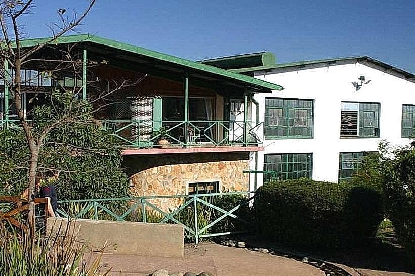
Infrastructure & Amenities
The main camp features an administrative reception office, a small interpretation center, public restrooms, and an informal restaurant facility. Overnight infrastructure includes self-catering log cabins, a main campsite with hot-water ablution blocks, and several primitive wilderness camps along the backcountry trails that have no facilities. Cellular signal (4G) is functional near the main entrance and high-altitude viewpoints but drops completely inside the deep river gorges and northern backcountry valleys.
Best Time to Visit
The most favorable conditions for hiking and outdoor activities occur during the dry winter months from May to August, characterized by clear skies, warm days, and cold nights where frost is common. The summer wet season from October to March brings heavy rainfall, dense mountain mists that severely reduce visibility, and a high risk of sudden electrical storms. Photography is most effective during the late afternoon in winter, when the low sun accentuates the rugged textures of the mountain ridges, or in early spring (September) when wildflowers bloom across the blackened, post-burn grasslands.
Facts & Legends
The reserve is home to rare, prehistoric plants known as cycads, specifically Encephalartos paucidentatus, which are often referred to as living fossils because they have remained largely unchanged for over 200 million years. Local folklore surrounding the deep chasms of Komati River gorge suggests these remote, mist-shrouded areas were avoided in the past due to beliefs that they harbored powerful river spirits and ancient mountain guardians.
Nearby Landmarks
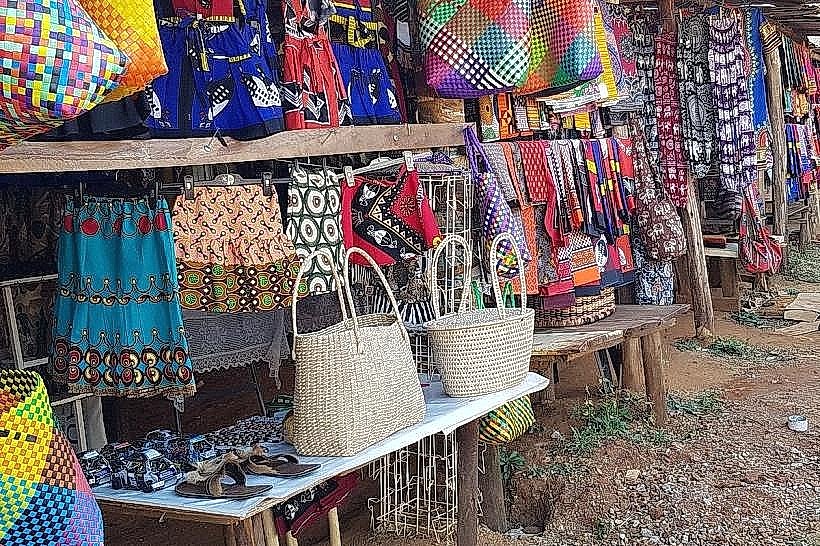
Ngwenya Glass Factory - 1.2km West (From the southern reserve boundary)
Hawane Dam and Nature Reserve - 4.1km Southeast
Forbes Reef Ghost Town - 4.3km East
Oshoek Border Post - 4.8km Southwest