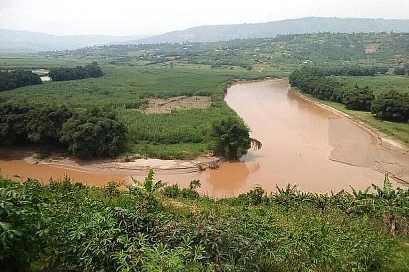
Landmark: Nyabarongo River View
City: Kigali
Country: Rwanda
Continent: Africa
Nyabarongo River View, Kigali, Rwanda, Africa
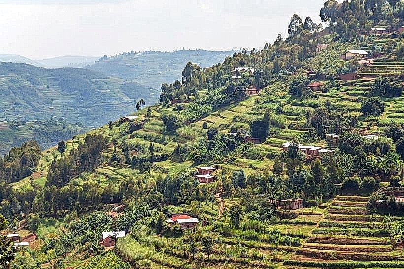
The Nyabarongo River View refers to the prominent vantage points along the bridge and valley floor where Rwanda's longest river bypasses the western edge of the capital. It is located at the border of the Nyarugenge and Kamonyi districts, approximately 10km west of the Kigali city center.
Visual Characteristics
The river is characterized by high turbidity, resulting in a distinct opaque brown or terracotta color due to heavy siltation from upstream erosion. It measures approximately 40 to 50 meters in width at the main crossing point. the surrounding valley consists of expansive papyrus wetlands, floodplains, and steep, terraced hillsides utilized for sugarcane and brick-making clay extraction. The structural centerpiece is the Nyabarongo Bridge, a reinforced concrete and steel beam construction painted in weathered grey tones.
Location & Access Logistics
Access is via the RN1 (Kigali–Musanze–Rubavu) highway, which serves as the primary artery to the Western Province. From the Kigali City Tower, the drive takes approximately 20 to 30 minutes depending on traffic at the Nyabugogo junction. Public transport via "matatus" (minibuses) departing from the Nyabugogo International Bus Terminal to "Giticyinyoni" or "Kamonyi" provides direct access to the bridge. Parking is restricted on the bridge itself; visitors typically park at small commercial stalls on the Giticyinyoni side and proceed on foot to the pedestrian walkways.
Historical & Ecological Origin
The Nyabarongo River is a major tributary of the Nile, formed by the confluence of the Mwogo and Mbirurume rivers. Geologically, it carves through the metamorphic rock of the Albertine Rift's eastern shoulder. Historically, the river valley has been a critical agricultural zone, though it is ecologically sensitive due to mining runoff and deforestation. The current bridge infrastructure was modernized to handle heavy freight transit between Rwanda and the Democratic Republic of Congo.
Key Highlights & Activities
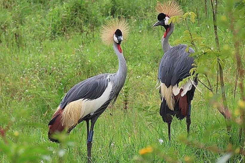
Sightseeing from the bridge pedestrian path offers a 180-degree view of the meandering river and the Mount Jali foothills. Bird watching is a primary activity in the adjacent wetlands, where kingfishers and herons are frequently observed. Small-scale artisanal brick-making and traditional fishing using wooden pirogues can be viewed from the riverbanks. Photography is common, specifically focusing on the contrast between the brown water and the green valley vegetation.
Infrastructure & Amenities
The immediate bridge area lacks formal tourist infrastructure such as public restrooms or visitor centers. 4G and 5G cellular coverage is consistent across the valley floor. Shaded areas are non-existent on the bridge, though small shops at the Giticyinyoni trading center provide basic refreshments and bottled water. Pedestrian safety is managed via narrow raised walkways on both sides of the bridge, separated from heavy truck traffic by steel guardrails.
Best Time to Visit
The best time for photography is the early morning (07:00 to 09:00) when the valley is often filled with low-lying mist. The dry seasons from June to August provide the clearest skies and most stable river levels. Conversely, the rainy seasons (March–May) offer the most dramatic views of the river in full surge, though the water's silt content and brown coloration are most intense during this period.
Facts & Legends
A verified geographical fact is that the Nyabarongo River forms part of the most distant source of the Nile River system. A local historical oddity is that the river was traditionally considered a sacred boundary in ancient Rwanda; crossing it often symbolized a transition between different provincial jurisdictions or spiritual realms. Today, it remains the primary source of water for the Nyabarongo Power Station located further downstream.
Nearby Landmarks
Mount Jali – 2.8km East
Giticyinyoni Trading Center – 0.5km East
Nyabugogo International Bus Terminal – 3.2km East
Mount Kigali – 4.5km South
Kigali Independent University (ULK) – 5.5km Northeast