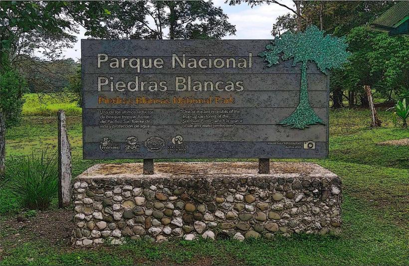
Landmark: Piedras Blancas National Park
City: Zona Sur
Country: Costa Rica
Continent: North America
Piedras Blancas National Park, Zona Sur, Costa Rica, North America
Piedras Blancas National Park is a protected area located in the Osa Peninsula of Costa Rica, within the Zona Sur region.
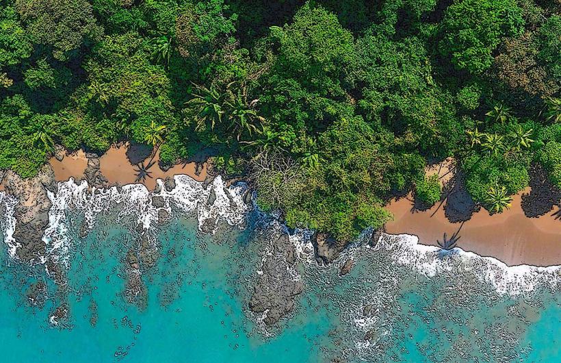
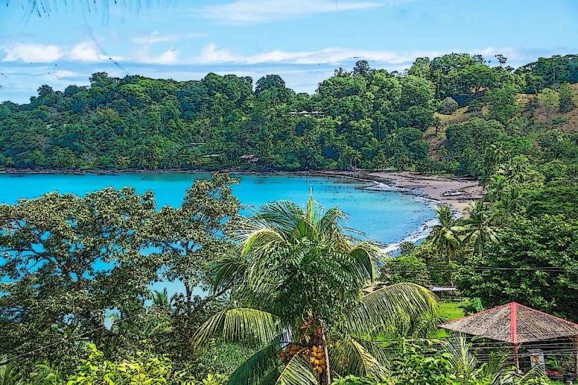
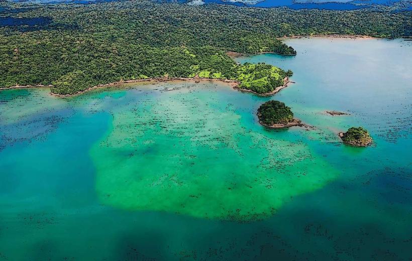
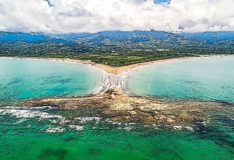
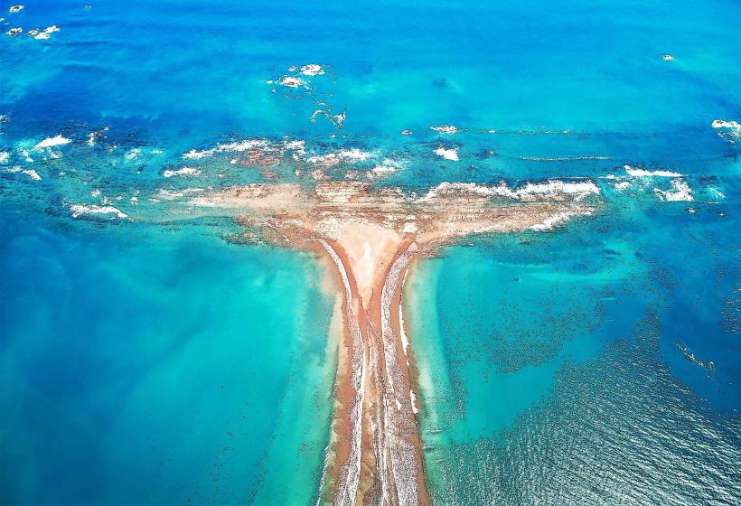
This park encompasses a significant portion of the Golfo Dulce's Pacific coastline and adjacent rainforest.
Visual Characteristics
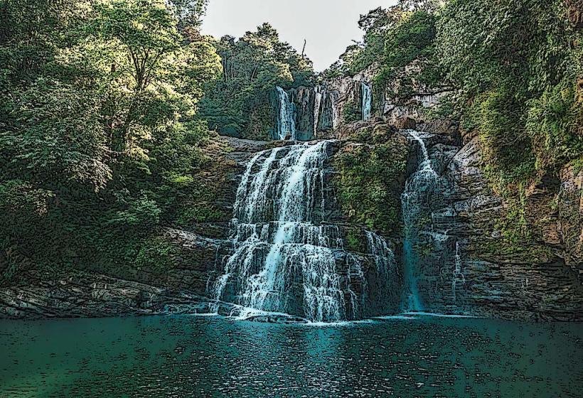
The park's coastline features dark volcanic sand beaches interspersed with rocky outcrops. The Golfo Dulce waters are typically calm and range in color from deep blue to turquoise depending on depth and light. Inland, the landscape is dominated by dense primary rainforest characterized by a high canopy, abundant epiphytes, and a variety of tree species. Elevations within the park range from sea level to approximately 1,000 meters.
Location & Access Logistics
Piedras Blancas National Park is situated approximately 30 kilometers west of Puerto Jiménez. Access is primarily via the unpaved Carretera Costanera Sur (Costanera Sur Highway), which runs along the Golfo Dulce. The main park entrance is located near the community of La Ponderosa. Limited parking is available at designated trailheads. Public transport options are scarce; visitors typically rely on private vehicles or taxis from Puerto Jiménez. Boat access to certain coastal areas is also possible but requires private arrangements.
Historical & Ecological Origin
Piedras Blancas National Park was established in 1991 to protect the remaining primary rainforest and coastal ecosystems of the Osa Peninsula, which were under threat from deforestation and development. Ecologically, it represents a critical transition zone between the drier forests of the northern Osa and the wetter forests of Corcovado National Park. The park protects a significant portion of the Golfo Dulce, a tropical fjord known for its unique marine biodiversity.
Key Highlights & Activities
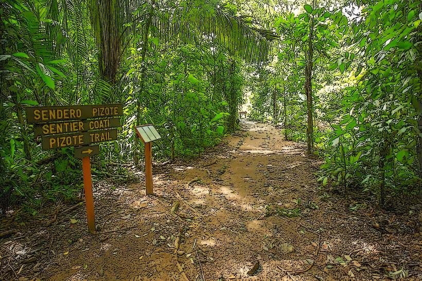
Hiking is permitted on designated trails, such as the Sendero El Pizote and Sendero Las Esferas, which offer opportunities to observe wildlife and forest flora. Kayaking and paddleboarding are possible within the Golfo Dulce, providing access to coastal areas and marine life viewing. Birdwatching is a primary activity, with numerous resident and migratory species present. Limited snorkeling is feasible in sheltered coves during calm conditions.
Infrastructure & Amenities
Basic facilities are available at the park's main entrance, including restrooms and informational signage. Shade is abundant within the forest canopy. Cell phone signal is generally unreliable within the park boundaries, particularly in deeper forest areas. Food vendors are not present within the park; visitors should bring their own supplies. Limited lodging options are available in nearby communities.
Best Time to Visit
The dry season, from December to April, offers the most favorable weather conditions with less rainfall. The green season (May to November) brings higher humidity and more frequent rain showers, which can impact trail conditions. For wildlife viewing, early morning and late afternoon provide the best opportunities. High tide is generally preferable for coastal exploration and kayaking.
Facts & Legends
The Golfo Dulce is one of only three tropical fjords in the world. Local folklore speaks of ancient indigenous settlements within the park's boundaries, though definitive archaeological evidence is limited. A specific tip for visitors is to be aware of the presence of venomous snakes, particularly during the wetter months, and to stay on marked trails.
Nearby Landmarks
- Corcovado National Park (15km Southwest)
- Drake Bay (25km Northwest)
- Puerto Jiménez (30km East)
- Golfo Dulce Forest Reserve (5km Northeast)
- Playa Lapa (8km South)