Landmark: Whale’s Tail Beach
City: Zona Sur
Country: Costa Rica
Continent: North America
Whale’s Tail Beach, Zona Sur, Costa Rica, North America
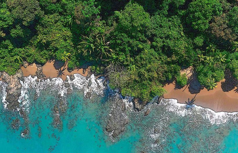
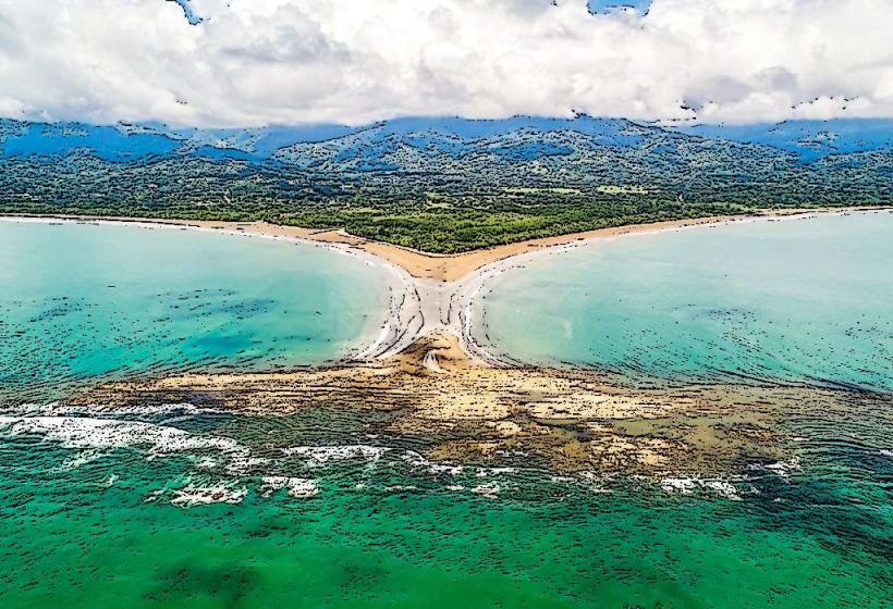
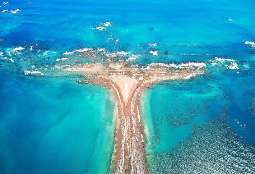
Whale's Tail Beach is a sandbar formation located in the Osa Peninsula region of Costa Rica, specifically within the Zona Sur.
This unique geographical feature extends into the Pacific Ocean, creating a distinctive shape resembling a whale's tail.
Visual Characteristics
The beach consists of a long, narrow sandbar composed of fine, light-colored sand. The sandbar's width varies, typically ranging from 50 to 100 meters. The ocean waters on either side exhibit varying shades of blue and green depending on depth and light conditions. The vegetation on the adjacent mainland is dense tropical rainforest.
Location & Access Logistics
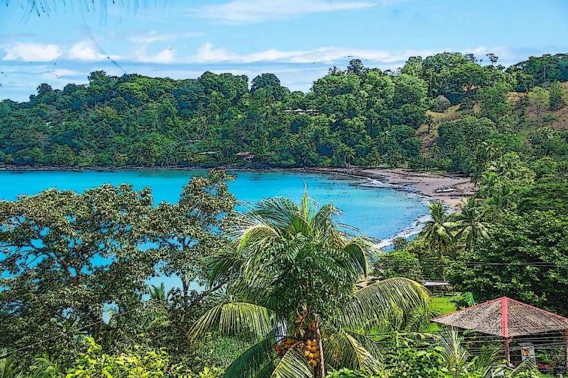
Whale's Tail Beach is situated within the Marino Ballena National Park. Access is primarily via the town of Uvita. From Uvita, travel south on Costanera Highway 34 for approximately 2 kilometers. Turn west onto the unpaved road leading to the park entrance. Parking is available at the national park's main entrance facilities. From the entrance, it is a 1.5-kilometer walk along the beach to reach the sandbar. Public transport to Uvita is available via intercity buses from San Jose and other major cities. No direct public transport reaches the park entrance.
Historical & Ecological Origin
The sandbar is a natural geological formation, a tombolo, created by the deposition of sand and sediment carried by ocean currents. Its formation is influenced by the prevailing wave patterns and the presence of offshore rocks that disrupt current flow. The surrounding area is part of a protected marine national park established to conserve marine life and coastal ecosystems.
Key Highlights & Activities
Walking the length of the sandbar is the primary activity. Snorkeling is possible in the calmer waters on the leeward side of the sandbar during low tide. Birdwatching is common, with various seabirds frequenting the area. Kayaking and paddleboarding are options in the bay adjacent to the sandbar.
Infrastructure & Amenities
Restrooms and changing facilities are available at the Marino Ballena National Park entrance. Limited shade is provided by scattered trees near the park entrance. Cell phone signal (4G) is generally available near the park entrance and Uvita, but can be intermittent on the sandbar itself. Food vendors are typically located near the park entrance and in Uvita; there are no vendors directly on the sandbar.
Best Time to Visit
The sandbar is most accessible and visually prominent during low tide. The best time of day for photography is typically in the late afternoon, approximately 1-2 hours before sunset, for favorable lighting. The dry season, from December to April, offers the most consistent weather conditions. The months of September and October can experience significant rainfall.
Facts & Legends
The sandbar's shape is most pronounced during the spring tides, which occur twice a month. Local folklore sometimes refers to the sandbar as a resting place for ancient sea creatures.
Nearby Landmarks
- Marino Ballena National Park Entrance (0.2km North)
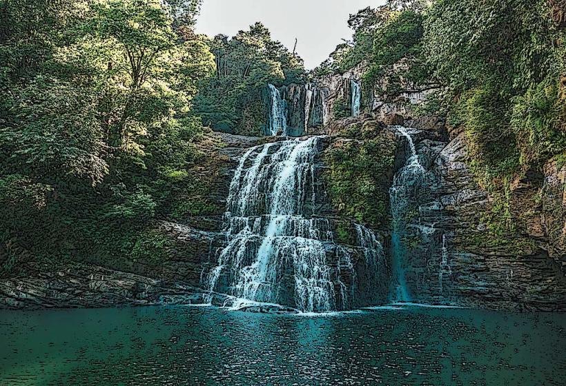
- Uvita Waterfall (2.5km Northeast)
- Playa Hermosa (3.0km South)
- Playa Dominical (15.0km North)