Information
Landmark: Galapagos Marine ReserveCity: Galapagos Islands
Country: Ecuador
Continent: South America
Galapagos Marine Reserve, Galapagos Islands, Ecuador, South America
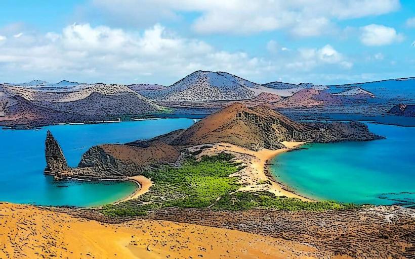
The Galapagos Marine Reserve is a protected ocean area encompassing the waters surrounding the Galapagos Islands in Ecuador.
This reserve is recognized for its exceptional biodiversity and is a critical component of the Galapagos National Park.
Visual Characteristics
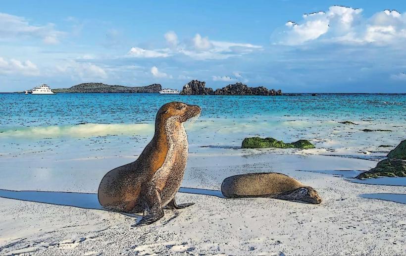
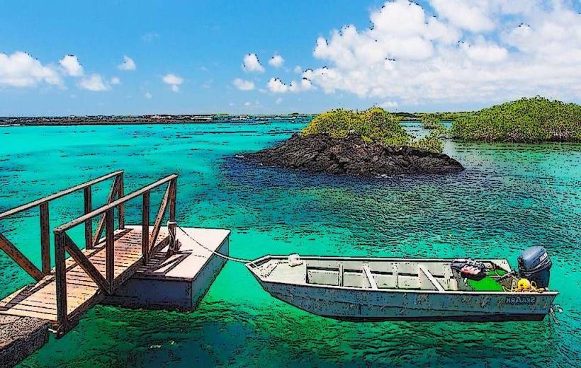
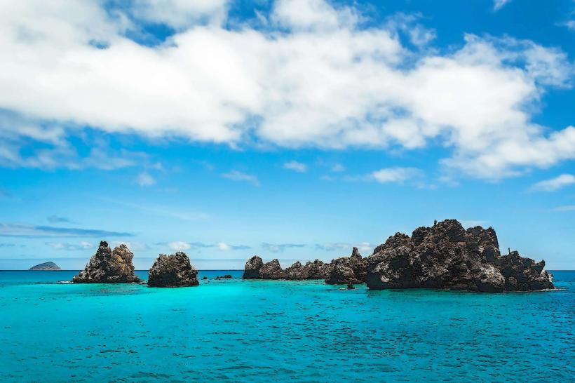
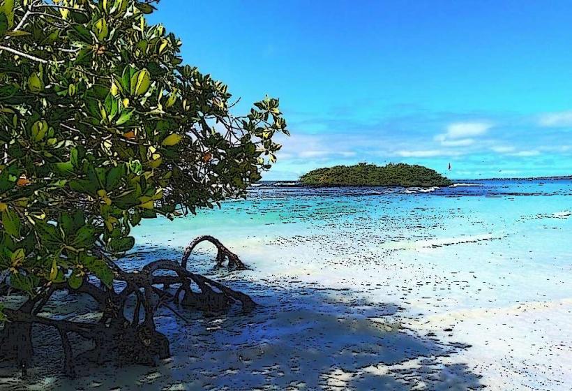
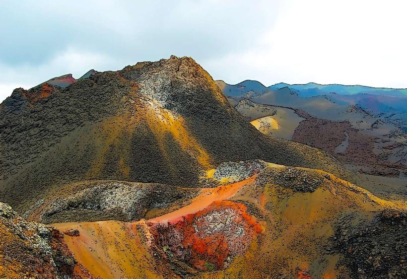
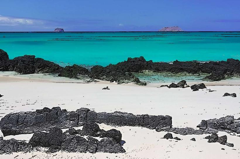
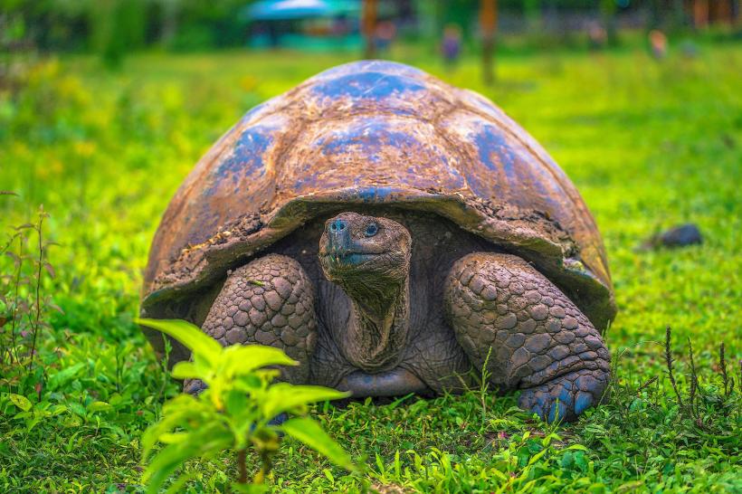
The reserve's visual characteristics are defined by its marine environment. Water clarity varies, often exhibiting deep blues and greens, with visibility influenced by currents and plankton levels. Submerged environments feature volcanic rock formations, sandy seabeds, and diverse coral structures in shallower areas. Marine life is the primary visual element, including schools of fish, sea turtles, marine iguanas, sharks, and various cetaceans.
Location & Access Logistics
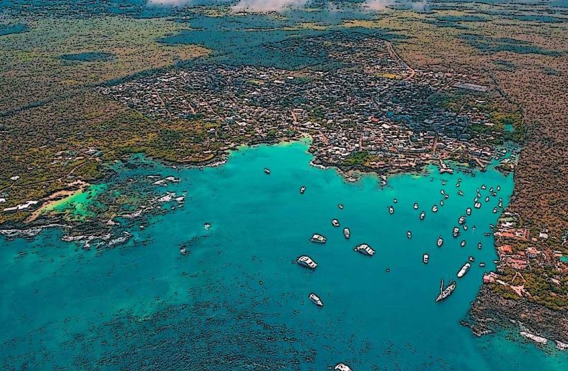
The Galapagos Marine Reserve surrounds the Galapagos Archipelago, located approximately 1,000 kilometers (620 miles) west of mainland Ecuador. Access is primarily via air to Baltra Airport (GPS) or San Cristóbal Airport (SCY) on Santa Cruz and San Cristóbal islands, respectively. From these islands, boat transfers are necessary to reach various points within the reserve. Inter-island travel is facilitated by speedboats and ferries. No direct road access exists to the reserve itself; access is by sea. Parking is available at port facilities on inhabited islands.
Historical & Ecological Origin
The Galapagos Marine Reserve was established by Ecuadorian law in 1998, with its boundaries formally defined. Ecologically, it is situated at the confluence of three major ocean currents: the Humboldt Current (cold, nutrient-rich), the Panama Current (warm), and the Equatorial Counter Current. This unique oceanographic setting supports a rich and diverse marine ecosystem, a classification of a Large Marine Ecosystem (LME).
Key Highlights & Activities
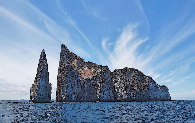
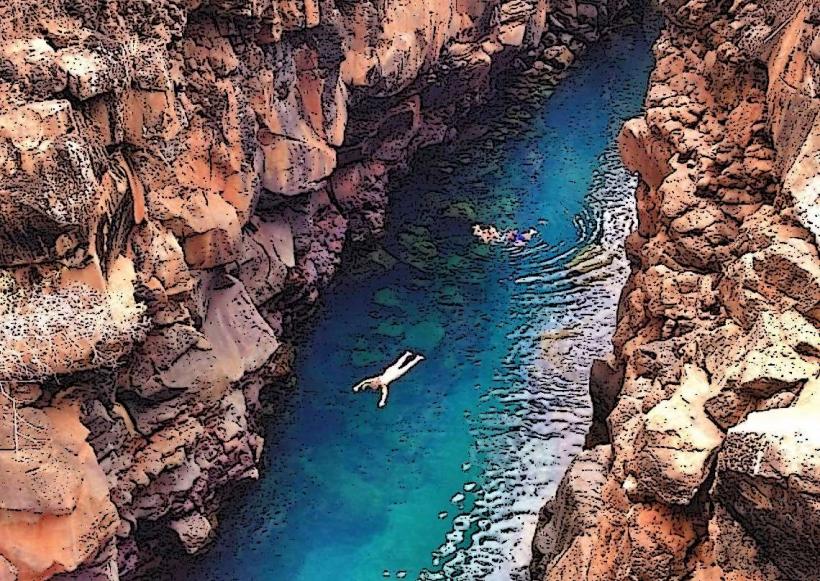
Activities include scuba diving and snorkeling at designated sites such as Kicker Rock, Gordon Rocks, and Darwin Bay. Wildlife observation from boats is common. Kayaking and paddleboarding are permitted in specific bays. Fishing is strictly regulated and prohibited in most areas of the reserve.
Infrastructure & Amenities
Infrastructure is limited within the reserve itself. On the inhabited islands (Santa Cruz, San Cristóbal, Isabela, Floreana), basic amenities like restrooms, food vendors, and limited shade are available at port towns and designated visitor sites. Cell phone signal (4G/5G) is generally available in populated areas on the main islands but is unreliable or absent within the open marine reserve.
Best Time to Visit
The best time for marine life viewing is generally from June to November, which corresponds to the cooler, drier season (Garúa season) when nutrient-rich waters attract more pelagic species. Water temperatures range from 20-24°C (68-75°F) during this period. From December to May (warm season), water temperatures are warmer (24-28°C / 75-82°F), offering better conditions for snorkeling and diving for some species. High tide is generally preferable for accessing certain shallow snorkeling sites.
Facts & Legends
A unique aspect of the reserve is the presence of endemic marine species, such as the Galapagos marine iguana, the only sea-going lizard in the world. A specific visitor tip is to be aware of strong currents at popular dive sites like Gordon Rocks, which require experienced divers.
Nearby Landmarks
- Santa Cruz Island (0.1km West)
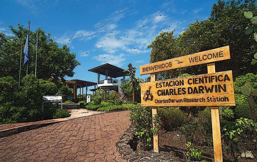
- Charles Darwin Research Station (0.5km West)
- Highlands of Santa Cruz (5km North)
- Tortuga Bay (2km Southwest)
- San Cristóbal Island (90km Southeast)