Landmark: Bhumibol Dam
City: Gulf of Thailand
Country: Thailand
Continent: Asia
Bhumibol Dam, Gulf of Thailand, Thailand, Asia
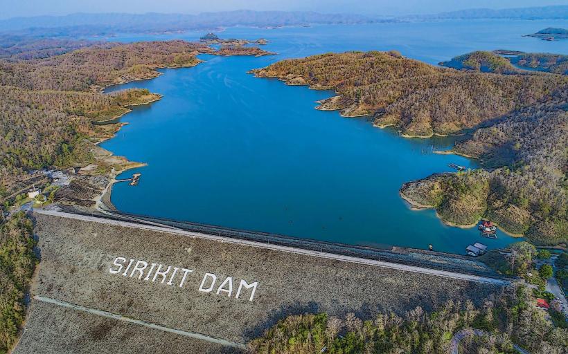
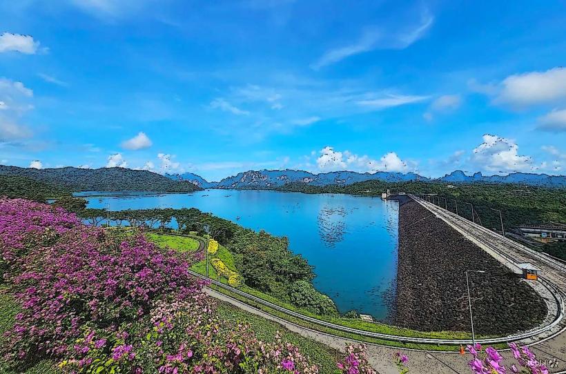
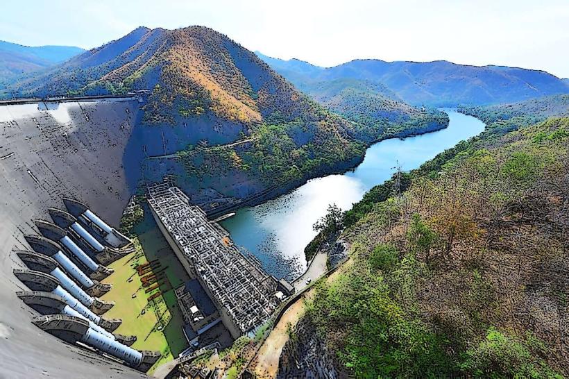
The Bhumibol Dam is a concrete gravity dam located on the Ping River in Tak Province, Thailand, within the Gulf of Thailand watershed.
Visual Characteristics
The dam structure is composed of concrete and measures 154 meters in height and 1,270 meters in length. It forms a reservoir with a surface area of approximately 289 square kilometers when at full capacity. The spillway gates are a prominent feature of the dam's crest.
Location & Access Logistics
The dam is situated approximately 47 kilometers northwest of the city of Tak. Access is via Highway 1 (Phahonyothin Road) north from Tak, then turning onto Highway 105 (Mae Sot-Umphang Road) for approximately 20 kilometers. A smaller, paved road leads directly to the dam site. Ample parking is available at the dam's visitor center and surrounding areas. Public transport options to Tak city are available, with local buses or songthaews providing transport from Tak to the dam vicinity.
Historical & Ecological Origin
Construction of the Bhumibol Dam, originally known as Yanhee Dam, began in 1958 and was completed in 1964. It was designed by the Royal Irrigation Department of Thailand and built by a consortium of international contractors. Its primary purpose is hydroelectric power generation, flood control, and irrigation. The dam impounds the Ping River, creating a large artificial lake.
Key Highlights & Activities
Visitors can observe the dam's operational structure from designated viewpoints. The visitor center provides information on the dam's history and function. Boat tours on the reservoir are sometimes available, offering views of the surrounding landscape. Fishing is permitted in designated areas of the reservoir.
Infrastructure & Amenities
Restrooms are available at the visitor center. Shaded areas are provided at viewing platforms. Cell phone signal (4G) is generally available in the vicinity of the dam. Food vendors are typically present near the visitor center and parking areas, offering local snacks and meals.
Best Time to Visit
The best time of day for photography is generally in the morning or late afternoon when the sun angle provides optimal lighting on the dam structure. The dry season, from November to April, offers the most stable weather conditions. Water levels in the reservoir fluctuate based on rainfall, with higher levels typically occurring during the rainy season (May to October).
Facts & Legends
The dam was renamed in honor of King Bhumibol Adulyadej on his 60th birthday in 1987. A local legend suggests that the spirits of the mountains surrounding the reservoir are protective of the dam, ensuring its continued operation.
Nearby Landmarks
- Taksin Maharat National Park (15km Southwest)
- Wat Phra That Doi Sao (25km Northwest)
- Mae Sot City (45km Southwest)
- Phra That Doi Mon Ngoh (30km West)