Landmark: Congo Nile Trail
City: Karongi
Country: Rwanda
Continent: Africa
Congo Nile Trail, Karongi, Rwanda, Africa
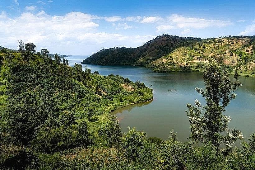
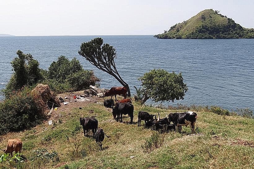
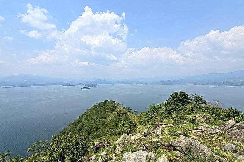
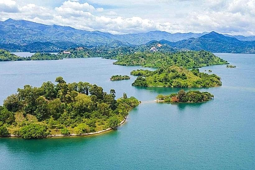
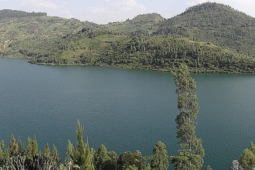
The Congo Nile Trail is a 227km multi-stage transit corridor extending along the eastern divide of Lake Kivu in western Rwanda. It traverses the Rubavu, Rutsiro, Karongi, Nyamasheke, and Rusizi districts, marking the hydrographic separation between the Nile and Congo River basins.
Visual Characteristics
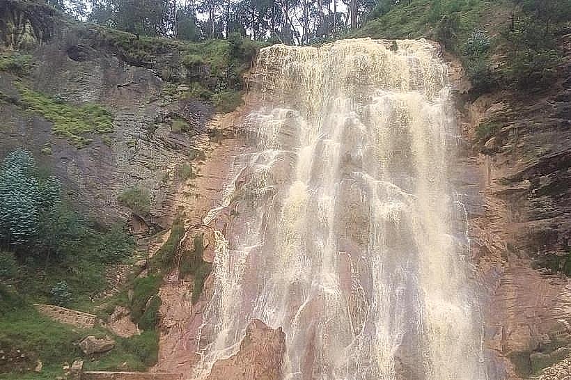
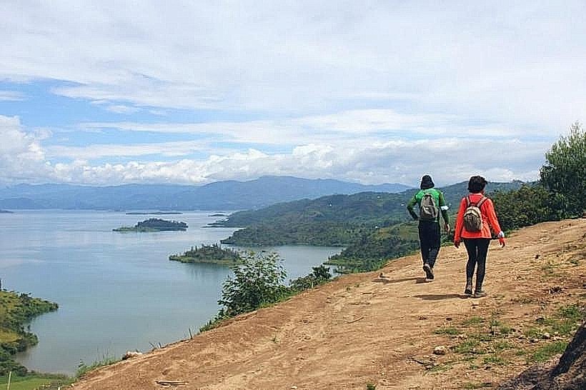
The trail consists of a network of dirt tracks, single-track paths, and paved road segments through high-altitude montane landscapes. Surfaces range from compacted red latosol to volcanic rock fragments. Vegetation includes eucalyptus plantations, terraced coffee and tea estates, and dense pockets of tropical rainforest reaching elevations of 2,630 meters.
Location & Access Logistics
The northern trailhead begins in Gisenyi (Rubavu) near the Grande Barrière border post, while the southern terminus is in Cyangugu (Rusizi). Major access points include the RN2 and RN7 highways. Hikers and cyclists typically access intermediate segments via Lake Kivu water taxis or regional bus services stopping at Karongi and Nyamasheke.
Historical & Ecological Origin
Developed by the Rwanda Development Board in 2009, the trail was designed to integrate rural agricultural communities into the national tourism infrastructure. Geologically, the route follows the western arm of the East African Rift, characterized by metamorphic rock formations and ancient volcanic activity that shaped the rift valley floor.
Key Highlights & Activities
Mountain biking the full length typically requires 5 to 7 days, while hiking the entire distance takes 10 to 12 days. Specific activities include guided tours of the Pfunda Tea Estate, birdwatching in the Mukura Forest, and visiting local coffee washing stations. Multi-day kayaking expeditions are also possible parallel to the coastal trail segments.
Infrastructure & Amenities
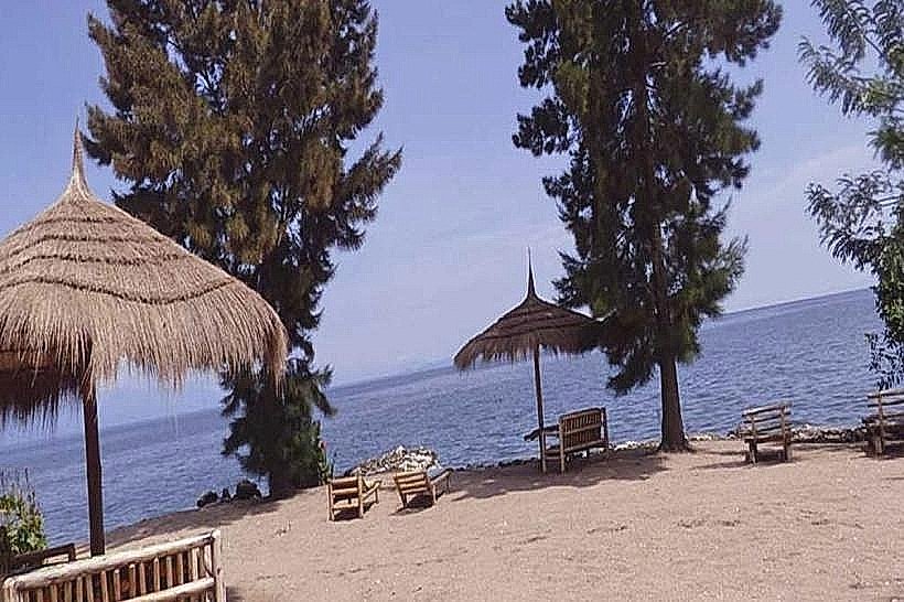
The trail features 8 official campsites and several primary-school-based guesthouses. Basic pit latrines are available at designated stops, though formal restrooms are restricted to urban centers and lakeside lodges. 4G cellular coverage is intermittent in deep valleys but stable on ridgelines; 5G is available in Rubavu, Karongi, and Rusizi.
Best Time to Visit
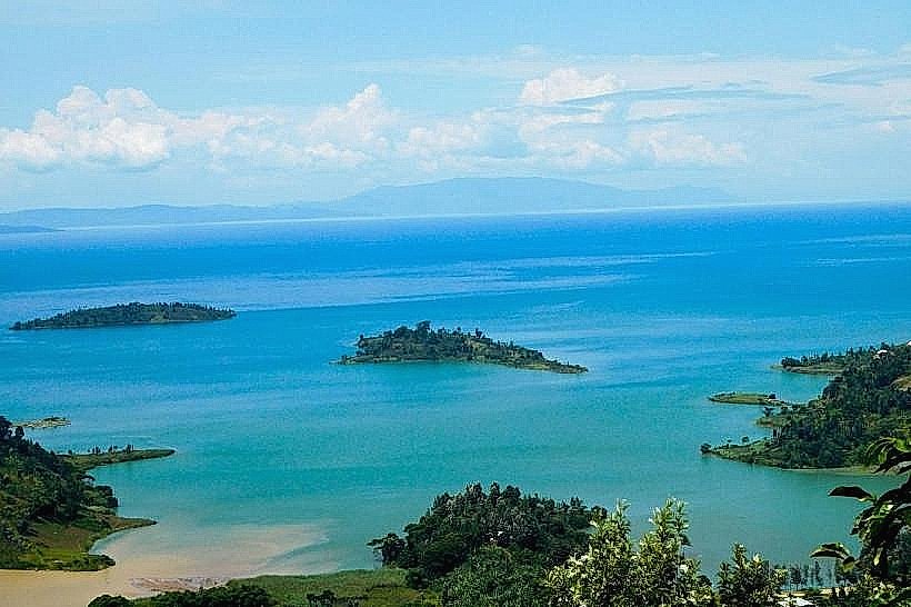
The primary dry season from June to August provides the most stable terrain for cycling and hiking. The short dry season in January and February is also viable. Photography is optimal during the early morning (06:30–08:30) when mist often settles over Lake Kivu and the surrounding terraced hills.
Facts & Legends
The trail’s name is a geographical literalism; rain falling on the eastern side of the ridge flows into the Nile, while rain on the western side drains into the Congo River. A logistical tip: the "Brasserie" segment near Gisenyi is known for steep technical climbs that often require "hike-a-bike" maneuvers for non-professional cyclists.
Nearby Landmarks
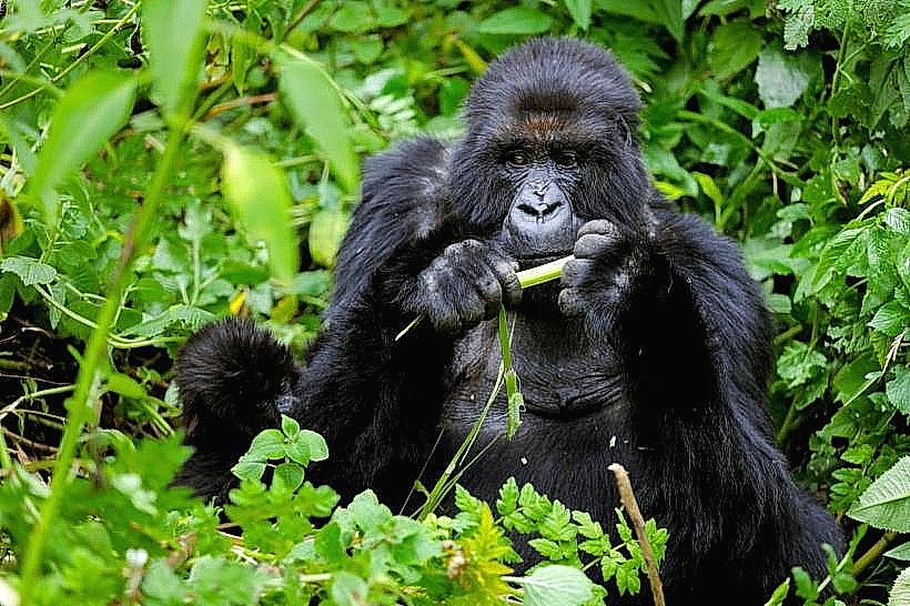
Nyungwe Forest National Park – 4.5km East (from southern segments)
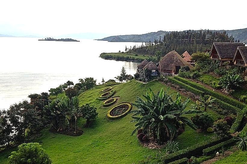
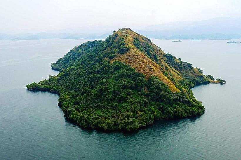
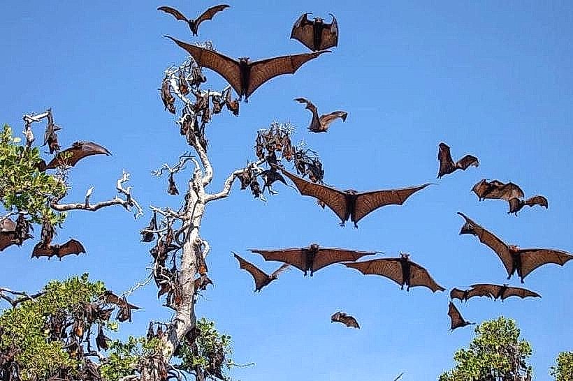
Napoleon Island – 2.0km West (visible from Karongi segments)
Gishwati-Mukura National Park – 3.5km East (from Rutsiro segments)
Emeraude Kivu Resort – 0.5km West (at Rusizi terminus)
Pfunda Tea Factory – 1.2km East (near Rubavu start)