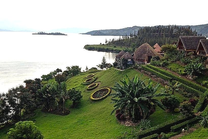
Landmark: Karongi Waterfront
City: Karongi
Country: Rwanda
Continent: Africa
Karongi Waterfront, Karongi, Rwanda, Africa
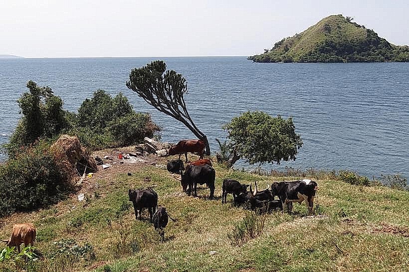
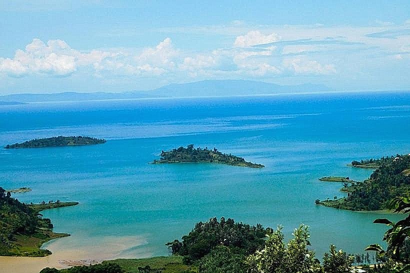
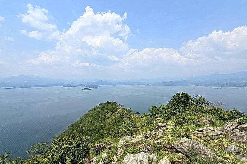
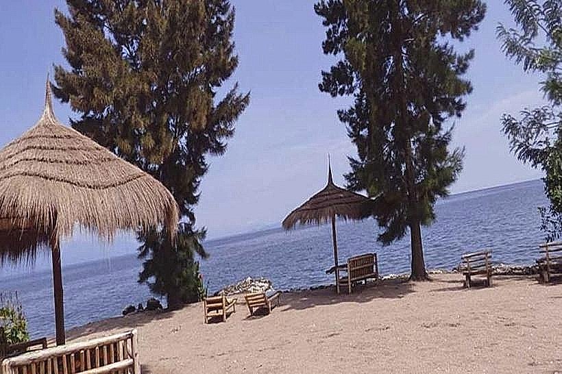
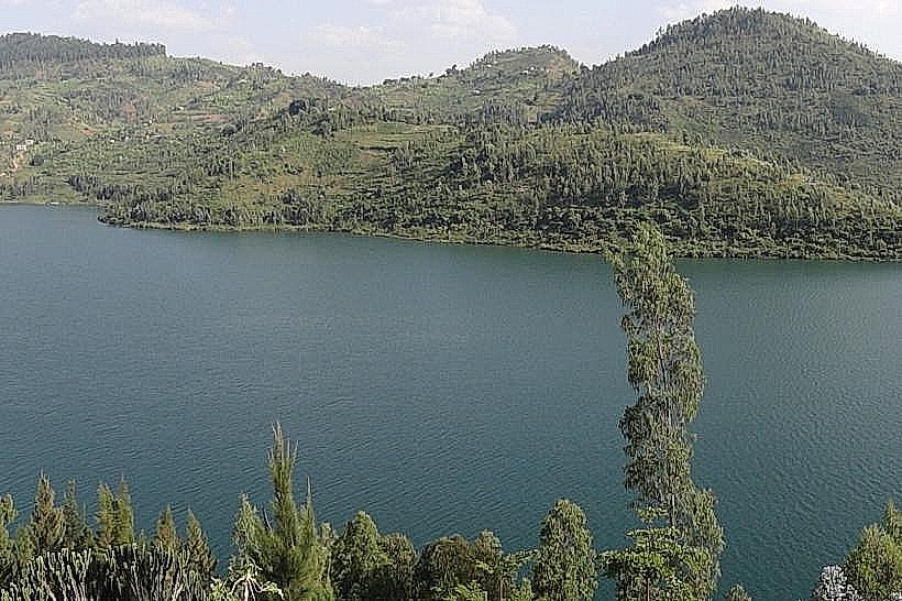
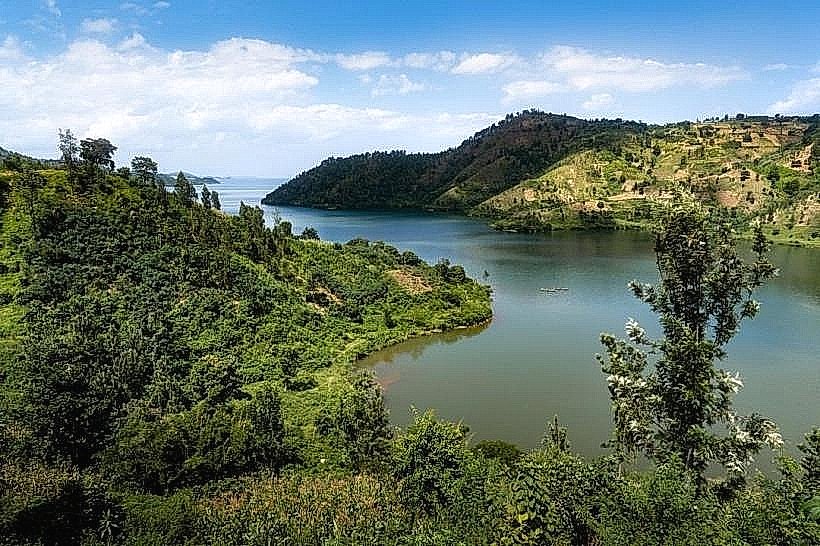
Karongi Waterfront is a prominent lakefront area located in the town of Karongi (formerly Kibuye) on the eastern shores of Lake Kivu. It is characterized by its dramatic topography, featuring deep bays and steep, emerald-green hills that drop directly into the water.
Visual Characteristics
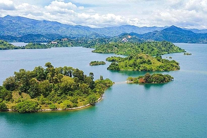
The waterfront is defined by a highly irregular coastline with numerous sheltered inlets and rocky peninsulas. The water is deep and dark green, reflecting the dense eucalyptus and pine forests on the surrounding hills. Several small, uninhabited islands are visible within 1km of the shore, and the area is notably quieter and more rural than the northern Rubavu coastline.
Location & Access Logistics
The waterfront is accessed via the RN2 highway, which connects Karongi to Rubavu (90km North) and Kigali (130km East). From the Karongi town center, the main tourist waterfront is a 5-minute drive or a 15-minute walk along Avenue du Lac. Public buses from Kigali's Nyabugogo terminal reach the Karongi station in approximately three and a half hours.
Historical & Ecological Origin
Formed by the tectonic subsidence of the Albertine Rift, the Karongi sector is one of the deepest parts of Lake Kivu. Historically, it served as a quiet fishing outpost before being developed into a primary administrative and tourism hub for the Western Province. The local ecology is dominated by the lake's meromictic properties and the steep, terraced agricultural landscapes of the Nile-Congo Divide.
Key Highlights & Activities
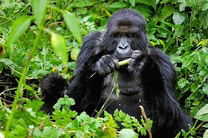
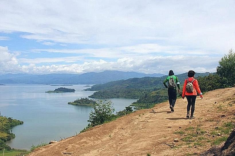
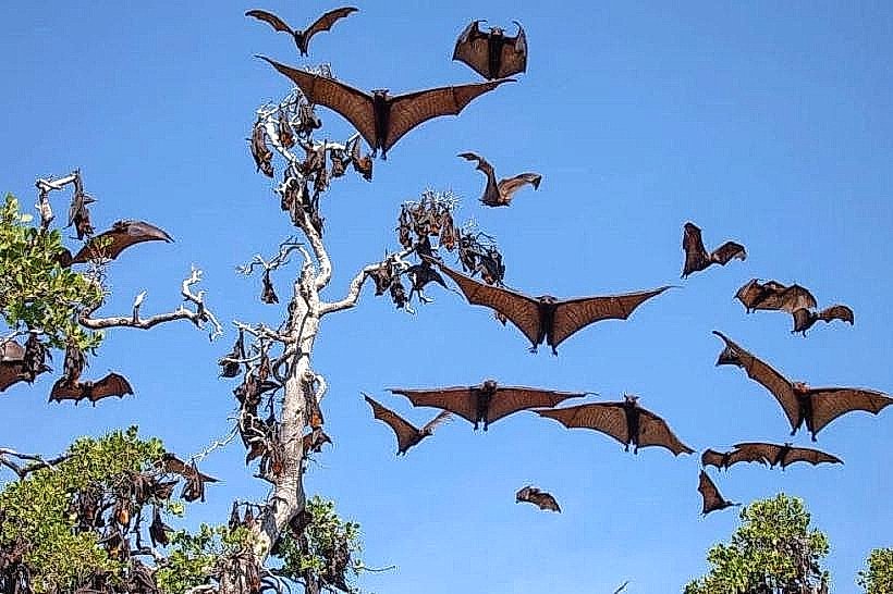
Boat trips to Napoleon Island (known for its fruit bat colony) and Amahoro Island depart regularly from the main docks. The waterfront is a primary segment of the Congo Nile Trail, offering well-marked paths for hikers and mountain bikers. Kayaking in the sheltered bays is a frequent activity due to the lack of strong wind-driven waves.
Infrastructure & Amenities
The area features a paved lakeside road with several viewpoints and public benches. 4G and 5G cellular coverage is consistent across the waterfront. While public restrooms are limited to the nearby hotels and the Environment Museum, small local restaurants and cafes serving "Isambaza" are concentrated near the town's main pier.
Best Time to Visit
The best time for boat excursions is during the early morning (07:00 to 10:00) when the water is calmest. For photography, the late afternoon provides backlighting against the Congolese mountains on the western horizon. The dry months of June to August are ideal for trekking the surrounding hills.
Facts & Legends
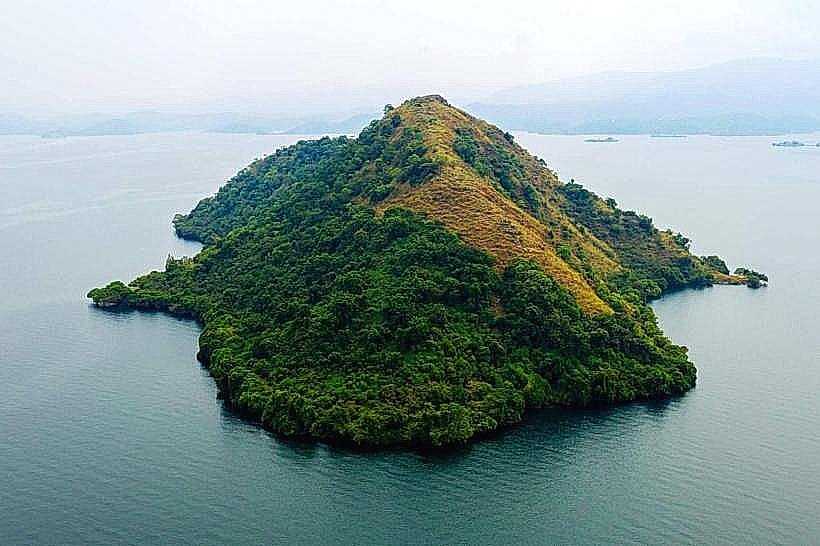
A local legend surrounds Napoleon Island, so named because its profile from a distance resembles the hat of Napoleon Bonaparte; it is home to thousands of straw-colored fruit bats. A logistical tip for travelers is that the public ferry connecting Rubavu and Rusizi stops at the Karongi waterfront twice a week, providing a low-cost scenic transit option.
Nearby Landmarks
Environment Museum: 0.5km East
Napoleon Island: 2.5km West (by boat)
Amahoro Island: 1.8km Southwest (by boat)
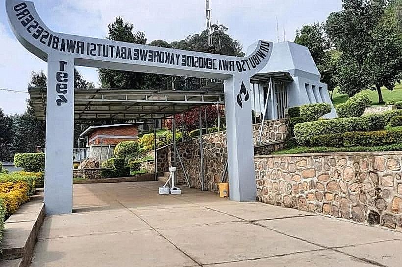
Bisesero Genocide Memorial: 12.0km Southeast
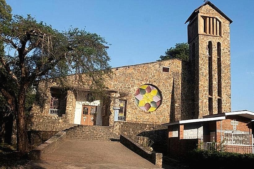
Kibuye Catholic Church: 1.2km North