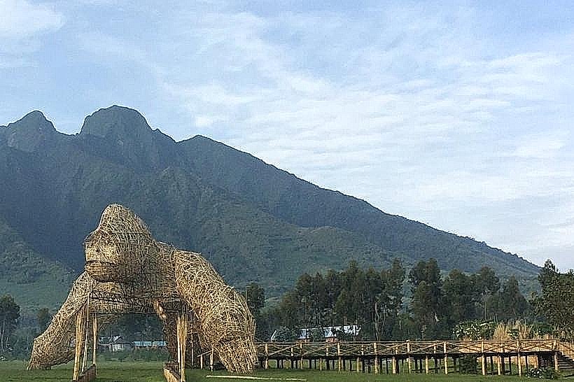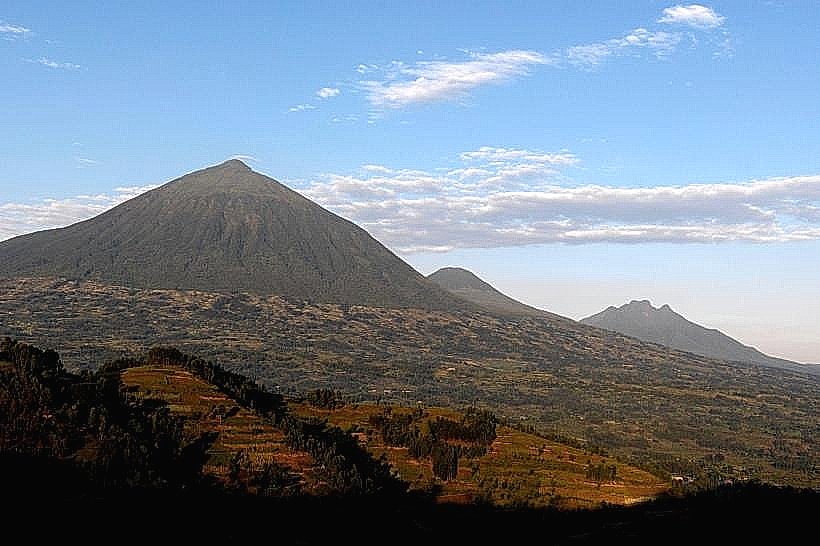
Landmark: Mount Muhabura
City: Musanze
Country: Rwanda
Continent: Africa
Mount Muhabura, Musanze, Rwanda, Africa
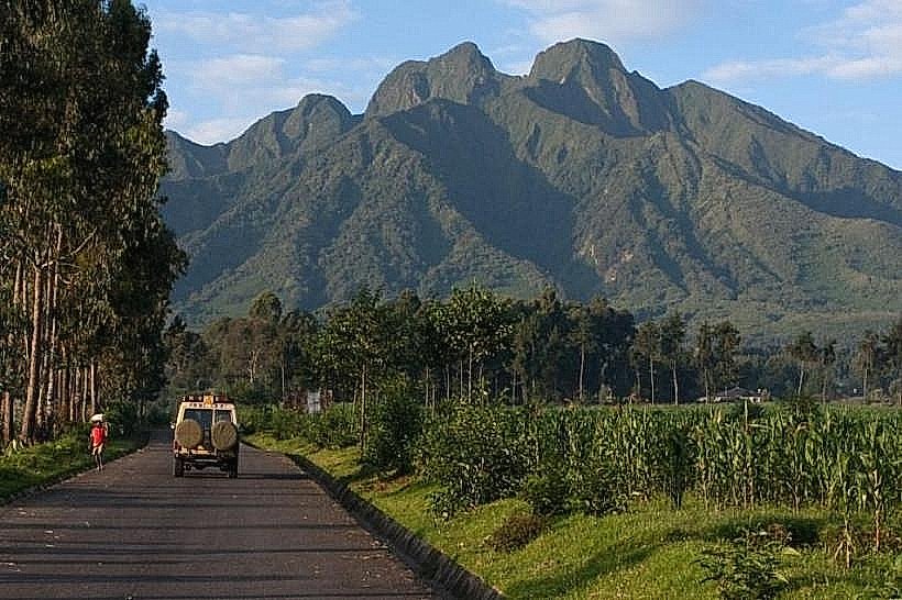
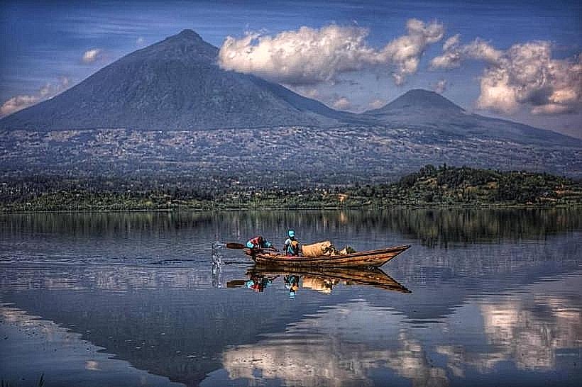
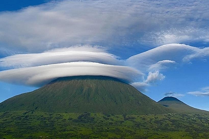
Mount Muhabura is an inactive stratovolcano in the Virunga Mountains, rising to an elevation of 4,127 meters. It is the third-highest peak in the range and sits directly on the border between Rwanda and Uganda, marking the easternmost point of the volcanic chain.
Visual Characteristics
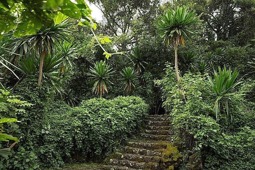
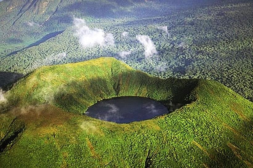
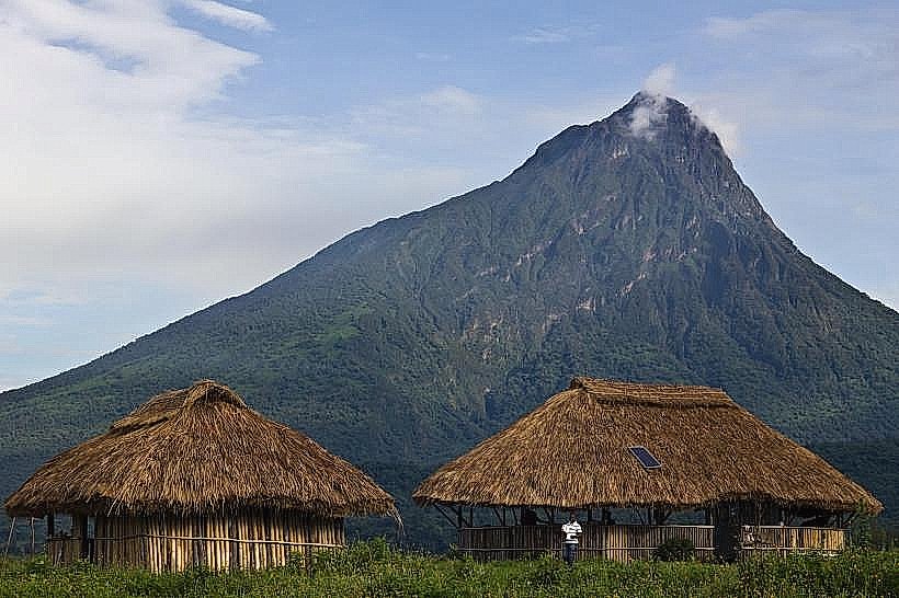
The mountain is defined by a classic, steep conical shape that makes it visible from significant distances across both northern Rwanda and southwestern Uganda. The summit features a small, 40-meter-wide crater lake surrounded by giant lobelias and open alpine moorland. Vegetation transitions from dense bamboo at the base (2,300m) to montane forest and eventually high-altitude heath. Due to its exposed position, the slopes are often drier than those of the central Virunga volcanoes, though the peak is frequently shrouded in clouds.
Location & Access Logistics
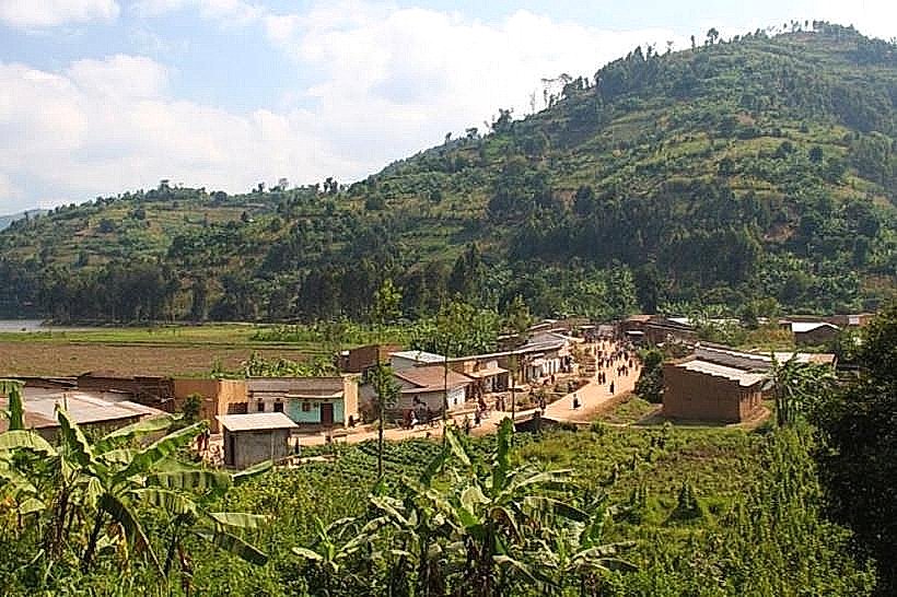
Muhabura is situated approximately 15km northeast of Musanze (Rwanda) and 10km south of Kisoro (Uganda).
Rwanda Access: Starts at the Kinigi Park Headquarters in Volcanoes National Park. Briefing occurs at 07:00, followed by a 45-minute drive to the trailhead.
Uganda Access: Starts at the Ntebeko Visitor Center in Mgahinga Gorilla National Park.
The hike is a rigorous full-day endeavor, typically taking 8 to 10 hours round trip with a vertical gain of approximately 1,700 meters. A high-clearance 4x4 vehicle is required to reach the trailheads. Permits cost approximately $80 for international tourists and include mandatory armed rangers and guides.
Historical & Ecological Origin
The name "Muhabura" translates to "The Guide" in Kinyarwanda, a reference to its historical use as a navigational landmark for travelers in the region. Geologically, it is a dormant stratovolcano formed by successive lava eruptions along the Albertine Rift during the Holocene epoch. Ecologically, it serves as a vital corridor for wildlife, including buffaloes, elephants, and occasionally mountain gorillas. It also supports unique high-altitude fauna such as the Albertine Rift butterfly and cold-adapted frogs in the summit crater.
Key Highlights & Activities
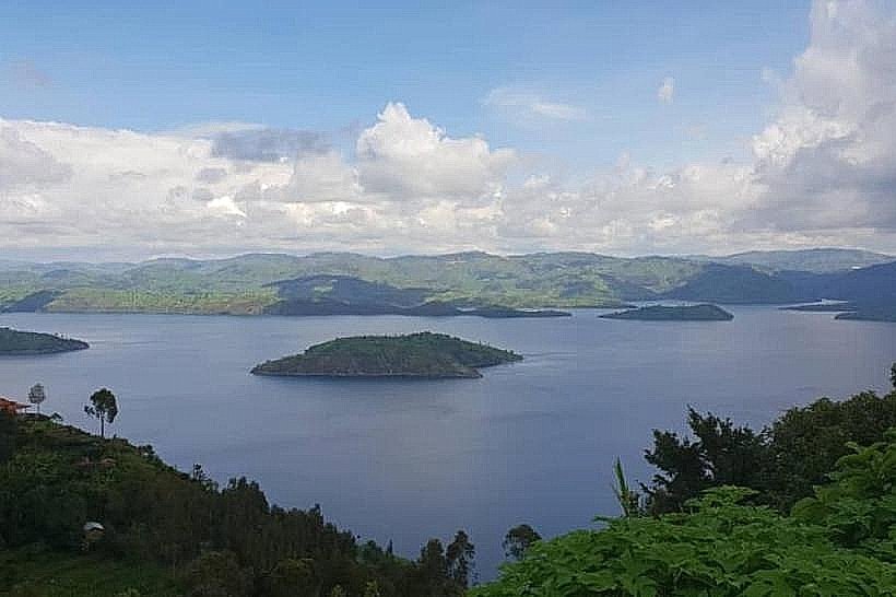
The primary activity is the summit trek, which is considered the most physically demanding one-day hike in the Virungas due to its sustained steep gradient (30-35 degrees). Reaching the summit allows hikers to stand on the international border and view the Twin Lakes (Burera and Ruhondo) in Rwanda, as well as Lake Bunyonyi, Lake Edward, and the Rwenzori Mountains in Uganda. Bird watching is frequent on the lower slopes, with over 120 species recorded, including various sunbirds and the Rwenzori Turaco.
Infrastructure & Amenities
Infrastructure on the mountain is minimal, consisting of two primary rest points on the Ugandan side at 3,117m and 3,860m. There are no permanent shelters, toilets, or water sources on the trail; hikers must be self-sufficient with 3 to 4 liters of water and packed rations. Modern restrooms and briefing facilities are available at the Kinigi or Ntebeko headquarters. 4G cellular signal is available at the park bases but becomes non-existent in the upper alpine zones. Porters are available for hire at the trailheads to assist with gear.
Best Time to Visit
The dry seasons-June to September and December to February-are the only recommended periods for the ascent. During these months, the volcanic ash and soil are more stable, and the summit is less likely to be obscured by heavy mist. In the rainy seasons, the steep clay sections become dangerously slippery, and extreme cold at the summit can lead to rapid onset of altitude-related symptoms.
Facts & Legends
A verified geological fact is that the crater lake at the summit is cold enough that swimming is strongly discouraged, despite its clear appearance. A local legend from the Batwa people suggests the mountain is the "elder" of the range, watching over the smaller Gahinga and Sabyinyo. A unique logistical detail: Muhabura is the only Virunga volcano that offers a clear view of the "Twin Lakes" of Rwanda and the "Lake of 1,000 Islands" (Bunyonyi) in Uganda from a single vantage point.
Nearby Landmarks
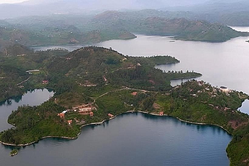
Lake Burera – 8.5km South
Mount Gahinga – 3.5km West
Cyanika Border Post – 7.0km East
Ntaruka Power Station – 9.0km South
Ntebeko Visitor Center – 5.5km Northwest