Landmark: Execution Rock
City: Lobamba
Country: Eswatini
Continent: Africa
Execution Rock, Lobamba, Eswatini, Africa
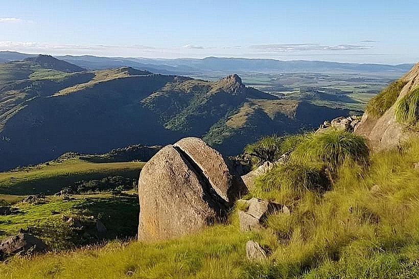
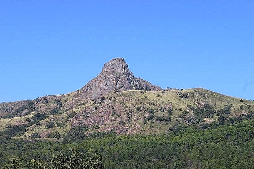
Execution Rock, historically known as Nyonyane Mountain or the "Rock of Execution," is a sharp phonolite volcanic peak situated within the Mlilwane Wildlife Sanctuary in the Ezulwini Valley. The landmark is characterized by its sheer, near-vertical southern cliff face that drops abruptly into the valley floor below.
Visual Characteristics
The landmark presents a distinctive, pointed geological silhouette featuring an exposed, steep granite-like summit that transitions into a vertical precipice on its southern aspect. The northern slopes are less severe, covered in dense, hardy mountain bushveld, indigenous acacia thickets, and patches of dry montane grassland. The rock surface itself displays a weathered gray and charcoal coloration, deeply scarred by natural fractures and fissures where specialized succulent flora, including specialized aloe species, cling to the stone.
Location & Access Logistics
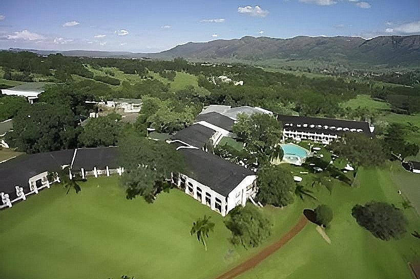
The peak is positioned inside the central zone of the Mlilwane Wildlife Sanctuary, approximately 22 kilometers south of Mbabane and 11 kilometers west of Lobamba. Access is achieved by entering Mlilwane via the paved local road from Lobamba or Malkerns, and then proceeding on unpaved safari tracks to the base trailhead. Public transport minibuses drop passengers at the main reserve turnoff on the MR103 highway, requiring a 3-kilometer walk to the sanctuary gate, followed by a backcountry trek. Designated dirt parking areas are available at the Mlilwane Rest Camp and the Hippo Haunt Restaurant trailhead base.
Historical & Ecological Origin
Geologically, Execution Rock is an ancient volcanic plug or remnant dome formed through magma intrusion during the Karoo volcanic episode millions of years ago, later exposed through long-term differential weathering of the surrounding landscape. Historically, the peak served as an ancient execution site under early Swati monarchs until the late 19th century, where individuals convicted of capital crimes, witchcraft, or treason were marched to the summit and forced off the sheer edge. Ecologically, it sits within a protected sanctuary zone, providing nesting ledges for raptors such as the black eagle and acting as a rugged terrain refuge for klipspringers and chacma baboons.
Key Highlights & Activities
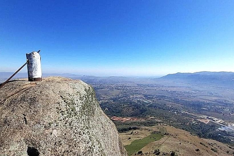
Hiking to the summit plateau is the primary recreational activity, utilizing the challenging Nyonyane Trail which requires 2 to 3 hours of steep pedestrian climbing. Guided horseback safaris depart from the central rest camp and ascend the lower, gentler ridges of the mountain. Mountain biking is permitted along designated lower tracks, and the summit provides an elevated, panoramic platform for landscape photography detailing the entire expanse of the Ezulwini Valley and the distant Mdzimba Range.
Infrastructure & Amenities
The mountain trail and summit zone are completely primitive and wild, meaning there are no public restrooms, built shelters, handrails, or trash receptacles along the paths. Hikers must carry all personal water and emergency provisions. Cellular network coverage (4G) is operational on the exposed high-altitude summit due to line-of-sight proximity to valley towers, but drops out completely along the heavily wooded northern ravines. Modern amenities, treated water, and restaurant services are located exclusively at the main Mlilwane Rest Camp at the base.
Best Time to Visit
The optimal period for ascending the rock is during the dry winter months from May to August, when daytime temperatures are mild, humidity is low, and trail tracks are firm. Early morning departures between 06:00 and 08:00 are critical during summer to avoid intense heat and potential heat exhaustion on the unshaded upper rock switchbacks. Photography is best executed during the late afternoon golden hour between 15:30 and 17:00, when the low sun casts long shadows across the valley floor and illuminates the sheer red-gray southern cliff face. Summer afternoons must be avoided due to the severe hazard of lightning strikes on the exposed peak.
Facts & Legends
The grim historical method of execution used at the summit gives the mountain its contemporary English name, a practice recorded by early European concessionaires and travelers who documented the traditional legal codes of the early Swati kingdom. Local folklore states that the spirits of those forced off the precipice still linger within the deep, forested boulder scree at the base of the cliff, leading some traditional elders to regard the immediate southern under-shallows of the peak with spiritual caution.
Nearby Landmarks
Mlilwane Rest Camp - 2.8km South-Southeast
Mantenga Nature Reserve (Western Boundary) - 3.1km Northeast
Mantenga Cultural Village - 3.9km Northeast
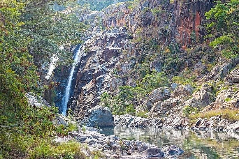
Mantenga Falls - 4.1km Northeast
Milwane Sanctuary Gate - 4.3km Southeast