Landmark: Sheba's Breast Hiking Trail
City: Lobamba
Country: Eswatini
Continent: Africa
Sheba's Breast Hiking Trail, Lobamba, Eswatini, Africa
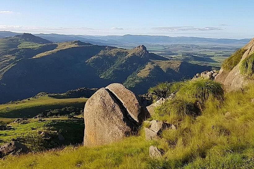
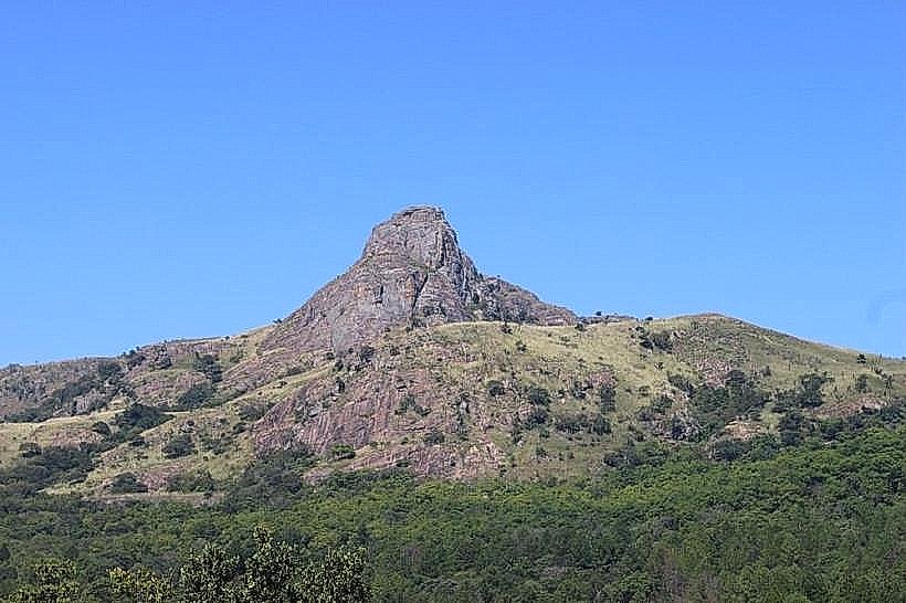
Sheba's Breast Hiking Trail is a historic mountain footpath that ascends a pair of prominent, symmetrical phonolite volcanic peaks known as Sheba's Breasts. Situated on the rugged Nyonyane mountain ridge within the Ezulwini Valley, the trail provides a steep, direct route up a landscape famous for its literary associations and panoramic vantage points.
Visual Characteristics
The trail climbs through a diverse topography that shifts from dense indigenous valley scrub and riverine thickets to open, windswept montane grasslands on the upper slopes. The twin peaks themselves are smooth, rounded granite-like formations composed of dark gray and weathered charcoal volcanic rock, rising out of the green ridge line. The path is narrow, cut directly into the reddish Highveld loam, and features natural stone steps, steep gravel switchbacks, and exposed bedrock sections where hardy succulents, aloes, and lichens cling to the rock faces.
Location & Access Logistics
The trailhead originates near the boundary of the Mlilwane Wildlife Sanctuary and the Mantenga area, approximately 18 kilometers south of Mbabane. Access is achieved by driving south from the capital along the paved MR103 road into the Ezulwini tourism corridor, turning west onto the access roads toward Lidwala Lodge or Mantenga Drive. Public transport via local minibuses (kombis) drops passengers along the main MR103 highway, leaving a 1.5 to 2-kilometer walk to the formal trail starting points. Vehicle parking is available on-site at the community-run trail bases or adjacent lodge properties.
Historical & Ecological Origin
Geologically, the twin peaks are part of an ancient volcanic plug system formed during the Karoo volcanism era millions of years ago, later shaped into distinctive mounds by millions of years of differential erosion. Historically, the landmark gained international fame after inspiring the setting for the mountain fortress in H. Rider Haggard's classic 1885 adventure novel, King Solomon's Mines. Ecologically, the trail traverses a midveld-to-highveld transition zone, protecting pocket forests in the ravines that serve as habitats for small mammals like the rock hyrax, vervet monkeys, and diverse raptor species.
Key Highlights & Activities
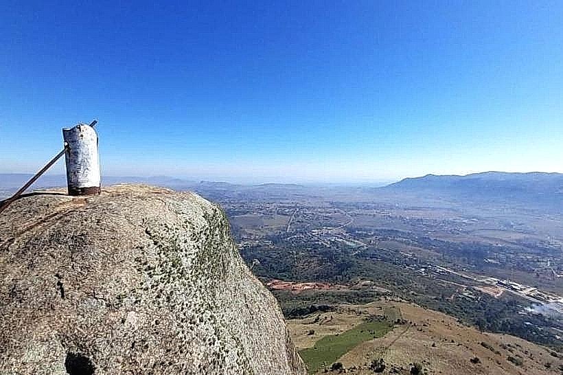
Trekking and trail running are the primary activities, with the standard out-and-back route requiring 2 to 3 hours of moderate to strenuous physical exertion. The trail links directly with the wider network of paths leading up to Execution Rock for advanced hikers seeking longer loops. Birdwatching is highly productive along the lower, forested stream beds, while the summit plateau provides an unshaded, 360-degree platform for landscape photography overlooking the entire Ezulwini Valley, the modern developments of the Gables, and the distant Mdzimba Range.
Infrastructure & Amenities
The hiking trail is a managed wilderness path that lacks developed public utilities along its length, meaning there are no public restrooms, built shelters, or trash receptacles on the slopes or the peaks. Basic directional trail signage and markers are maintained by local eco-tourism initiatives at key intersections. Cellular network coverage (4G) remains stable along the entire route due to a direct line of sight to the telecommunications towers operating on the valley floor. Treated water, public restrooms, and dining options are located exclusively at the trail bases down in the valley.
Best Time to Visit
The optimal period for hiking the trail is during the dry winter season from May to August, when ambient daytime temperatures are mild, humidity is low, and the trail surface is dry and secure. Early morning departures between 06:00 and 08:00 are critical during the summer months to avoid intense midday heat on the completely unshaded upper switchbacks. Summer afternoons from November to March must be avoided entirely due to high humidity and the severe risk of sudden, dangerous electrical storms that bring a lightning hazard to the exposed peaks.
Facts & Legends
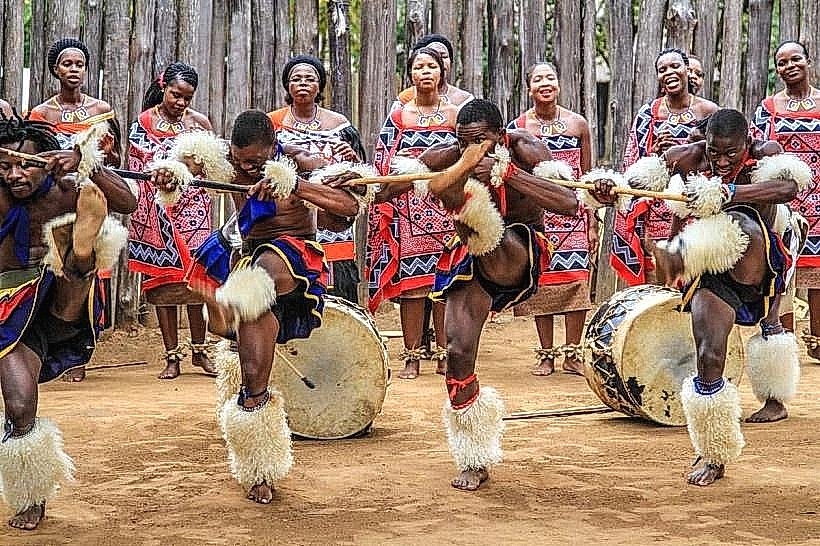
According to regional historical accounts, the author H. Rider Haggard walked these specific valley paths during his time in southern Africa, using the striking symmetry of the twin peaks to anchor the geography of his fictional lost kingdom. Local oral traditions associate the broader Nyonyane ridge with early tribal defensive maneuvers, noting that the hidden caves and deep rock clefts flanking the trail were used by local communities to safeguard livestock and families during 19th-century regional conflicts.
Nearby Landmarks
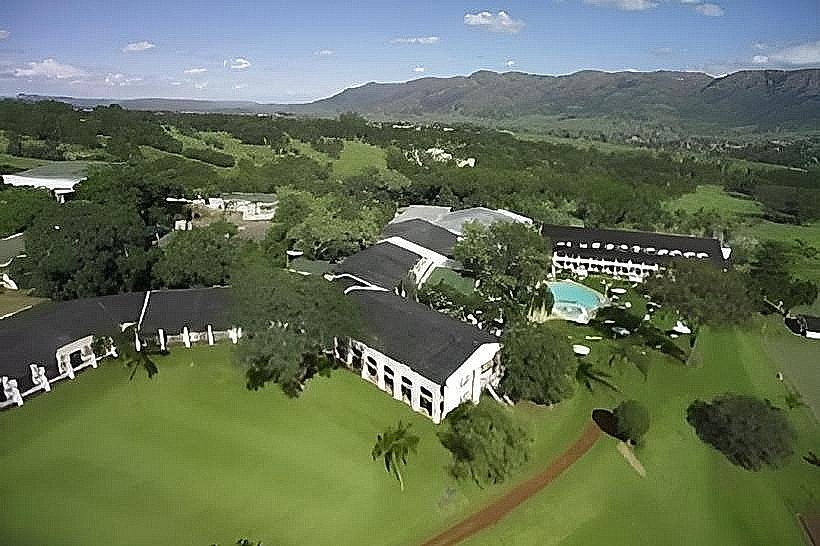
Lidwala Backpacker Lodge (Trailhead Base) - 0.2km East
Mantenga Lifestyle & Craft Centre - 1.2km East-Southeast
Mantenga Cultural Village - 1.5km West-Southwest
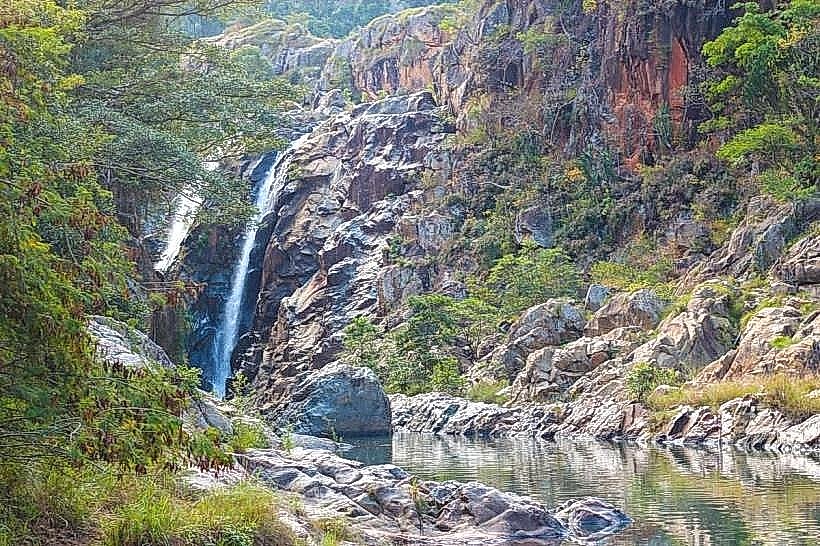
Mantenga Falls - 1.8km West-Southwest
The Gables Shopping Centre - 2.5km Southeast