Landmark: Shaat Viewpoint
City: Salalah
Country: Oman
Continent: Asia
Shaat Viewpoint, Salalah, Oman, Asia
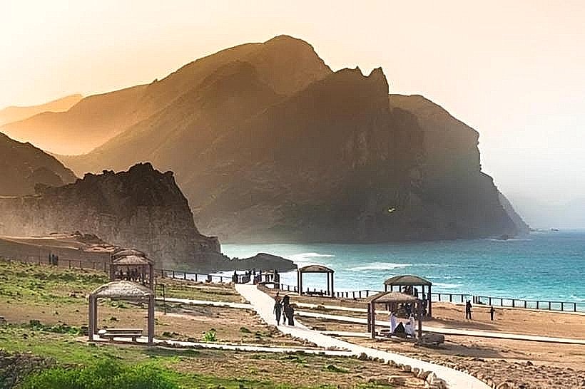
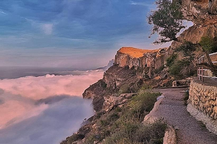
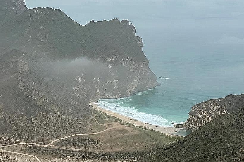
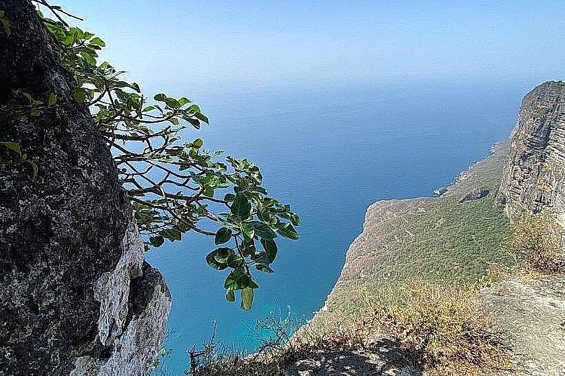
Shaat Viewpoint is an elevated coastal observation platform situated on the cliffs of Jabal Al Qamar. The site is located approximately 100 kilometers west of Salalah, positioned near the village of Shaat in the western Dhofar region.
Visual Characteristics
The landmark is positioned on a sheer limestone precipice that rises between 600 and 1,000 meters above the Arabian Sea. The viewpoint features a paved observation area protected by a waist-high perimeter wall constructed from local stone. The visual landscape consists of vertical grey cliffs, a vast blue ocean expanse, and a persistent layer of white clouds or mist that often sits below the cliff edge during the monsoon season.
Location & Access Logistics
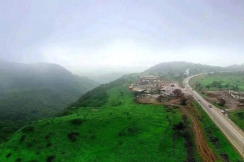
Access is via the Salalah-Sarfait Road (Route 47). After ascending the mountains past the Mughsail area, a marked turnoff leads to a paved side road that terminates at the cliff edge. The drive from Salalah takes approximately 1.5 to 2 hours. There is a paved parking area located directly adjacent to the observation wall. No public transport serves this remote mountain location; access is limited to private vehicles, taxis, or tour operators.
Historical & Ecological Origin
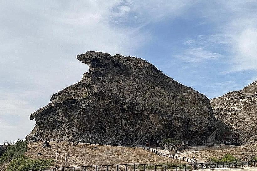
The viewpoint is part of the Qamar mountain range, a geological formation composed of Eocene limestone and dolostone. The cliffs were formed by tectonic activity and subsequent erosion by wind and sea. Historically, this high-altitude plateau served as a grazing ground for Jabal tribes and a strategic lookout for monitoring coastal maritime movements.
Key Highlights & Activities
The primary activity is observing the vertical drop and the coastal panorama. A short, paved walking path follows the cliff line for several hundred meters, allowing for different perspectives of the jagged coastline. It is a specific site for landscape photography, especially for capturing "cloud sea" effects. Binoculars are useful for spotting large birds of prey, such as eagles, that nest in the cliff crevices.
Infrastructure & Amenities
The site includes a paved walkway and multiple shaded seating pavilions with stone benches. Basic public restrooms are located near the parking entrance. There are no food vendors or shops at the viewpoint; the nearest services are located in the village of Rakhyut or back toward Mughsail. Cell phone signal (4G) is generally available but can be weak depending on cloud density.
Best Time to Visit
The most dramatic conditions occur during the Khareef (June to September) when the viewpoint sits above a blanket of clouds, though the road ascent can be hazardous due to low visibility. For clear views of the ocean, the winter months (October to March) are optimal. For photography, the early morning provides the clearest atmosphere and side-lighting on the vertical cliff faces.
Facts & Legends
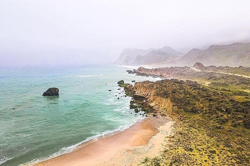
A verified geological oddity is that the cliffs at Shaat are among the highest direct coastal drops in the Arabian Peninsula. Local tradition suggests that the plateau was once used as a site for ancient signal fires that could be seen by inland tribes. A tip for visitors is to walk approximately 200 meters west of the main wall to find a natural rock balcony that offers an unobstructed view of the coastline extending toward Yemen.
Nearby Landmarks
Shaat Sinkhole (1.5km North)
Rakhyut Beach (25km West)
Mughsail Blowholes (48km East)
Al Fizayah Beach (35km East)