City: Tripoli
Country: Lebanon
Continent: Asia
Tripoli, Lebanon, Asia
Tripoli serves as the primary economic and political center of North Lebanon, acting as the country’s second-largest city and its principal northern port. It is located 85 kilometers north of Beirut on a small alluvial plain bordering the Mediterranean Sea at the foot of the Lebanon Mountains.
Historical Timeline
Founded after 700 BCE, Tripoli became the capital of a Phoenician triple federation comprising Sidon, Tyre, and Arvad. It was governed successively by Seleucids, Romans, and Arabs (635 CE) before the Crusader Raymond of Saint-Gilles besieged and partially destroyed it in 1109. The city was leveled by the Mamluks in 1289 and rebuilt inland, moving away from its original coastal site. Ottoman rule (1516–1918) and the subsequent French Mandate (1920) shaped its modern administrative status. The most significant event defining its current urban form was the 13th-century Mamluk relocation, which created the dense, labyrinthine medina structure that exists today.
Demographics & Population
The city has an estimated population of 378,000 within the urban area as of 2026, with a metropolitan population exceeding 500,000. The demographics are primarily Sunni Muslim (80%), with significant Alawite and Christian minorities. The median age is approximately 29 years, reflecting a younger demographic compared to the national average.
Urban Layout & Key Districts
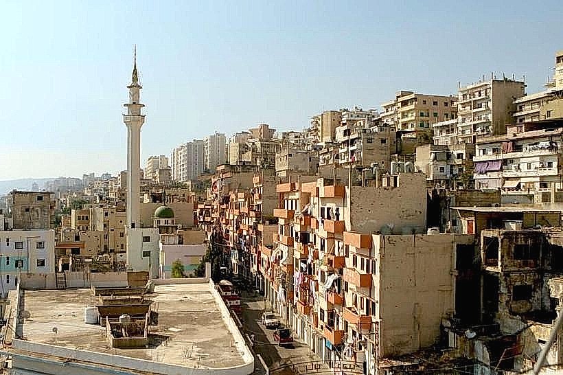
The city is physically bifurcated into two distinct zones separated by approximately 3 kilometers of modern development.
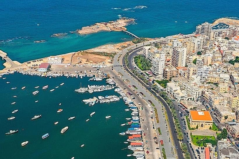
Al-Mina: The coastal port district, located to the west on the site of the ancient city; it is the primary residential and maritime hub.
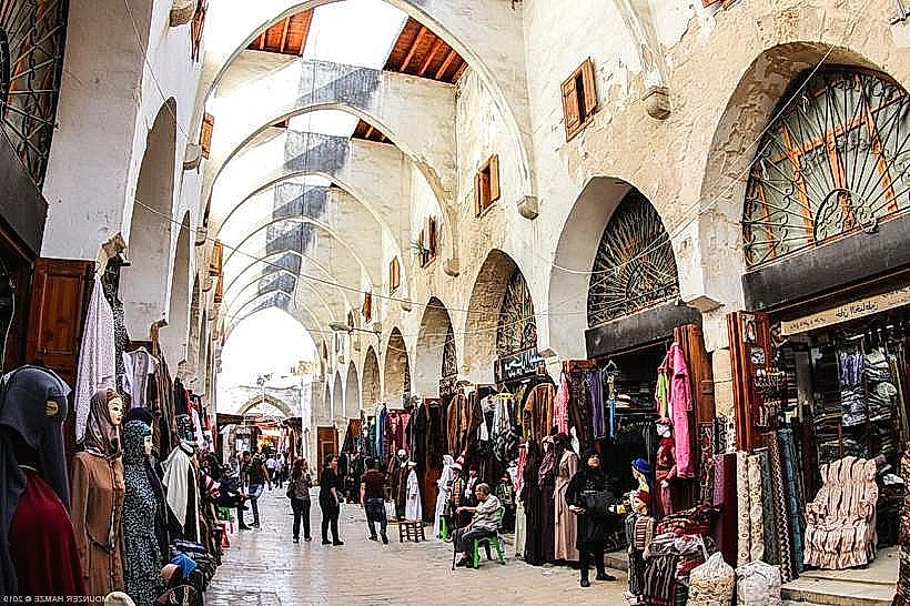
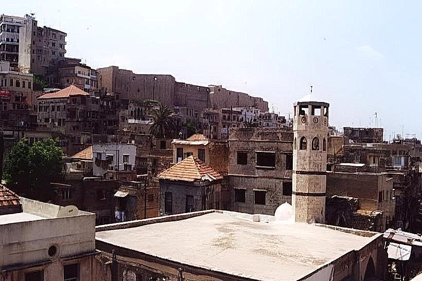
The Medina (Old City): The historical Mamluk core located inland to the east, characterized by narrow alleys and traditional souks.
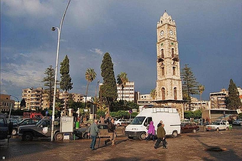
El-Tall: The central administrative district connecting the Old City to modern expansion, marked by Ottoman-era architecture and the clock tower.
Top City Landmarks
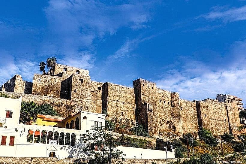
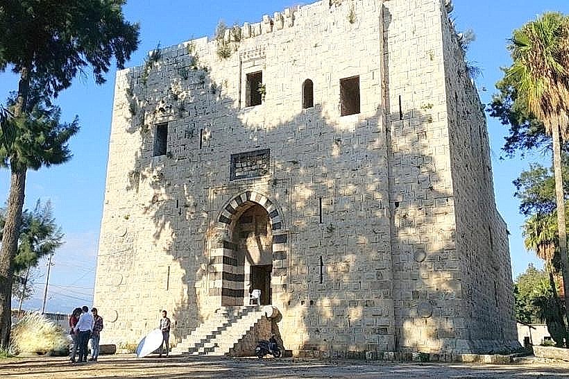
Citadel of Raymond de Saint-Gilles: A massive Crusader fortress overlooking the Abu Ali River.
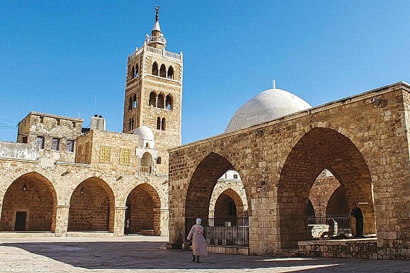
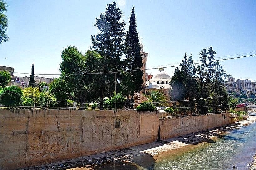
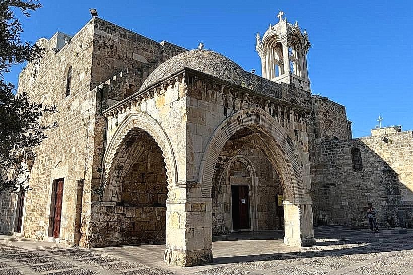
The Great Mansouri Mosque: A Mamluk-era mosque built on the site of a former Crusader church.
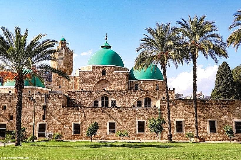
Taynal Mosque: Notable for its distinct Mamluk architecture and dual-domed prayer hall.
The Clock Tower: An Ottoman landmark situated in the central El-Tall square.
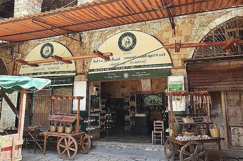
The Souks: A series of interconnected medieval markets, including the Khan al-Saboun (Soap Khan) and Khan al-Khayyatin (Tailors' Khan).
Transportation Network
Internal transport relies on the "Service" (shared taxi) system and private taxis. There is no metro or rail service. Shared minivans (locally called "Vans") are the primary mode of transit between Al-Mina and the city center. Official taxis are white with red license plates. Traffic density is high, particularly around the El-Tall and Abu Ali River bridges. Ride-sharing apps like Bolt are increasingly utilized for fixed-rate travel.
Safety & "Red Zones"
Travel advisories as of May 2026 categorize Tripoli as a high-risk zone for foreign nationals due to intermittent localized instability. Specific "Red Zones" include the neighborhoods of Bab al-Tabbaneh and Jabal Mohsen, which have a history of sectarian friction. Travelers should avoid large political gatherings and exercise high caution in the Old City after dark. Common scams involve overcharging for taxi rides and unofficial "guided tours" in the souks.
Digital & Financial Infrastructure
Internet speeds average 30–50 Mbps via 4G/LTE, with Fiber-to-the-Home (FTTH) limited to specific commercial zones. Mobile services are managed by Alfa and Touch. While the Lebanese Pound (LBP) is the legal tender, the economy is highly dollarized (USD). Card acceptance is low outside of major supermarkets and hotels; the vast majority of transactions in the souks and Al-Mina require cash. ATMs are widely available but may have restrictive withdrawal limits for local currency.
Climate & Air Quality
Tripoli has a Mediterranean climate. Summer temperatures (June–August) range from 26°C to 33°C with high humidity. Winter (December–February) is cool and rainy, ranging from 9°C to 16°C. Air quality is often impacted by industrial emissions from the nearby port and dust from the surrounding plains. Heavy rainfall in late winter (March) can lead to localized flooding near the Abu Ali River.
Culture & Social Norms
The city is culturally more conservative than Beirut.
Tipping: 10% is standard in seated restaurants.
Greeting: Handshakes are common, though some may prefer a verbal greeting without physical contact.
Dress Code: Modest attire is expected; men and women should keep shoulders and knees covered in public areas, particularly in the Medina.
Alcohol/Smoking: Alcohol is not sold or consumed in the majority of establishments within the city center; its consumption is largely restricted to specific hotels or private clubs in Al-Mina.
Accommodation Zones
Al-Mina: Recommended for its proximity to the waterfront, sea breezes, and higher concentration of boutique hotels.
Beirut Highway Entrance: Stay near the southern entrance for easier logistical access to transit hubs and modern commercial amenities.
Local Cost Index
1 Espresso: 190,000 LBP ($2.00 USD)
1 Standard Lunch (Falafel/Shawarma): 470,000 LBP ($5.00 USD)
1 Shared Taxi (Service): 95,000 LBP ($1.00 USD)
Nearby Day Trips
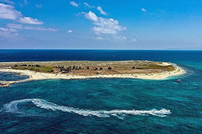
The Palm Islands Nature Reserve: A group of offshore islands reachable by boat (5 km).
Ehden: A mountain village known for its nature reserve and mild summer climate (35 km).
The Cedars of God (Bsharri): Ancient cedar forest and UNESCO World Heritage site (45 km).
Batroun: A coastal town known for its Phoenician wall and citrus groves (30 km).
Facts & Legends
Local legend dictates that the "Lion Tower" (Burj al-Sabaa) in Al-Mina was named not for the stone carvings on its exterior, but for a subterranean passage rumored to connect the tower directly to the Citadel inland, allowing Mamluk soldiers to move unseen across the city. A verified historical oddity is that Tripoli was once the global center of the silk trade, specifically for "Triple Silk," a high-density fabric that gave the city a monopoly on luxury textiles in the medieval Mediterranean.