Landmark: Canopy Walkway
City: Nyamasheke
Country: Rwanda
Continent: Africa
Canopy Walkway, Nyamasheke, Rwanda, Africa
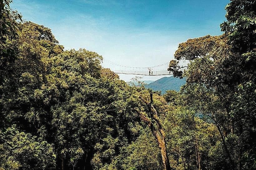
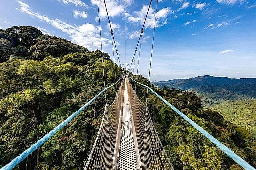
The Canopy Walkway is a high-altitude suspension bridge and the most prominent adventure tourism attraction in Nyungwe National Park, located in the Nyamasheke and Rusizi Districts of the Western Province. It is the only canopy walk of its kind in East Africa, offering a 360-degree view of the ancient montane rainforest from the upper forest strata.
Visual Characteristics
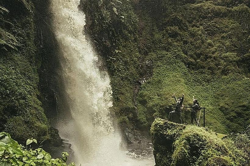
The walkway is a multi-part suspension bridge composed of aluminum and high-tension steel cables, featuring a narrow, anti-slip metal floor and chest-high safety netting. It is divided into three sections: a short 25m span, a long 90m span, and a terminal 45m span. The visual experience is dominated by the contrasting "bird’s-eye view" of the deep green forest canopy, the 70m vertical drop into the valley below, and the distant mist-covered ridges of the Albertine Rift.
Location & Access Logistics
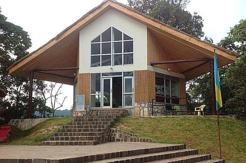
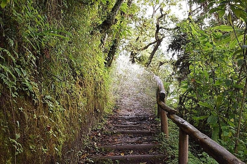
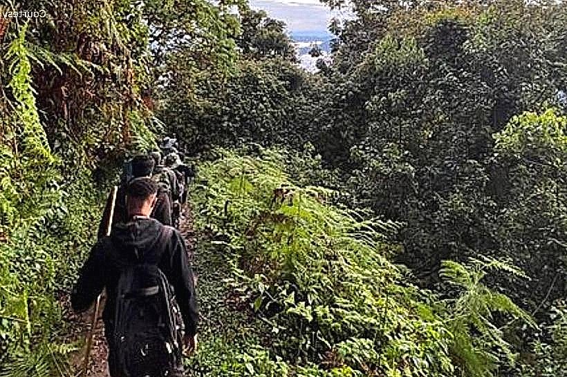
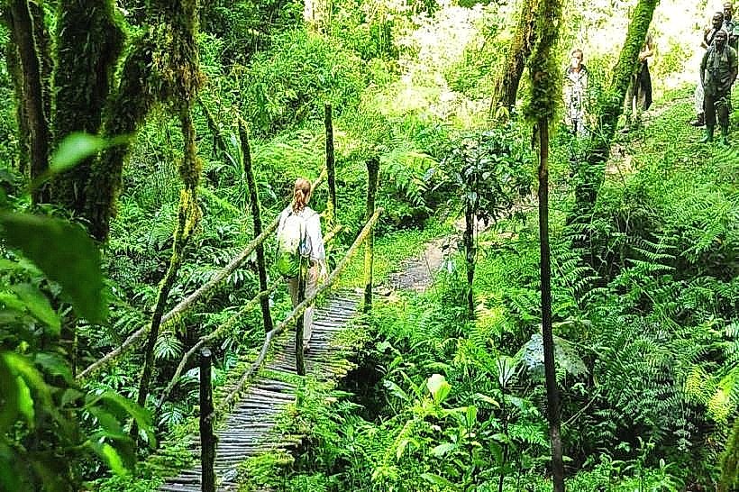
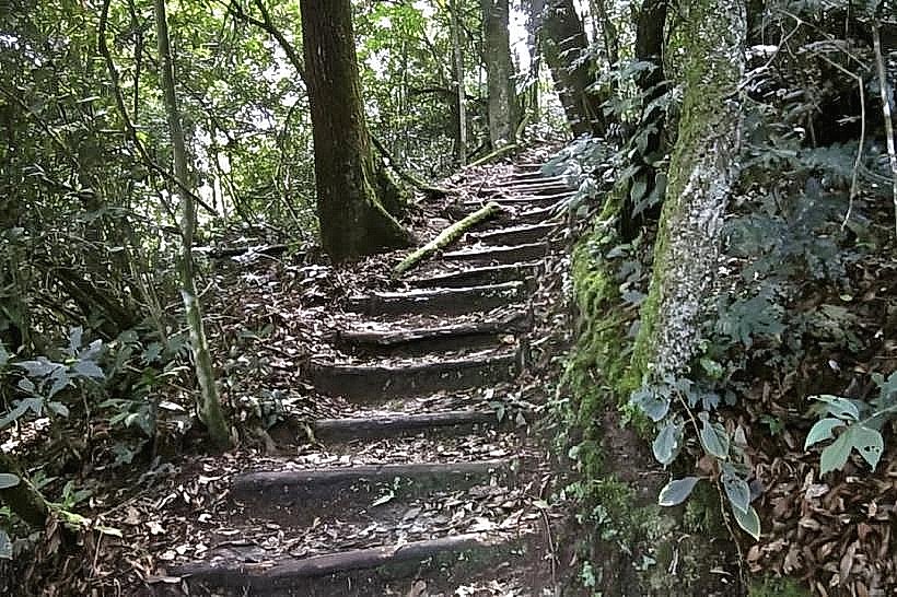
The trailhead is located at the Uwinka Visitor Center, approximately 55km from Karongi (Kibuye) and 35km from Rusizi (Cyangugu) along the RN6 highway. Access requires a 4x4 vehicle to reach the visitor center from either direction. From the center, visitors must hike a 2.1km segment of the Igishigishigi Trail, which is moderately steep and can be slippery. The entire excursion, including the hike and the walkway, takes approximately 2 to 2.5 hours.
Historical & Ecological Origin
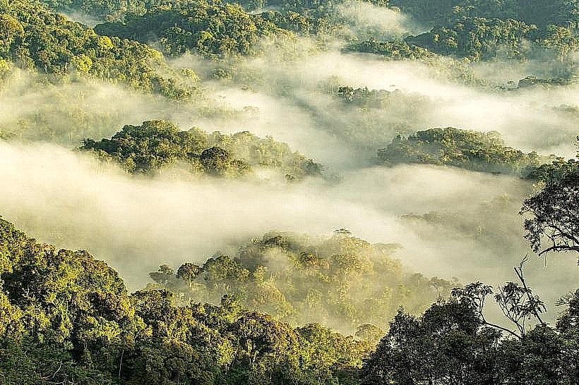
Opened in 2010 as a joint project between the Rwanda Development Board (RDB) and USAID, the walkway was engineered to provide access to the "canopy zone"-the most biodiverse layer of the rainforest. Geologically, the site spans a deep ravine in the Nyungwe massif, a prehistoric forest that survived the last ice age. The ecosystem at this height (approx. 2,400m above sea level) supports epiphytic orchids, rare mosses, and specialized bird species that rarely descend to the forest floor.
Key Highlights & Activities
Aerial Game Viewing: Frequent sightings of the L'Hoest's monkey, Blue monkey, and Black-and-white colobus from an overhead perspective.
Ornithology: Superior vantage points for spotting the Great Blue Turaco and various endemic sunbirds in the flowering upper canopy.
Adrenaline Trekking: Crossing the 90m central span, which reaches a maximum height of 70m above the forest floor, providing a significant vertical exposure.
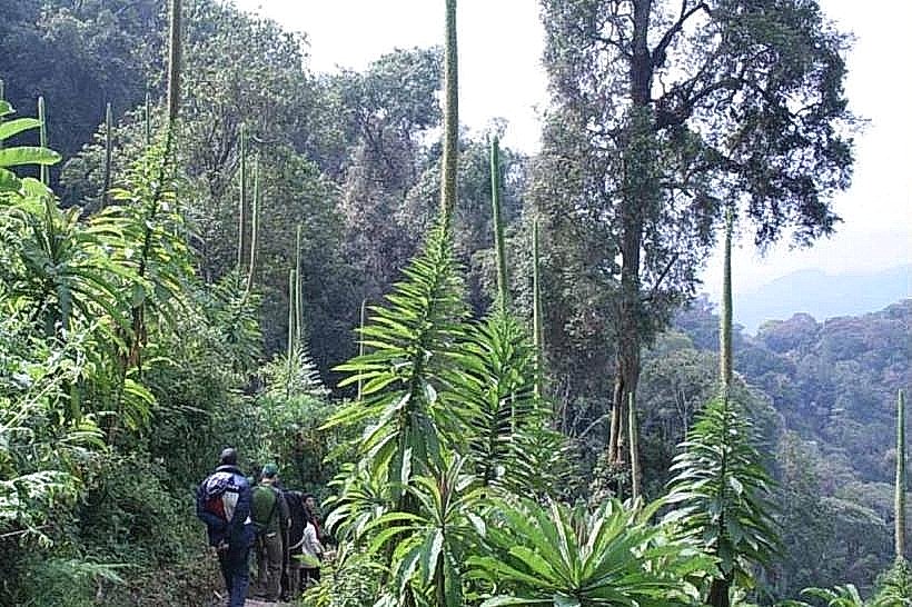
Botanical Study: Close-range observation of the giant ferns (Igishigishigi) and ancient hardwood trees like Newtonia buchananii.
Infrastructure & Amenities
The Uwinka Visitor Center features a reception desk, a small gift shop, and a café serving coffee and snacks. Modern public restrooms and a sheltered waiting area are available at the trailhead. 4G cellular signal is stable at the visitor center but becomes intermittent or non-existent on the forest trails. Professional guides are mandatory and provided as part of the activity fee; they are equipped with two-way radios and first-aid kits.
Best Time to Visit
Scheduled departures occur at 08:00, 10:00, 13:00, and 15:00. The 08:00 slot is the most recommended to avoid the frequent afternoon rains and to see the forest while the morning mist is clearing. The dry seasons (June to August and December to February) offer the most stable footing on the trails, though the "Emerald Season" (March–May) provides the most vibrant green forest views for photography.
Facts & Legends
Local lore from the surrounding communities often refers to the deep valley under the walkway as a place of ancient spirits due to the constant mist and echoes. A specific tip for visitors: the suspension bridge is designed to sway; those with a fear of heights should focus on the distant horizon rather than the metal floor. Sturdy hiking boots with good traction are essential, and the park provides walking sticks at the trailhead.
Nearby Landmarks
Uwinka Visitor Center – 2.1km (Trailhead)
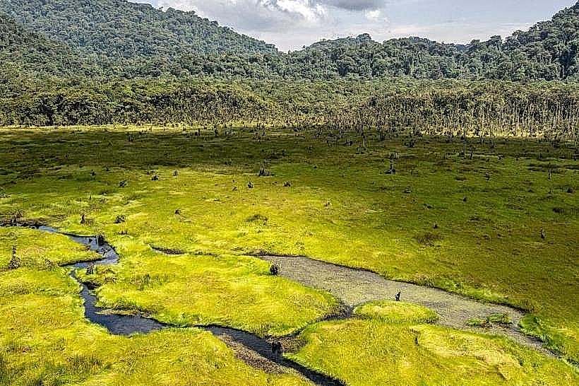
Kamiranzovu Swamp – 8.5km West
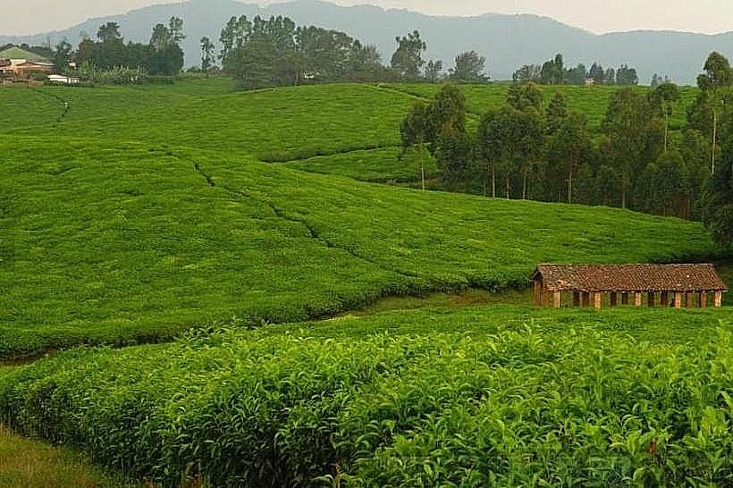
Gisakura Tea Estate – 22km West
Nyungwe House (One&Only) – 23km West
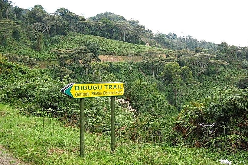
Mount Bigugu – 12km East