Landmark: Umuyove Trail
City: Nyamasheke
Country: Rwanda
Continent: Africa
Umuyove Trail, Nyamasheke, Rwanda, Africa
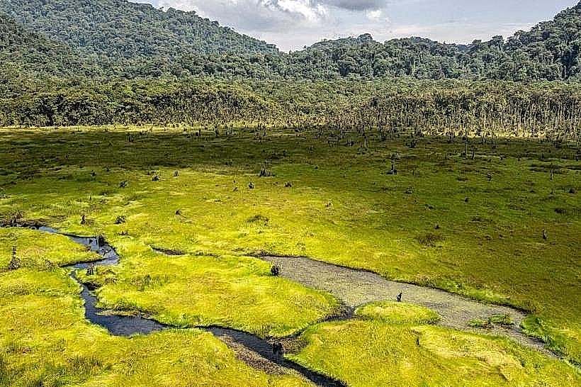
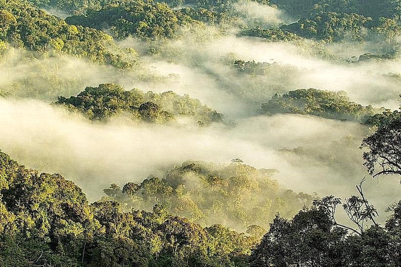
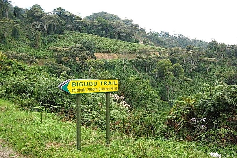
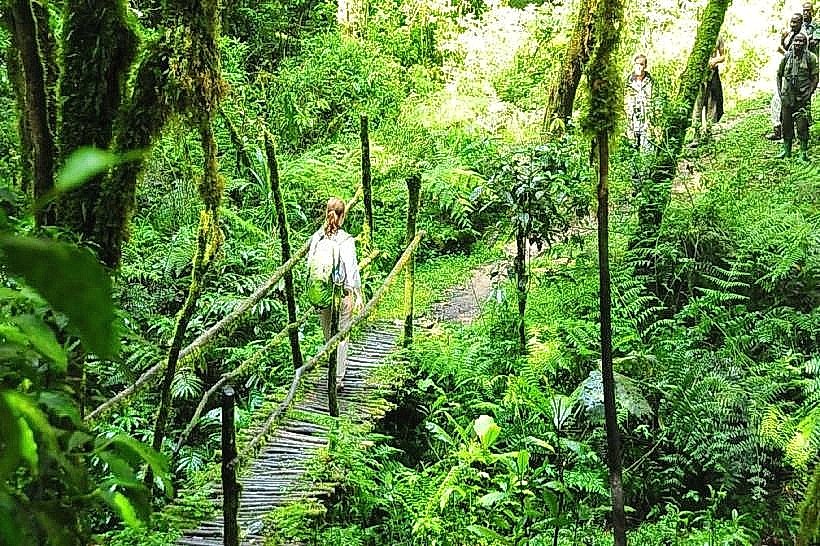
The Umuyove Trail is a popular hiking route located in the Uwinka sector of Nyungwe National Park in southwestern Rwanda. It provides a direct path through high-canopy forest to several waterfall viewpoints within the montane ecosystem.
Visual Characteristics
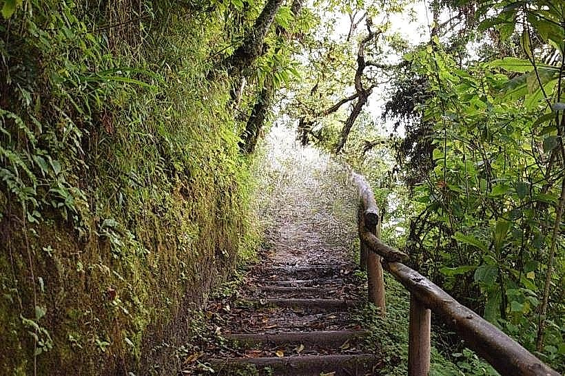
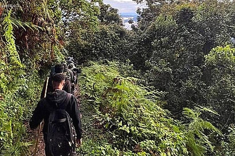
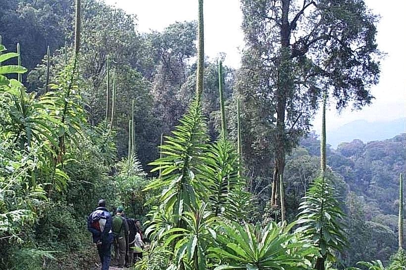
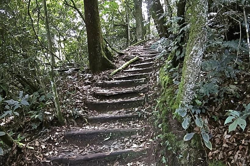
The trail surface is composed of dark, moist loam and dense root systems that create natural steps across the forest floor. Vegetation is dominated by the tall Entandrophragma excelsum (Mahogany) trees, which feature massive buttress roots and clear boles reaching up to 50 meters. The understory is relatively open compared to other park sectors, allowing for greater visibility of the high-canopy structure and hanging lianas.
Location & Access Logistics
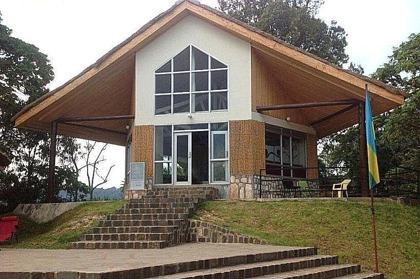
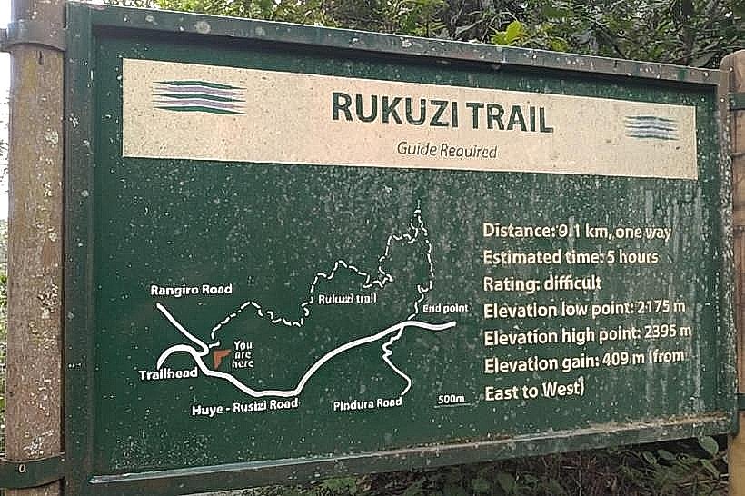
The trailhead begins at the Uwinka Reception Centre, situated on the RN6 highway approximately 54km from Rusizi and 218km from Kigali. Access is available via private vehicle or the public bus route traveling between Kigali and the Western Province, with a designated stop at the park gate. Parking is provided at the reception center, where hikers must register and meet a mandatory park ranger before entering the trail system.
Historical & Ecological Origin
The Umuyove Trail was established as one of the park’s primary interpretive routes to showcase the "Umuyove" (Mahogany) trees that characterize this specific forest block. Ecologically, the area serves as a critical micro-habitat for several Albertine Rift endemic bird species and provides a dense canopy cover that regulates the local hydrological cycle. The trail follows natural ridgelines formed by ancient tectonic shifts within the Western Rift Valley.
Key Highlights & Activities
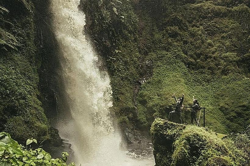
The 5.5km round-trip trek typically requires 3 to 4 hours to complete and is classified as a moderate-intensity hike. Key activities include birdwatching, with frequent sightings of the Great Blue Turaco, and visiting three distinct waterfall viewpoints. Primate observation is common, specifically for the L'Hoest's monkey and the silver monkey.
Infrastructure & Amenities
Full visitor facilities are located at the Uwinka trailhead, including a reception desk, restrooms, and a small café. Along the Umuyove Trail, infrastructure is limited to basic wooden benches at designated resting points and reinforced earthen steps on steeper sections. Cellular signal (4G/5G) is generally reliable at the trailhead but becomes intermittent or absent as the trail descends into the forested valleys.
Best Time to Visit
The driest months of June to August and December to February offer the most stable trail conditions and reduced risk of slipping. Photography is optimal in the early morning (08:00 to 09:30) when light filters through the tall mahogany canopy before the daily cloud cover increases. During the peak rainy season (April-May), parts of the trail may become difficult to navigate due to mud.
Facts & Legends
The trail's namesake, the Entandrophragma excelsum, is one of Africa's tallest indigenous trees and was historically protected by local communities who viewed these giants as "sentinels" of the forest. A verified historical oddity is that the trail passes through a section of the forest where the canopy is so dense that it remains significantly cooler than the surrounding Uwinka ridges, even during midday.
Nearby Landmarks
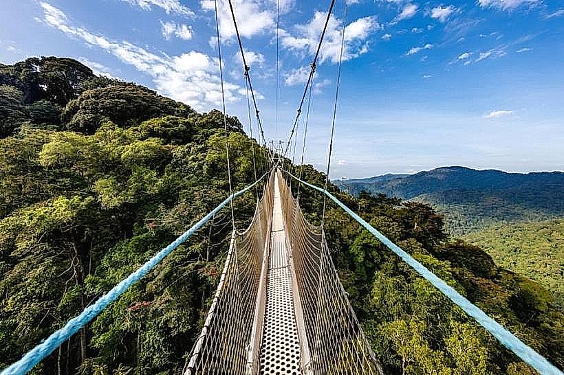
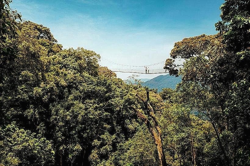
Uwinka Canopy Walkway: 0.4km South
Igishigishigi Trail: 0.2km South
Imbaraga Trail: 0.3km West
Irebero Trail: 0.6km North