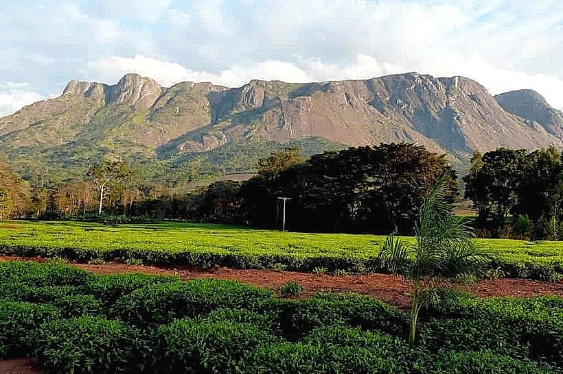
Landmark: Michiru Mountain Conservation Area
City: Blantyre
Country: Malawi
Continent: Africa
Michiru Mountain Conservation Area, Blantyre, Malawi, Africa
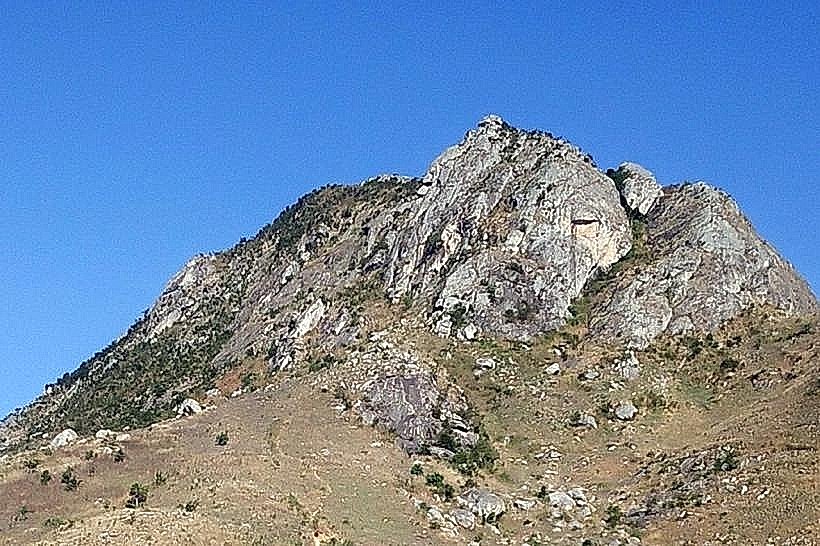
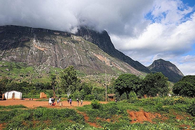
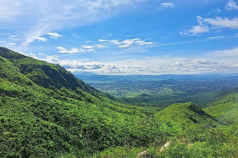
Michiru Mountain Conservation Area, also designated as the Michiru Mountain Nature Sanctuary, is a protected forest reserve and ecological refuge positioned on the edge of the Great Rift Valley. The reserve encompasses 3,004 hectares of rugged highland terrain located on the northern boundary of the Blantyre District.
Visual Characteristics
The topography features steep slopes composed of granite and gneiss that rise sharply from the surrounding high plateau to a peak elevation of approximately 1,470 meters above sea level. The landscape is dominated by dense, indigenous Brachystegia miombo woodland, transitioning into thick riverine forests along the lower ravines and open montane grasslands near the ridges. The color profile consists of the silver-grey tones of exposed granite cliffs, rich red clay soil paths, and deep greens within the forested valleys. The lower southern slopes feature structured stone steps and bronze plaque stations integrated directly into the natural forest trails.
Location & Access Logistics
The main entrance and forestry office are situated approximately 8 kilometers northwest of the Blantyre city center. Vehicles access the sanctuary by driving north from the commercial hub through the Chilomoni township via Chileka Road and turning onto the unpaved, uneven dirt tracks leading toward the base of the mountain. Due to the rough, rocky surface of the final mountain tracks, a high-clearance or four-wheel-drive vehicle is required. Public transit passengers can take a local minibus from the central Blantyre terminal to Chilomoni, disembark near the Zambezi church, and complete a 2-kilometer uphill walk along the marked dirt roads to reach the trailhead parking clearing.
Historical & Ecological Origin
The territory was formally gazetted as a state forest reserve by the Malawian government in 1970 to stem the rapid urban encroachment of Blantyre and preserve the regional highland watershed. The site holds a critical ecological classification as an isolated biodiversity hotspot within a highly urbanized district, protecting endemic flora and providing a biological corridor for native fauna. Historically, the mountain range has served as a geographical landmark since the pre-colonial era and remains a site of significant cultural and spiritual heritage for the indigenous Mang'anja and Yao populations.
Key Highlights & Activities
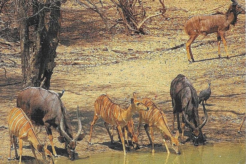
Trekking and trail walking represent the primary activities across three distinct designated routes: the Summit Trail (a 2 to 3-hour hike to the peak), the Forest Trail, and the Waterfall Trail leading to a secluded forest cascade. Birdwatching is highly active, with the reserve hosting over 100 species including the African paradise flycatcher, sunbirds, and hornbills. Visitors can hike the "Way of the Cross" route on the southern end, a structured loop that culminates at a large cement cross monument at the ridge peak. Guided wildlife viewing can be arranged through local rangers to track resident mammals such as baboons, blue monkeys, bushbucks, and porcupines.
Infrastructure & Amenities
The entry zone houses the Michiru Nature Sanctuary Office, which provides basic visitor reception services and a gravel vehicle parking lot. Developed amenities are low-intervention, consisting of basic restroom installations and designated outdoor clearing sites for picnicking and rustic camping. Continuous natural shade is available under the thick miombo canopy along the lower Forest Trail, while the upper peaks and rocky lookouts are entirely exposed to weather elements. Mobile cellular coverage on 4G lines remains stable near the Chilomoni boundary and on elevated ridges, but drops significantly inside the deep northern ravines. There are no commercial food vendors or supply shops on the mountain, requiring visitors to transport all food and water provisions directly from Blantyre.
Best Time to Visit
The ideal period for hiking and landscape photography is during the dry winter season from May to October, when daily temperatures average a comfortable 15 to 22 degrees Celsius and trail conditions remain firm. Morning hours between 06:30 and 09:30 are preferred for ascending the Summit Trail to secure clear panoramic views over Blantyre and the Shire Highlands before midday haze or low-lying clouds develop. The wet summer season from November to April stimulates lush green foliage and fills the forest streams, but introduces heavy downpours that render the dirt tracks muddy, slippery, and difficult to navigate.
Facts & Legends
The southern ridge contains a unique religious pilgrimage site known as the world's second "Krizevac" (meaning Cross Mountain), mirroring a famous spiritual site in Bosnia and Herzegovina; it features 15 bronze plaque stations directing hikers up a stone path to a monumental summit cross. Local environmental records document that while surrounding urban expansion has heavily pressured the reserve, the dense, rocky cracks of the mountain still shelter a highly secretive population of nocturnal spotted hyenas and large African rock pythons.
Nearby Landmarks
Chilomoni Township Center – 2.0km South
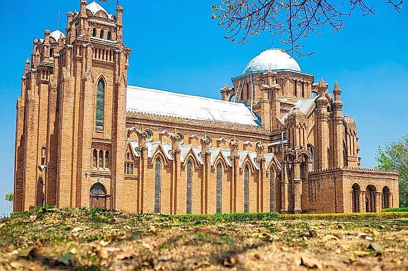
St. Michael and All Angels Church – 6.8km Southeast
Blantyre Sports Club – 7.5km Southeast
Ndirande Mountain Forest Reserve – 10.1km East
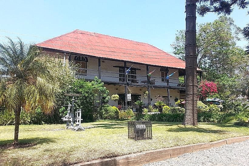
Mandala House (La Caverna) – 8.2km Southeast