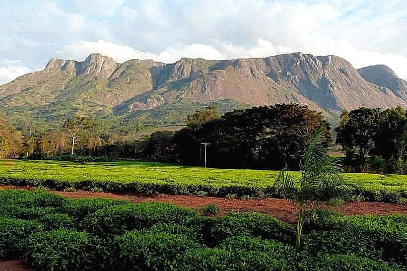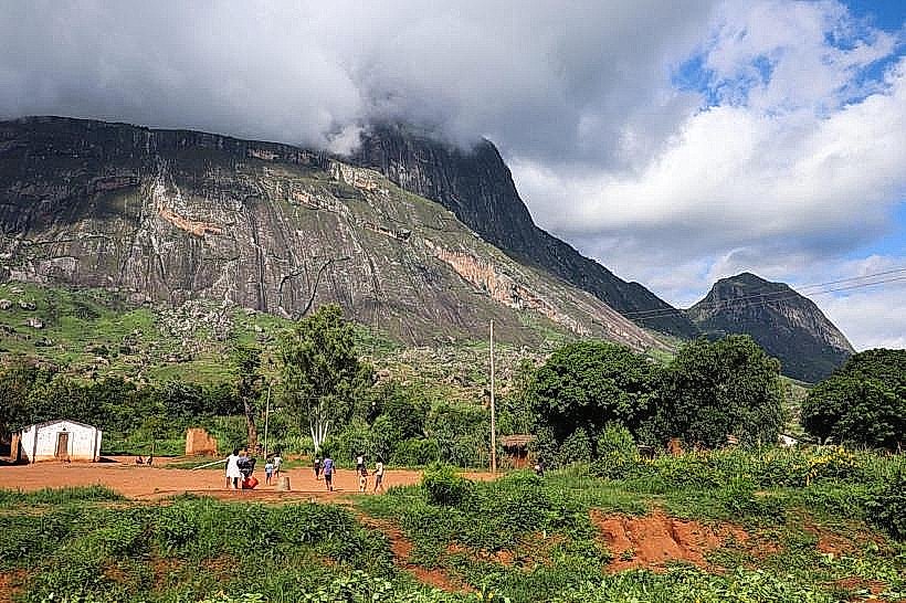
Landmark: Mount Ndirande
City: Blantyre
Country: Malawi
Continent: Africa
Mount Ndirande, Blantyre, Malawi, Africa
Mount Ndirande, also designated as the Ndirande Forest Reserve, is an isolated mountain massif and protected forestry zone located on the immediate northern boundary of the Blantyre municipal area. The landmark rises directly above the high-density residential settlements of the Ndirande township, forming a prominent geological backdrop to the commercial sectors of the city.
Visual Characteristics
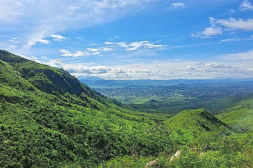
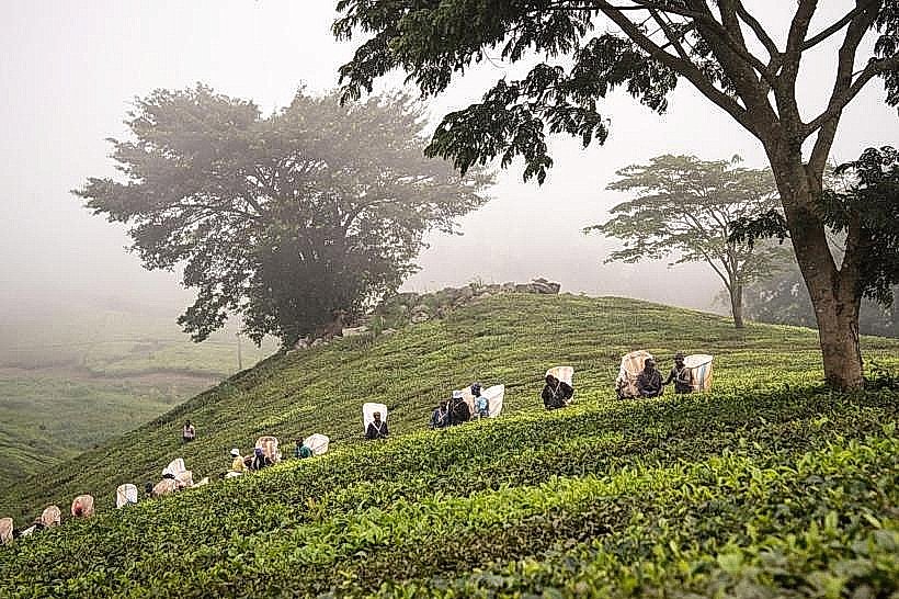
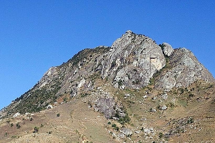
The mountain features an elongated, spine-like ridge profile with exceptionally steep, rocky slopes composed of Precambrian granulite and syenite masonry. The terrain rises to a maximum peak elevation of 1,604 meters above sea level, presenting a stark structural profile marked by sheer granite precipices and loose talus fields. While historically covered in indigenous woodland, the current landscape features a heavily managed matrix of exotic pine plantations, eucalyptus rows, and vast areas of open scrub and montane grasses. The upper southern crest houses multiple tall metallic telecommunications towers and concrete anchor stations, contrasting with the dark grey rock faces and light green grass expanses.
Location & Access Logistics
The landmark is situated approximately 5.5 kilometers north-northeast of the Blantyre central business district. Private vehicles approach the primary southern trailheads by driving north through the Ndirande township via Makata Road or Ring Road, turning onto the steeply inclined unpaved logging tracks near the Makata industrial area. A rugged gravel parking clearing is available near the base forestry checkpoint, from which high-clearance four-wheel-drive vehicles can navigate a rough service track up to the mountain col at 1,300 meters. Public transport commuters can catch a local minibus from the main Blantyre terminal to the Ndirande market stop and complete an uphill pedestrian walk of 1.2 kilometers along earthen tracks to reach the formal reserve gates.
Historical & Ecological Origin
The territory was formally gazetted as a state forest reserve by the British colonial administration in 1922, encompassing 1,433 hectares of mountain terrain to secure the upper drainage basins of local municipal streams. Geologically, the ridge forms an structural component of the Shire Highlands basement complex, left exposed through centuries of differential weathering and tectonic uplift along the East African Rift system. Throughout the mid-to-late twentieth century, the state transitioned large sections of the reserve into a commercial softwood plantation to meet urban timber demands, creating a highly modified ecological zone that requires continuous management by the Department of Forestry to control urban encroachment and illegal biomass harvesting.
Key Highlights & Activities
Trekking and steep mountain hiking represent the primary public activities, with a well-established route tracking from the car park up to the telecommunications towers and culminating at the 1,604-meter peak marked by a concrete survey column. The elevated ridge areas function as panoramic observation platforms, offering clear vistas over the entire Blantyre municipal layout, the Limbe commercial zone, and Mount Soche to the south. Rock scrambling is common along the exposed granite cliffs of the northern faces, and self-guided birdwatching along the lower pine margins allows for the tracking of hardy raptor and passerine species.
Infrastructure & Amenities
The reserve operates under a low-intervention framework and lacks centralized visitor centers, permanent ticketing offices, or public restroom facilities along the trail networks. Shade is available beneath the stands of commercial pine trees along the lower tiers and the mountain col, but the final summit trail and upper rocky ridges are entirely exposed to weather elements. Mobile telecommunications connectivity is exceptional across the entire mountain layout, with powerful 4G and 5G network signals generated directly by the major service towers positioned on the southern crest. There are no food vendors or supply shops on the reserve property, requiring visitors to secure all necessary hydration and provisions from the commercial markets in Ndirande township below.
Best Time to Visit
The optimal period for structural photography and trail trekking corresponds with the dry winter season from May to August, when afternoon temperatures remain mild between 16 and 20 degrees Celsius and atmospheric dust is low. Morning hours between 07:00 and 10:00 are highly preferred for ascending the ridge to secure clear panoramic views before intense solar heat generates valley mists or urban smoke hazes that obscure the horizon. The wet summer season from November to April introduces heavy rain cycles that wash out sections of the unpaved dirt access tracks and render the steep clay footpaths slick and hazardous for foot travel.
Facts & Legends
The southern peak area features a prominent geological outcrop known locally as the Kamuzu Lookout, which was historically utilized by the early independence government as a scenic vantage point for visiting state dignitaries. Local field guides note that the mountain represents a major environmental transition point in the district, where the intensive community-led replanting initiatives launched by local conservation groups since the early 2000s are directly visible as expanding green blocks designed to actively reclaim the lower slopes from historical deforestation.
Nearby Landmarks
Ndirande Township Commercial Core – 1.2km South
Makata Industrial Area – 2.4km Southwest
Kamuzu Stadium National Arena – 3.8km South-Southwest
Chichiri Shopping Mall Complex – 4.2km South
Michiru Mountain Conservation Area – 10.1km West